Downtown in Peterborough, Ontario — Central Canada (North America)
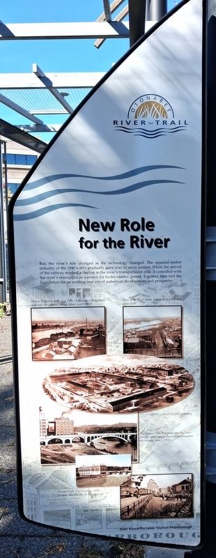
New Role for the River
Otonabee River Trail
Photographed by William Fischer, Jr., October 9, 2026
1. New Role for the River Marker
But, the river's role changed as the technology changed. The squared-timber industry of the 1840's-60's gradually gave way to sawn lumber. While the arrival of the railway marked a decline in the river's transportation role, it coincided with the river's resurgence as a source for hydro-electric power. Together, they laid the foundation for an exciting new era of industrial development and prosperity.
[Photo captions read]
• Denne & Sperry Mill circa 1881 (at the end of King Street and near the original site of Adam Scott's Mill)
• View of the River before industrial development circa 1875
• Canadian General Electric Company [birds-eye illustration of complex]
• The Quaker Oats Company and the "new" Hunter Street bridge (built to accommodate the railway lines c 1920)
• Peterborough Waterworks c.1893 (present day Zoo Site in background)
• CPR Station (now Tourism Bureau and Chamber of Commerce)
Visit: Kawartha Lakes Tourism Peterborough
Erected 2000 by City of Peterborough.
Topics. This historical marker is listed in these topic lists: Bridges & Viaducts • Industry & Commerce • Railroads & Streetcars • Waterways & Vessels. A significant historical year for this entry is 2000.
Location. 44° 18.111′ N, 78° 19.108′ W. Marker is in Peterborough, Ontario. It is in Downtown. It is on King Street just east of Water Street, on the right when traveling east. Marker and Walkway are in Millenium Park. Touch for map. Marker is at or near this postal address: 131 King Street, Peterborough ON K9J 0A5, Canada. Touch for directions.

Regionally, this marker is in Central Canada. Globally, it is in North America, the Western Hemisphere, the Western World, and the Anglosphere. Historically, it finds itself in what was once a British colony, the Viceroyalty of New France, the
this page online
Other nearby markers. At least 8 other markers are within walking distance of this marker: Industrial Waterfront (here, next to this marker); Peterborough Today (here, next to this marker); Our Enduring Legacy (here, next to this marker); From Frontier Town... (here, next to this marker); ...To Bustling City (here, next to this marker); The First Nations (here, next to this marker); Full Circle (here, next to this marker); The Landscape (a few steps from this marker). Touch for a list and map of all markers in Peterborough.
Photographed by William Fischer, Jr., October 9, 2026
2. New Role for the River Marker
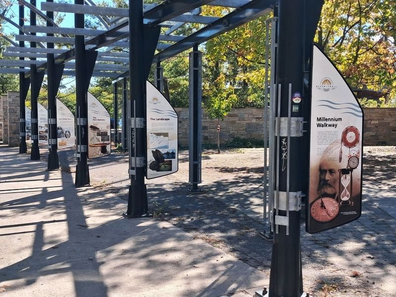
On rear of fifth pole back, not visible in photo
Photographed by William Fischer, Jr., October 9, 2026
3. Millenium Walkway
Credits. This page was last revised on October 28, 2026. It was originally submitted on October 28, 2026, by William Fischer, Jr. of Reynoldsburg, Ohio. This page has been viewed 5 times since then. Photos: 1, 2. submitted on October 28, 2026, by William Fischer, Jr. of Reynoldsburg, Ohio. 3. submitted on October 27, 2026, by William Fischer, Jr. of Reynoldsburg, Ohio.
