Near Newcastle in Dixon County, Nebraska — The American Midwest (Upper Plains)
Prehistoric Farmers
Photographed by Barry Swackhamer, July 17, 2025
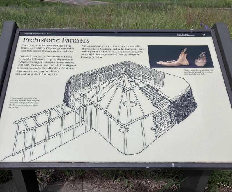
1. Prehistoric Farmers Marker
Captions: (middle left) Houses usually consisted of an entryway, a hearth, beds along the walls, and storage and refuse pits. The floor was about a foot below the surface.; (top right) Villagers made this corn shelling tool out of a dear jaw, and this spoon, or scoop, out of a deer skull.
Instead of roaming the Great Plains and living in portable hide-covered tepees, they settled in villages consisting of rectangular houses covered with earth, thatch, or mud. Instead of hunting and gathering foodstuffs, they tilled the soil and raised corn, squash, beans, and sunflowers and went on periodic hunting trips.
Archeologist speculate that this farming culture - like others along the Mississippi and in the Southwest - began to disappear about 1300 because of extensive droughts, widespread diseases, or warfare, possibly brought on by overpopulation.
Erected by National Park Service, U.S. Department of the Interior.
Topics. This historical marker is listed in this topic list: Indigenous Peoples and Communities.
Location. 42° 42.89′ N, 96° 57.11′ W. Marker is near Newcastle, Nebraska, in Dixon County. It can be reached from 579 Avenue (State Highway 15 Spur) near 579 Avenue. This marker is located at the Mulberry Bend
this page online

Regionally, this marker is in Eastern Nebraska. It is also in the American Midwest, in the Corn Belt, and on the prairies. Globally, it is in North America, the Western Hemisphere, the Western World, and the Anglosphere. Historically, it finds itself in what was once the Louisiana Purchase.
Other nearby markers. At least 8 other markers are within 5 miles of this marker, measured as the crow flies: Sculpting the Landscape (here, next to this marker); The Great Missouri River (a few steps from this marker); Mulberry Bend Scenic Overlook (a few steps from this marker); Frost Wilderness Game Production Area (approx. 2.4 miles away in South Dakota); Confluence of the Vermillion and Missouri Rivers (approx. 4.2 miles away in South Dakota); Vermillion (approx. 4.2 miles away in South Dakota); Lewis and Clark / Vermillion (approx. 4.2 miles away in South Dakota); Welcome to Cotton Park (approx. 4.2 miles away in South Dakota).
Photographed by Barry Swackhamer, July 17, 2025
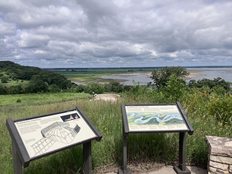
2. Prehistoric Farmers Marker
Marker on left
Credits. This page was last revised on November 1, 2026. It was originally submitted on November 1, 2026, by Barry Swackhamer of Brentwood, California. This page has been viewed 7 times since then. Photos: 1, 2. submitted on November 1, 2026, by Barry Swackhamer of Brentwood, California.
