Near Tybee Island in Chatham County, Georgia — The American South (South Atlantic)
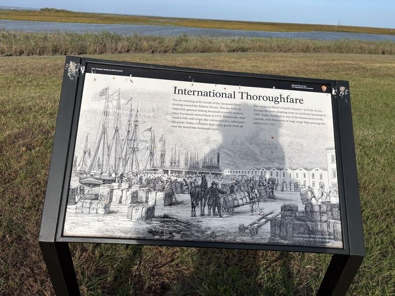
International Thoroughfare
| — | Fort Pulaski National Monument | — |
Photographed by Benjamin Rubin, November 1, 2026
1. International Thoroughfare Marker
The Savannah River's North Channel — in front of you — became the main shipping route to and from Savannah in 1909. Today, Savannah is one of the busiest ports in the country, with thousands of large cargo ships passing this point every year.
Erected by National Park Service.
Topics. This historical marker is listed in these topic lists: Industry & Commerce • Waterways & Vessels. A significant historical year for this entry is 1732.
Location. 32° 1.722′ N, 80° 53.371′ W. Marker is near Tybee Island, Georgia, in Chatham County. It is on U.S. 80. Touch for map. Marker is at or near this postal address: 30757 US-80, Tybee Island GA 31328, United States of America. Touch for directions.

Regionally, this marker is on the Coastal Plain, on the Georgia Coast
this page online
Other nearby markers. At least 8 other markers are within walking distance of this marker: This Memorial Commemorates The Act Of... (about 400 feet away, measured in a direct line); Hot Shot Furnace (about 400 feet away); Model 1859 Seacoast Carriage (about 400 feet away); Red-hot Shot (about 400 feet away); Key to the South (about 400 feet away); Powder Magazine (about 500 feet away); Changing Landscape (about 500 feet away); 4.5 Inch Blakely Rifle (about 600 feet away). Touch for a list and map of all markers in Tybee Island.
Credits. This page was last revised on November 5, 2026. It was originally submitted on November 1, 2026, by Benjamin Rubin of Columbia, South Carolina. This page has been viewed 9 times since then. Photo 1. submitted on November 1, 2026, by Benjamin Rubin of Columbia, South Carolina. • Andrew Ruppenstein was the editor who published this page.
