Near Tybee Island in Chatham County, Georgia — The American South (South Atlantic)
Shining Sentinel
| — | Fort Pulaski National Monument | — |
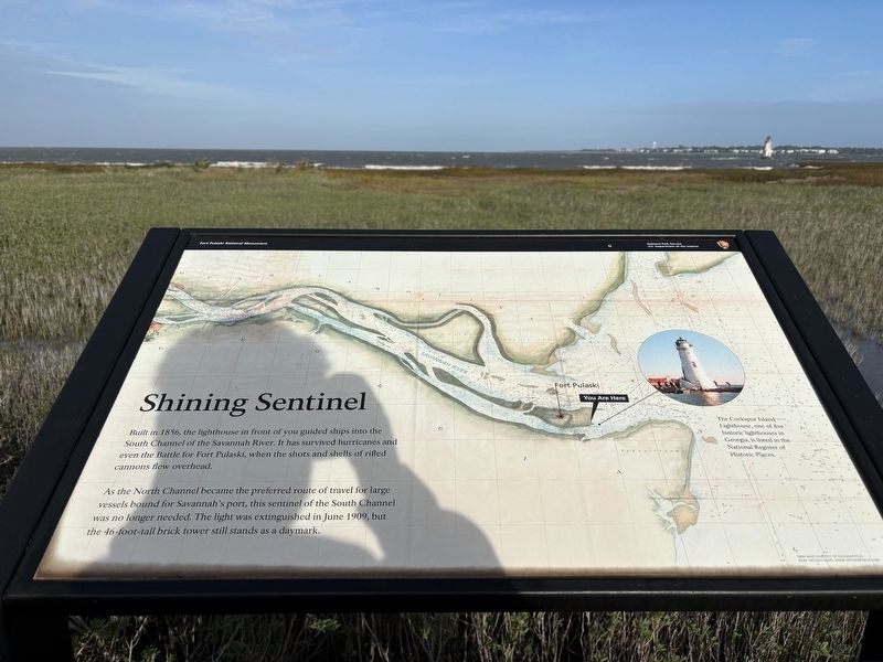
Photographed by Benjamin Rubin, November 1, 2026
1. Shining Sentinel Marker
Built in 1856, the lighthouse in front of you guided ships into the South Channel of the Savannah River. It has survived hurricanes and even the Battle for Fort Pulaski, when the shots and shells of rifled cannons flew overhead.
As the North Channel became the preferred route of travel for large vessels bound for Savannah's port, this sentinel of the South Channel was no longer needed. The light was extinguished in June 1909, but the 46-foot-tall brick tower still stands as a daymark.
1860s map courtesy of Geographicus Rare Antique Maps, www.geographicus.com
Erected by National Park Service, U.S. Department of the Interior.
Topics. This historical marker is listed in these topic lists: Industry & Commerce • Waterways & Vessels. A significant historical month for this entry is June 1909.
Location. 32° 1.391′ N, 80° 53.051′ W. Marker is near Tybee Island, Georgia, in Chatham County. It can be reached from Fort Pulaski Road east of Cockspur Island Road. Located at the Lighthouse
this page online

Regionally, this marker is on the Coastal Plain, on the Georgia Coast and the Golden Isles, in Greater Savannah, and on the Sea Islands. It is also in the American South, specifically in the Deep South, and on the Eastern Seaboard. Globally, it is in the North Atlantic Region, North America, the Western Hemisphere, the Western World, and the Anglosphere. Historically, it finds itself in what was once New Spain, the territory of the Mississippian Culture, one of the original Thirteen Colonies, one of the Confederate States of America, and the Antebellum South.
Other nearby markers. At least 8 other markers are within walking distance of this marker: 5,275 Shots & Shells in 30 Hours (approx. 0.4 miles away); The Breached Wall (approx. 0.4 miles away); A Devastating Bombardment (approx. 0.4 miles away); Federal Siege Batteries (approx. 0.4 miles away); Shifting Shoreline (approx. 0.4 miles away); Through the Thick Brick Wall (approx. 0.4 miles away); Brooke Rifle (approx. 0.4 miles away); 4.5 Inch Blakely Rifle (approx. 0.4 miles away). Touch for a list and map of all markers in Tybee Island.
Also see . . . Fort Pulaski National Monument. National Park Service (Submitted on November 7, 2026.)
Credits. This page was last revised on November 7, 2026. It was originally submitted on November 2, 2026, by Benjamin Rubin of Columbia, South Carolina. This page has been viewed 13 times since then. Photo 1. submitted on November 2, 2026, by Benjamin Rubin of Columbia, South Carolina. • Bernard Fisher was the editor who published this page.
Editor’s want-list for this marker. Wide shot of marker and its surroundings. Photos of the lighthouse. • Can you help?
