Hurricane in Putnam County, West Virginia — The American South (Appalachia)
Hurricane Bridge
"A furious fire upon us"
Photographed by Bradley Owen, October 31, 2026
1. Hurricane Bridge Marker
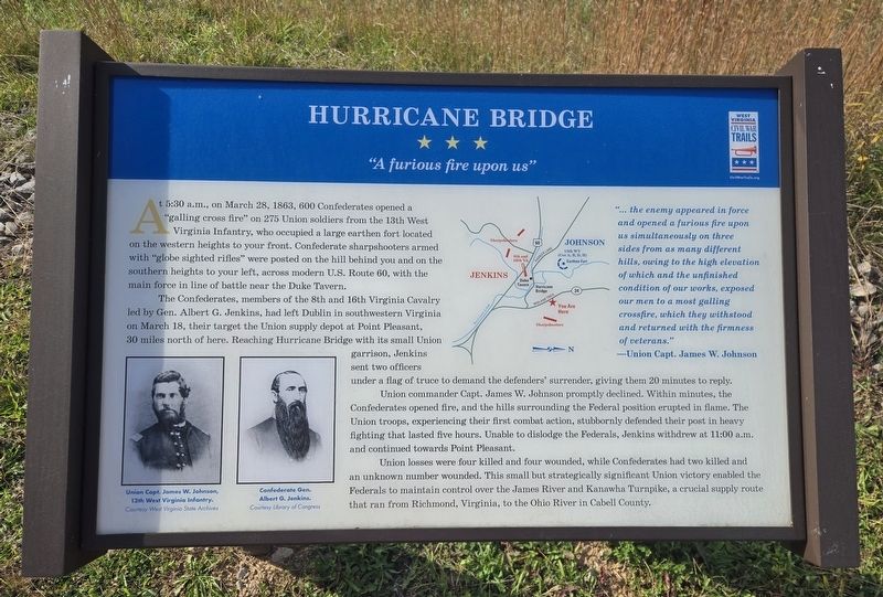
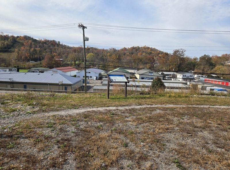
At 5:30 a.m., on March 28, 1863, 600 Confederates opened a "galling cross fire" on 275 Union soldiers from the 13th West Virginia Infantry, who occupied a large earthen fort located on the western heights to your front. Confederate sharpshooters armed with "globe sighted rifles" were posted on the hill behind you and on the southern heights to your left, across modern U.S. Route 60, with the main force in line of battle near the Duke Tavern.
The Confederates, members of the 8th and 16th Virginia Cavalry led by Gen. Albert G. Jenkins, had left Dublin in southwestern Virginia on March 18, their target the Union supply depot at Point Pleasant, 30 miles north of here. Reaching Hurricane Bridge with its small Union garrison, Jenkins sent two officers under a flag of truce to demand the defenders' surrender, giving them 20 minutes to reply.
Union commander Capt. James W. Johnson promptly declined. Within minutes, the Confederates opened fire, and the hills surrounding the Federal position erupted in flame. The Union troops, experiencing their first combat action, stubbornly defended their post in heavy fighting that lasted
this page online
Union losses were four killed and four wounded, while Confederates had two killed and an unknown number wounded. This small but strategically significant Union victory enabled the Federals to maintain control over the James River and Kanawha Turnpike, a crucial supply route that ran from Richmond, Virginia, to the Ohio River in Cabell County.
"... the enemy appeared in force and opened a furious fire upon us simultaneously on three sides from as many different hills, owing to the high elevation of which and the unfinished condition of our works, exposed our men to a most galling crossfire, which they withstood and returned with the firmness of veterans."
-Union Capt. James W. Johnson
(Captions):
Union Capt. James W. Johnson, 13th West Virginia Infantry.
Courtesy West Virginia State Archives
Confederate Gen. Albert G. Jenkins.
Courtesy Library of Congress
Erected 2025 by West Virginia Civil War Trails.
Topics. This historical marker is listed in this topic list: War, US Civil. A significant historical date for this entry is March 28, 1863.
Location. 38° 25.187′ N,
Photographed by Bradley Owen, October 31, 2026
2. Hurricane Bridge Marker

Regionally, this marker is in the Kyova Tri-State Region. It is also in the American South, specifically in the Upper South, in Appalachia, and specifically in Southern Appalachia. Globally, it is in North America, the Western Hemisphere, the Western World, and the Anglosphere. Historically, it finds itself in what was once the territory of the Mississippian Culture.
Other nearby markers. At least 8 other markers are within 6 miles of this marker, measured as the crow flies: Hurricane Baptist Church / Hurricane Bridge Skirmish (approx. 0.3 miles away); Curry School District Memorial (approx. 0.9 miles away); Asbury House (approx. one mile away); In Memory of all Veterans (approx. 1.1 miles away); Calvin W Jones (approx. 1.2 miles away); West Virginia Pollinators (approx. 2.3 miles away); a different marker also named West Virginia Pollinators (approx. 2.3 miles away); Union Baptist Church (approx. 5.4 miles away). Touch for a list and map of all markers in Hurricane.
Credits. This page was last revised on November 2, 2026. It was originally submitted on November 2, 2026, by Bradley Owen of Morgantown, West Virginia. This page has been viewed 7 times since then. Photos: 1, 2. submitted on November 2, 2026, by Bradley Owen of Morgantown, West Virginia.
