Near Homer in Dakota County, Nebraska — The American Midwest (Upper Plains)
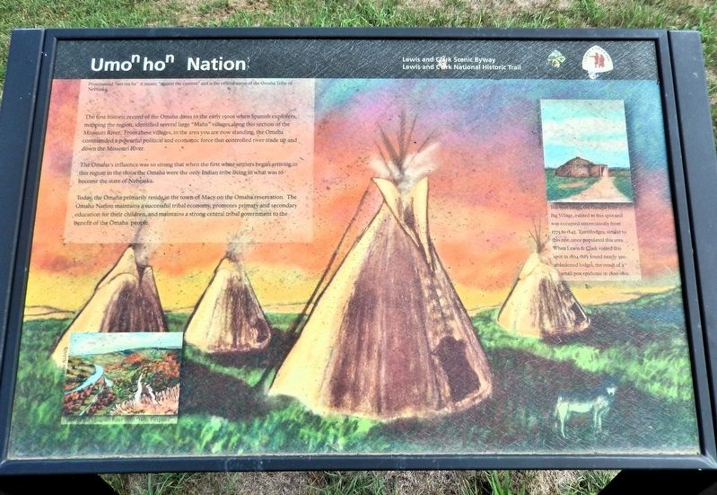
Umoⁿhoⁿ Nation
| — | Lewis and Clark National Historic Trail | — |
Photographed by Cosmos Mariner, August 24, 2022
1. Umoⁿhoⁿ Nation Marker
Pronounced “um ma ha” it means “against the current” and is the official name of the Omaha Tribe of Nebraska.
The first historic record of the Omaha dates to the early 1500s when Spanish explorers, mapping the region, identified several large “Maha” villages along this section of the Missouri River. From these villages, in the area you are now standing, the Omaha commanded a powerful political and economic force that controlled river trade up and down the Missouri River.
The Omaha's influence was so strong that when the first white settlers began arriving in this region in the 1800s the Omaha were the only Indian tribe living in what was to become the state of Nebraska.
Today the Omaha primarily reside in the town of Macy on the Omaha reservation. The Omaha Nation maintains a successful tribal economy, promotes primary and secondary education for their children, and maintains a strong central tribal government to the benefit of the Omaha people.
Ton won tonga, the Omaha Tribe’s Big Village, existed in this spot and was occupied intermittently from 1775 to 1845. Earthlodges, similar to this one, once populated this area.
this page online
Erected by Lewis and Clark Scenic Byway and Lewis and Clark National Historic Trail.
Topics and series. This historical marker is listed in this topic list: Indigenous Peoples and Communities. In addition, it is included in the Lewis & Clark Expedition series list. A significant historical year for this entry is 1804.
Location. 42° 21.253′ N, 96° 27.792′ W. Marker is near Homer, Nebraska, in Dakota County. It is on U.S. 77 one mile north of 225th Street, on the right when traveling north. The marker is in an interpretive wayside on the east side of the highway. Touch for map. Marker is in this post office area: Homer NE 68030, United States of America. Touch for directions.

Regionally, this marker is in Eastern Nebraska. It is also in the American Midwest, in the Lewis & Clark Corridor, in the Corn Belt, and on the prairies. Globally, it is in North America, the Western Hemisphere, the Western World, and the Anglosphere. Historically, it finds itself in what was once the Louisiana Purchase.
Photographed by Cosmos Mariner, August 24, 2022
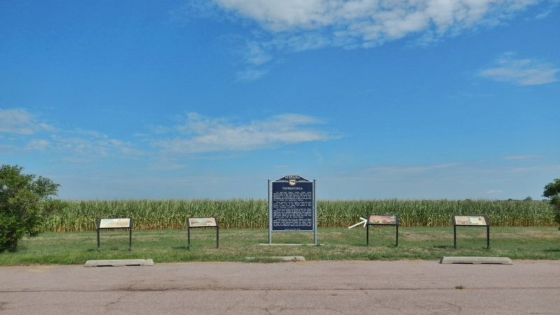
2. Umoⁿhoⁿ Nation Marker
This is marker is the second from the right of four interpretive panels alongside the Nebraska State Historical Society “Tonwantonga” marker at this wayside.
Other nearby markers. At least 8 other markers are within 6 miles of this marker, measured as the crow flies: Tonwantonga (here, next to this marker); A Trial and a Council (here, next to this marker); Fish Camp (a few steps from this marker); Combs School (approx. 4.3 miles away); Territorial Church (approx. 4.7 miles away); August 16, 1804 (approx. 5.7 miles away in Iowa); August 3, 1804 (approx. 5.7 miles away in Iowa); August 8, 1804 (approx. 5.7 miles away in Iowa). Touch for a list and map of all markers in Homer.
Also see . . . Journals of the Lewis & Clark Expedition, August 14, 1804.
Excerpt: [Whitehouse, note #2] During the winter of 1799–1800 the Omahas experienced a catastrophic smallpox epidemic that is supposed to have reduced their numbers to about 900–1500 people, which would be close to Clark's estimate of “300 men,” counting three to five persons per adult male. Clark’s statement that they had no houses may be explained by the remark here that the village was in ruins; ordinarily at least the more industrious families had permanent earth lodges. The condition of the place may have resulted from the burning of the village during the smallpox epidemic, which may have left their society in disarray for some time, delaying their efforts to rebuild. Ordway says that they had about three hundred “cabins,” meaning perhaps that he saw their burned remains. If the wooden frame of an earth lodge was burned, the lodge would collapse.(Submitted on November 2, 2026, by Cosmos Mariner of Cape Canaveral, Florida.)
Credits. This page was last revised on November 2, 2026. It was originally submitted on November 2, 2026, by Cosmos Mariner of Cape Canaveral, Florida. This page has been viewed 10 times since then. Photos: 1, 2. submitted on November 2, 2026, by Cosmos Mariner of Cape Canaveral, Florida.
