Echternach, Echternach, Luxembourg — Western Europe
Eckturm
⎯⎯⎯
Tour de Coin
⎯⎯⎯
Corner Tower
Photographed by Andrew Ruppenstein, October 21, 2026
1. Eckturm / Tour du Coin / Corner Tower Marker

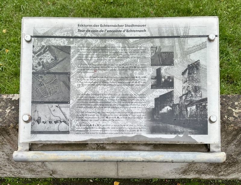
Bei archeologischen Untersuchungen im Jahre 1999 wurde festgestellt, daß die Fundamente dieses Turmes auf Holzpfosten nuhen. Eine dendrochronologische Analyse (Altersbestimmung durch Jahresringe) hat ergeben, daß der Turm mit sehr großer Wahrscheinlichkeit im Jahre 1250 erbaut wurde. Bachstücke von Keramik, die gleichzeitig aus den verschiedenen Schichten geborgen werden konnten, gehen sogar in die fränkische Zeit, dh. vor die Erbauung des Turmes zurück.
1998 wurde der Wassergraben, der um die Stadt die Mauer entlang lief, in diesem Teilbereich wieder freigelegt. Wie aus Plänen von 1550 (A) und 1818 (B) hervorgeht, wurde der mittelalterliche Wassergrahen (auf dem Deventerplan in blau) im 19. Jh. in Gärten umgewandelt.
Daß der Turm ein kegelförmiges Dach trug geht aus den Zeichnungen A, C und D hervor Als der Eckturm im Anfang des 19. Jh. zu Wohnzwecken umgebaut wurde, dürfte er halb abgetragen und mit einem Pultdach" versehen worden sein (EF). In den 20er Jahren des letzten Jahrhunderts wurde er bis auf die Grundmauern abgetragen.
Lors
this page online
En 1998, le fossé d'eau qui contournait jadis la ville et évoluait parallèlement aux murs, fut de nouveau mis en cette partie- dans son ancien lit. Comme on peut constater sur des plans de 1550 (A) et 1818 (B), le fossé d'eau (en bleu sur le plan Deventer) fut convertí en jardin au 19e siècle.
Sur les dessins A, C et D on reconnaît un toit en forme de cône sur la tour de coin. C'est seulement au début du 19e siècle quand la tour fut à moitié d'molie et transformée en maison; que celle-ci fut munie d'un toit "en pupitre" (E+F). Un siècle plus tard la tour fut également rasée jusqu'à une hauteur de 2 mètres.
Corner Tower of the Echternach Town Wall
During
Photographed by Andrew Ruppenstein, October 21, 2026
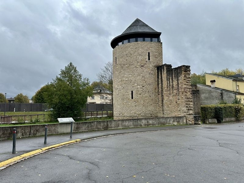
2. Eckturm / Tour de Coin / Corner Tower and marker
In 1998, the section of the town’s defensive moat that ran along the wall was uncovered once again. As shown in plans from 1550 (A) and 1818 (B), the medieval moat—depicted in blue on the Deventer map—was converted into gardens during the 19th century.
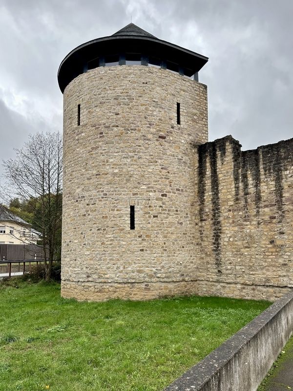
That the tower had a conical roof is evident from drawings A, C, and D. When the corner tower was converted for residential use in the early 19th century, it was likely partially demolished and fitted with a shed roof (EF). In the 1920s, it was demolished down to its foundation walls.
Topics. This historical marker is listed in these topic lists: Anthropology & Archaeology • Forts and Castles. A significant historical year for this entry is 1999.
Location. 49° 48.658′ N, 6° 25.569′ E. Marker is in Echternach,
Photographed by Andrew Ruppenstein, October 21, 2026
3. Eckturm / Tour de Coin / Corner Tower

Regionally, this marker is in the Guttland and in the Mullerthal. Globally, it is in Europe, the European Union, the Benelux Low Countries, the Schengen Area, Western Europe, and the Western World. Historically, it finds itself in what was once the Roman Empire and specifically also the Holy Roman Empire.
Other nearby markers. At least 8 other markers are within walking distance of this marker: Neckel Welschbillig (within shouting distance of this marker); Mur d’enceinte / Stadtmauer / City Walls (within shouting distance of this marker); First Electric Lighting (approx. 0.3 kilometers away); Herbert Kerngut (approx. 0.3 kilometers away); Berthold Kahn (approx. 0.4 kilometers away); Fontaine Saint-Willibrord / Sankt Willibrordus-Brunnen / Saint Willibrord Fountain (approx. 0.4 kilometers away); Hospice St Georges (approx. 0.4 kilometers away); Victor Hugo (approx. 0.4 kilometers away). Touch for a list and map of all markers in Echternach.
Credits. This page was last revised on November 3, 2026. It was originally submitted on November 3, 2026, by Andrew Ruppenstein of Lamorinda, California. This page has been viewed 9 times since then. Photos: 1, 2, 3. submitted on November 3, 2026, by Andrew Ruppenstein of Lamorinda, California.
