Beezley Trailhead in Ephrata in Grant County, Washington — The American West (Northwest)
Swimming/Ice Skating Floods
Memories of Growing Up in Ephrata
Photographed by Shirley A Stirling, October 24, 2026
1. Swimming/Ice Skating Floods Marker
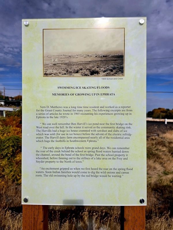
Vern D. Matthews was a long time time resident and worked as a reporter for the Grant County Journal for many years. The following excerpts are from a series of articles he wrote in 1965 recounting his experiences growing up in Ephrata in the late 1920's.
"We can well remember Ben Harvill's ice pond near the first bridge on the West road over the hill. In the winter it served as the community skating rink. The Harvills had a huge ice house crammed with sawdust and slabs of ice which was sold (for use in ice boxes) before the advent of the electric refridgerator. The Harvill dairy farm encompassed nearly all of the residential area which hugs the foothills in Southwestern Ephrata."
"The early days in Ephrata schools were grand days. We can remember the roar of the creek behind the school as spring flood waters hurried down the channel, around the bend of the first bridge. Past the school property it whooshed, before fanning out to the stillness of a lake area on the Frey and Snyder property to the North of town."
"An excitement gripped us when we first heard the roar on the spring flood. Soon Indian families wouldcome to dig the wild onions and camas roots. The old swimming hole up by the red bridge would be waiting."
Click or scan to see
this page online
Erected 2026 by Michael Scellick with installation by Don Bean and production by Purple Coyote.
Topics. This historical marker is listed in these topic lists: Environment • Settlements & Settlers. A significant historical year for this entry is 1908.
Location. 47° 19.402′ N, 119° 33.531′ W. Marker is in Ephrata, Washington, in Grant County. It is in Beezley Trailhead. It is on 1st Avenue near Cyrus Road, on the left when traveling west. Touch for map. Marker is at or near this postal address: 750 1st Avenue NW, Ephrata WA 98823, United States of America. Touch for directions.

Regionally, this marker is in the Columbia Basin. It is also in the American Mountain West and in the Lewis & Clark Corridor. Globally, it is in North America, on the Pacific Rim, in the Western Hemisphere, in the Western World, and in the Anglosphere.
Other nearby markers. At least 8 other markers are within walking distance of this marker: Ephrata Flood History (here, next to this marker); Springs and Streams in Canyon Made Ephrata an Oasis
Photographed by Shirley A Stirling, October 24, 2026
2. Swimming/Ice Skating Floods Marker
Credits. This page was last revised on November 4, 2026. It was originally submitted on October 25, 2026, by Shirley A Stirling of Lacey, Washington. This page has been viewed 17 times since then. Last updated on November 4, 2026, by Shirley A Stirling of Lacey, Washington. Photos: 1, 2. submitted on October 25, 2026, by Shirley A Stirling of Lacey, Washington. • Devry Becker Jones was the editor who published this page.
