Stammheim in Schweinfurt, Bavaria, Germany — Central Europe
Weinbauchronik von Stammheim
⎯⎯⎯
Stammheim Viniculture Timeline
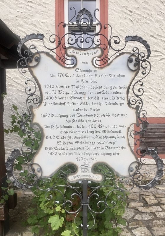
Photographed by Andrew Ruppenstein, September 24, 2019
1. Weinbauchronik von Stammheim / Stammheim Viniculture Timeline Marker

Weinbauchronik von Stammheim.
Um 770 Seit Karl dem Großen Weinbau in Franken.
1240 Kloster Maibronn bezieht den Zehntwein von 50 Morgen Weingarten aus Stammheim.
1400 Kloster Ebrach unterhält einen Kelterhof Fuerstbischof Julius Echter besitzt Weinberge hinter der Kirche.
1632 Rückgang des Weinbaues durch die Pest und den 30 jährigen Krieg
Im 18 Jahrhundert lebten 400 Einwohner vorwiegend vom Ertrag des Weinbaues.
1962 Erste Flurbereinigung-Aufschwung durch 23 Hektar Weinanlage "Eselsberg"
1968 Erstes Fränkisches Weinfest in Stammheim.
1982 Ende der Weinbergsbereinigung über 120 Hektar.
-
Stammheim Viniculture Timeline
From about 770, from the time of Charlemagne, there has been viticulture in Franconia.
In 1240, the Maibronn Monastery receives from Stammheim tithed wine from 50 acres of vineyards.
1400 The Ebrach Monastery maintains a wine cellar here. Prince Bishop Julius Echter owns vineyards behind the church.
1632 Wine production declines because of the plague and the Thirty Years War.
In the 18th century, 400 inhabitants lived mainly off of viticulture.
1962
this page online
1968 First Franconian wine festival held in Stammheim.
1982 Completion of more than 120 hectares of vineyard consolidation.
Erected 1984 by Stammheim.
Topics. This historical marker is listed in these topic lists: Agriculture • Food & Drink. A significant historical year for this entry is 770 CE.
Location. 49° 54.302′ N, 10° 11.622′ E. Marker is in Stammheim, Bayern (Bavaria), in Schweinfurt. It is at the intersection of Winzerstrasse and Maintalstrasse, on the left when traveling north on Winzerstrasse. Touch for map. Marker is in this post office area: Stammheim BY 97509, Germany. Touch for directions.

Regionally, this marker is in German Franconia. Globally, it is in Europe, the European Union, Atlantic Europe, Central Europe, the Schengen Area, Western Europe, and the Western World. Historically, it finds itself in what was once the Holy Roman Empire and also the former West Germany.
Other nearby markers. At least 8 other markers are within 3 kilometers of this marker, measured as the crow

Photographed by Andrew Ruppenstein, September 24, 2019
2. Weinbauchronik von Stammheim / Stammheim Viniculture Timeline Marker - wide view
The marker is visible here just to the right of the wine press.
Credits. This page was last revised on November 4, 2026. It was originally submitted on December 2, 2019, by Andrew Ruppenstein of Lamorinda, California. This page has been viewed 174 times since then and 14 times this year. Last updated on November 4, 2026, by Trudi Jacobson of Slingerlands, New York. Photos: 1, 2. submitted on December 2, 2019, by Andrew Ruppenstein of Lamorinda, California. • Devry Becker Jones was the editor who published this page.
