Colo in Story County, Iowa — The American Midwest (Upper Plains)
Lincoln Highway
Photographed by Jason Voigt, October 18, 2026
1. Lincoln Highway Marker
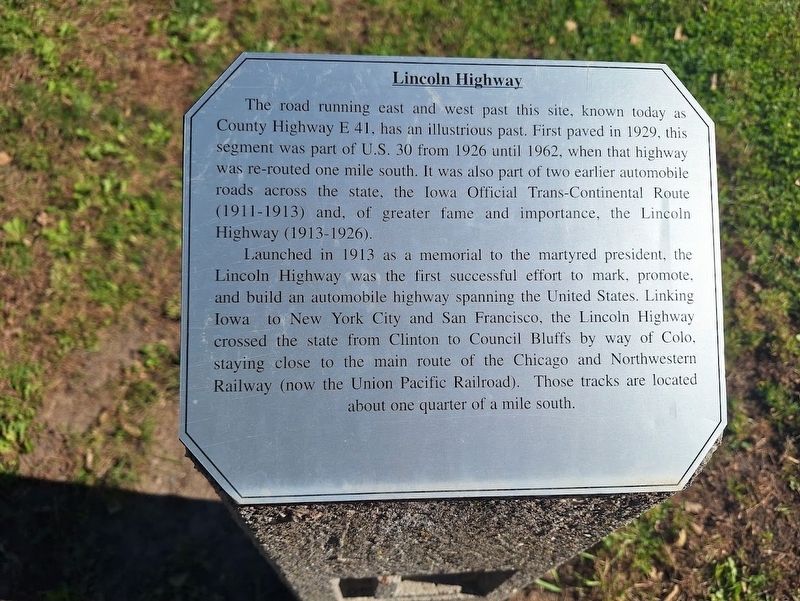
The road running east and west past this site, known today as County Highway E 41, has an illustrious past. First paved in 1929, this segment was part of U.S. 30 from 1926 until 1962, when that highway was re-routed one mile south. It was also part of two earlier automobile roads across the state, the Iowa Official Trans-Continental Route (1911-1913) and, of greater fame and importance, the Lincoln Highway (1913-1926).
Launched in 1913 as a memorial to the martyred president, the Lincoln Highway was the first successful effort to mark, promote, and build an automobile highway spanning the United States. Linking Iowa to New York City and San Francisco, the Lincoln Highway crossed the state from Clinton to Council Bluffs by way of Colo, staying close to the main route of the Chicago and Northwestern Railway (now the Union Pacific Railroad). Those tracks are located about one quarter of a mile south.
Topics and series. This historical marker is listed in this topic list: Roads & Vehicles. In addition, it is included in the Lincoln Highway series list. A significant historical year for this entry is 1929.
Location. 42° 1.362′ N, 93° 18.624′ W.
this page online

Regionally, this marker is in Greater Des Moines. It is also in the American Midwest and in the Corn Belt. Globally, it is in North America, the Western Hemisphere, the Western World, and the Anglosphere. Historically, it finds itself in what was once the territory of the Mississippian Culture and also the Louisiana Purchase.
Other nearby markers. At least 8 other markers are within walking distance of this marker: Colo Motel (a few steps from this marker); Colo Cabin Camp (within shouting distance of this marker); a different marker also named Colo Motel (within shouting distance of this marker); Niland's Cafe (within shouting distance of this marker); Service Station (within shouting distance of this marker); Colo Reed/Niland Corner (within shouting distance of this marker); Reed/Niland Corner
Photographed by Jason Voigt, October 18, 2026
2. Lincoln Highway Marker
Photographed by Jason Voigt, October 18, 2026
3. Lincoln Highway Marker
Credits. This page was last revised on November 4, 2026. It was originally submitted on November 4, 2026, by Jason Voigt of Glen Carbon, Illinois. This page has been viewed 8 times since then. Photos: 1, 2, 3. submitted on November 4, 2026, by Jason Voigt of Glen Carbon, Illinois.
