College Grove in Williamson County, Tennessee — The American South (East South Central)
Moses Steele Cemetery
Photographed by Darren Jefferson Clay, January 16, 2021
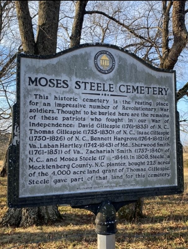
1. Moses Steele Cemetery Marker
This historic cemetery is the resting place for an impressive number of Revolutionary War soldiers. Thought to be buried here are the remains of these patriots who fought in our War of Independence: David Gillespie (1761-1835) of N.C., Thomas Gillespie (1755-1830) of N.C., Issac Gillespie (1750-1826) of N.C., Bennett Hargrove (1764-1842) of Va., Laban Hartley (1742-1843) of Md., Sherwood Smith (1761-1851) of Va., Zachariah Smith (1757-1840) of N.C., and Moses Steele (17 -1844). In 1808, Steele, a Mecklenberg County, N.C. planter, bought 225 acres of the 4,000 acre land grant of Thomas Gillespie. Steele gave part of that land for this cemetery.
Erected 1998 by Williamson County Historical Society.
Topics and series. This historical marker is listed in these topic lists: Cemeteries & Burial Sites • Settlements & Settlers • War, US Revolutionary. In addition, it is included in the Tennessee – Williamson County Historical Society series list. A significant historical year for this entry is 1808.
Location. 35° 42.968′ N, 86° 45.504′ W. Marker is in College Grove, Tennessee, in Williamson County. It is on Flat
this page online

Regionally, this marker is in Middle Tennessee and in Greater Nashville. It is also in the American South and specifically in the Upper South. Globally, it is in North America, the Western Hemisphere, the Western World, and the Anglosphere. Historically, it finds itself in what was once the territory of the Mississippian Culture, one of the Confederate States of America, and the Antebellum South.
Other nearby markers. At least 8 other markers are within 5 miles of this marker, measured as the crow flies: Old Reed’s Store (approx. 0.4 miles away); Edwards Grove Church (approx. 0.7 miles away); Cross Keys (approx. 2.6 miles away); In Memory of Gideon Riggs 1790-1871 (approx. 3.4 miles away); Riggs Cross Roads (approx. 3.4 miles away); Marshall County / Williamson County (approx. 3½ miles away); The Cove (approx. 3.6 miles away); Bethesda (approx. 4.1 miles away). Touch for a list and map of all markers in College Grove.
Also see . . . .

Photographed by Darren Jefferson Clay, January 16, 2021
2. Moses Steele Cemetery Marker

Photographed by Darren Jefferson Clay, January 16, 2021
3. Moses Steele Cemetery
Photographed by Darren Jefferson Clay, January 16, 2021
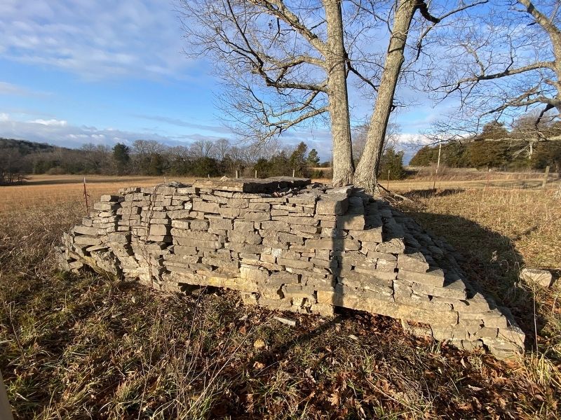
4. Laban Hartley’s grave
Credits. This page was last revised on November 5, 2026. It was originally submitted on January 16, 2021, by Darren Jefferson Clay of Duluth, Georgia. This page has been viewed 1,890 times since then and 253 times this year. Last updated on November 5, 2026, by Diane Klinefelter of McMurray, Pennsylvania. Photos: 1, 2, 3, 4. submitted on January 16, 2021, by Darren Jefferson Clay of Duluth, Georgia. • Devry Becker Jones was the editor who published this page.
