Castlefield in Manchester in Greater Manchester, England, United Kingdom — Northwestern Europe (the British Isles)
Roman Manchester
⎯⎯⎯
Welcome to Castlefield
Photographed by Ian Lefkowitz, September 14, 2026
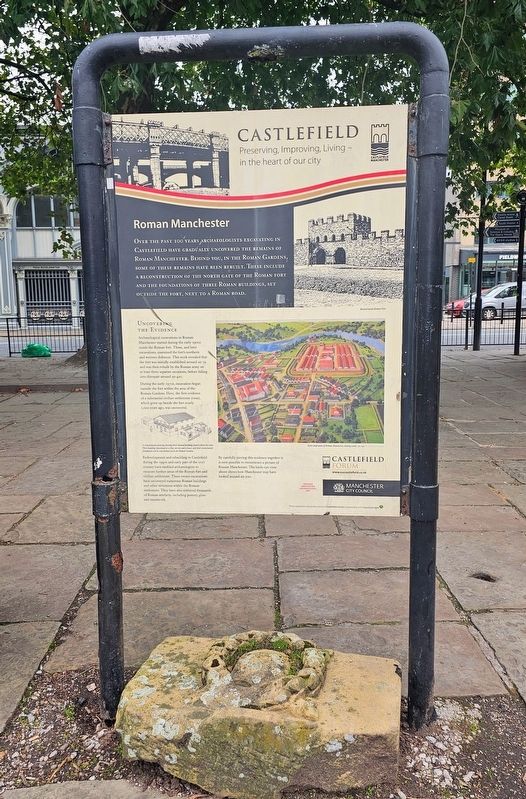
1. Roman Manchester side of marker
Over the past 100 years archaeologists excavating in Castlefield have gradually uncovered the remains of Roman Manchester. Behind you, in the Roman Gardens, some of these remains have been rebuilt. These include a reconstruction of the north gate of the Roman fort and the foundations of three Roman buildings, set outside the fort, next to a Roman road.
Uncovering the Evidence
Archaeological excavations in Roman Manchester started during the early 1900s inside the Roman fort. These, and later excavations, examined the fort’s northern and western defences. This work revealed that the fort was initially established around AD 79 and was then rebuilt by the Roman army on at least three separate occasions, before falling into disrepair around AD 410.
During the early 1970s, excavation began outside the fort within the area of the Roman Gardens. Here, the first evidence of a substantial civilian settlement (vicus), which grew up beside the fort nearly 2,000 years ago, was uncovered.
Redevelopment and rebuilding in Castlefield during the 1990s and early part of the 21st century have enabled archaeologists to excavate further areas of the Roman fort and civilian settlement. These recent excavations have uncovered numerous Roman buildings and other structures within the Roman settlement. They have also retrieved thousands of Roman artefacts, including pottery, glass and metalwork.
By carefully piecing this evidence together it is now possible to reconstruct a picture of Roman Manchester. The birds-eye view above shows how Manchester may have looked around AD 200.
(Captions)
Reconstructed Roman Fort
A reconstruction drawing showing three Roman buildings found within the vicus. These buildings functioned as a shop, an inn and a house, and their reconstructed foundations can be seen behind you in the Roman Gardens.
Artist impression of Roman Manchester, looking south, AD 200 © Graham Sumner
Welcome to Castlefield
Castlefield
this page online
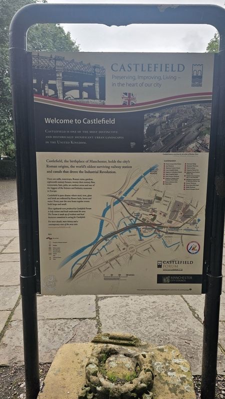
Castlefield, the birthplace of Manchester, holds the city’s Roman origins, the world’s oldest surviving railway station and canals that drove the Industrial Revolution.
There are mills, waterways, Roman ruins, gardens, eighteenth century houses, twenty-first century flats, restaurants, bars, pubs, an outdoor arena and one of the biggest of the Science and Industry museums in Europe.
Castlefield is pure drama: where steel, iron, glass and brick are softened by flower beds, lawns and water. Every year the area hosts regular events both large and small.
These signboards were produced by Castlefield Forum to help visitors and locals understand the area. The Forum is made up of residents and local businesses committed to caring for Castlefield.
For more details, more history and a contemporary view of the area visit: www.ourcastlefield.co.uk
Erected by Castlefield Forum.
Topics. This historical marker is listed in these topic lists: Anthropology & Archaeology • Forts and Castles. A significant historical year for this entry is 79 CE.
Location. 53° 28.563′ N,
Photographed by Ian Lefkowitz, September 14, 2026
2. Welcome to Castlefield side of marker

Regionally, this marker is in North West England. Globally, it is on the Atlantic Ocean, in the North Atlantic Region, in Europe, in Atlantic Europe, on one of the British Isles, in the Western World, and in the Anglosphere. Historically, it finds itself in what was once the Roman Empire.
Other nearby markers. At least 8 other markers are within walking distance of this marker: Campfield Markets & Fairs / Liverpool Road (within shouting distance of this marker); The North Gate / Roman Settlement in Manchester (within shouting distance of this marker); The Roman Fort (about 90 meters away, measured in a direct line); Two Cylinder Crossley Engine (about 120 meters away); Western Wall & Roman Granary (about 120 meters away); Pioneer Quay / Welcome to Castlefield (about 180 meters away); John Owens (about 180 meters away); Castlefield (about 210 meters away). Touch for a list and map of all markers in Manchester.
Also see . . . Mamucium (Wikipedia).
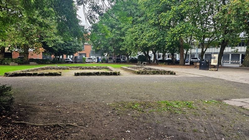
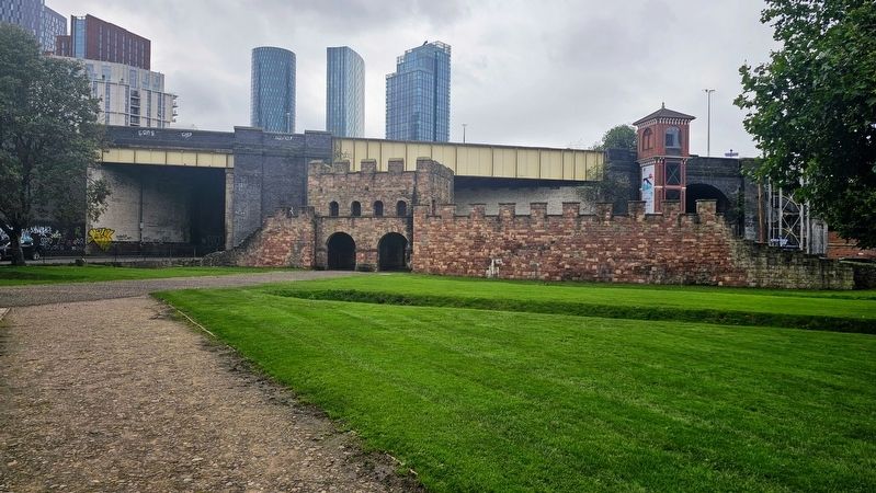
The ruins were left undisturbed until Manchester expanded rapidly during the Industrial Revolution in the late 18th century. Most of the fort was levelled to make way for new developments such as the construction of the Rochdale Canal and the Great Northern Railway. The site is now part of the Castlefield Urban Heritage Park that includes renovated warehouses. A section of the fort's wall along with its gatehouse, granaries, and other ancillary buildings from the vicus have been reconstructed(Submitted on November 6, 2026, by Ian Lefkowitz of New York, New York.)and are open to the public.Photographed by Ian Lefkowitz, September 14, 20263. Reconstructed Roman FoundationsThe signboard is located next to the reconstructions.
Photographed by Ian Lefkowitz, September 14, 2026
4. Roman Fort of Mamucium
This fort is the centerpiece of the park's Roman-era reconstructions.
Credits. This page was last revised on November 6, 2026. It was originally submitted on November 6, 2026, by Ian Lefkowitz of New York, New York. This page has been viewed 8 times since then. Photos: 1, 2, 3, 4. submitted on November 6, 2026, by Ian Lefkowitz of New York, New York. • Andrew Ruppenstein was the editor who published this page.
