Castlefield in Manchester in Greater Manchester, England, United Kingdom — Northwestern Europe (the British Isles)
Western Wall & Roman Granary
Photographed by Ian Lefkowitz, September 14, 2026
1. Western Wall & Roman Granary Marker
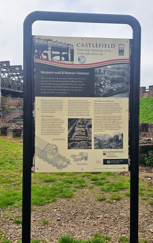
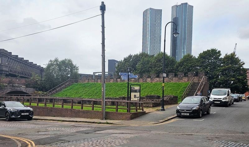
The area where you are now standing was initially outside the defensive walls of the Roman Fort. The western rampart (defensive wall) of the fort was roughly where Duke Street is on your left. It was later moved to where you can now see a reconstruction to your right.
This area of the Roman fort has seen two archaeological excavations: firstly, in 1906–7, by Francis Bruton and secondly, in 1985–6, by the Greater Manchester Archaeological Unit. These investigations have discovered complex Roman archaeology overlain and to varying degrees damaged by 19th and 20th century development.
The Rampart
Initially the rampart was roughly where Duke Street is now on your left, so this area in front of you was outside the fort’s defensive walls. The Romans dug pits in this area to extract gravel, presumably to help with construction of the fort defences. From the late 1st century to the mid–2nd century this area was used for defensive ditches. Later, the fort was expanded westwards to include this area, perhaps to act as a supply depot.
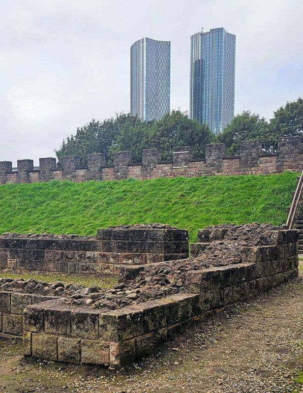
The ditches were filled in with material which included discarded pottery dating to the middle decades of the 2nd century. A new rampart, built of earth with a turf revetment, was erected further to the west with a new defensive ditch. This rampart was fronted with stone around AD 200 and survived until the end of the Roman period. You can see a reconstruction of the rampart to your right, with the outer defensive double ditch behind.
The Roman Granary
Within the expanded area of the fort new buildings were erected. These included a granary (horrea), the reconstructed stone foundations of which are in front of you. Granaries were used to store food supplies including grain and meat. The grain was either ground to make flour for bread using quernstones (stone tools used in pairs for grinding)
this page online
The granary was designed to keep the grain dry and cool and therefore minimise germination. This was achieved by providing a raised floor supported by pillars to reduce ground dampness and allow air flow, together with ventilation holes in the side walls. Loading was undertaken under a sheltered, raised platform at the end of the building. The grain might have been stored in wooden bins, sacks or baskets. Typically a Roman fort would have a pair of granaries — enough to supply the garrison in grain for a whole year.
(Captions)
Bruton’s excavation 1906–7
Greater Manchester Archaeological Unit dig on Duke Street (looking north), 1985–6
Bruton’s excavation 1906–7
An example of a Roman wagon used to transport grain and pulled by oxen.
Erected by Castlefield Forum.
Topics. This historical marker is listed in these topic lists: Anthropology & Archaeology • Forts and Castles. A significant historical year for this entry is 1906.
Location. 53° 28.537′ N, 2° 15.299′ W. Marker is in Manchester, England, in Greater Manchester. It is in Castlefield. It is at the intersection of Duke Street and Duke Place, on the right
Photographed by Ian Lefkowitz, September 14, 2026
2. Western Wall & Roman Granary Marker
The signboard is located along the reconstruction of the western wall of Mamucium.

Regionally, this marker is in North West England. Globally, it is on the Atlantic Ocean, in the North Atlantic Region, in Europe, in Atlantic Europe, on one of the British Isles, in the Western World, and in the Anglosphere. Historically, it finds itself in what was once the Roman Empire.
Other nearby markers. At least 8 other markers are within walking distance of this marker: The Roman Fort (within shouting distance of this marker); The North Gate / Roman Settlement in Manchester (about 90 meters away, measured in a direct line); Roman Manchester / Welcome to Castlefield (about 120 meters away); Two Cylinder Crossley Engine (about 120 meters away); Campfield Markets & Fairs / Liverpool Road (about 150 meters away); The Goods Office / 1830 Viaduct (about 150 meters away); Pioneer Quay / Welcome to Castlefield (about 210 meters away); John Owens (approx. 0.3 kilometers away). Touch for a list and map of all markers in Manchester.
Photographed by Ian Lefkowitz, September 14, 2026
3. Western Wall Reconstruction
Credits. This page was last revised on November 6, 2026. It was originally submitted on November 6, 2026, by Ian Lefkowitz of New York, New York. This page has been viewed 5 times since then. Photos: 1, 2, 3. submitted on November 6, 2026, by Ian Lefkowitz of New York, New York. • Andrew Ruppenstein was the editor who published this page.
