Wynot in Cedar County, Nebraska — The American Midwest (Upper Plains)
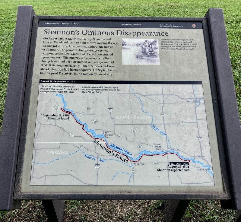
Shannon's Ominous Disappearance
Photographed by Barry Swackhamer, July 17, 2025
1. Shannon's Ominous Disappearance Marker
Caption: (top right) Private Shannon was hungry and out of ammunition when the was found. He had nearly 'Starved to death in a land of Plenty," Clark wrote, "for the want of Bullets and Something to kill his meat."
Erected by Cedar County Commission, Missouri National Recreational River, National Park Service.
Topics. This historical marker is listed in these topic lists: Exploration • Notable Events. A significant historical date for this entry is August 26, 1804.
Location. 42° 45.657′ N, 97° 4.918′ W. Marker is in Wynot, Nebraska, in Cedar County. It can be reached from rooky Bottom Road near 572nd Avenue. The marker is located at Brooky Bottom River Access. Touch for map. Marker is at or near this postal address: 89245 Brooky Bottom Road, Wynot NE 68792, United States of America. Touch for directions.

Regionally, this marker
this page online
Other nearby markers. At least 8 other markers are within 6 miles of this marker, measured as the crow flies: The Lewis & Clark Expedition (here, next to this marker); Up The Missouri River (here, next to this marker); Goat Island (within shouting distance of this marker); Sculpting the Landscape (within shouting distance of this marker); This memorial is erected to the memory of the children of Pheobe, Ann and Henson Wiseman (approx. 0.8 miles away); Meckling & Lincoln (approx. 5.6 miles away in South Dakota); Meckling (approx. 5.7 miles away in South Dakota); Trinity Lutheran Church (approx. 5.8 miles away in South Dakota). Touch for a list and map of all markers in Wynot.
Photographed by Barry Swackhamer, July 17, 2025
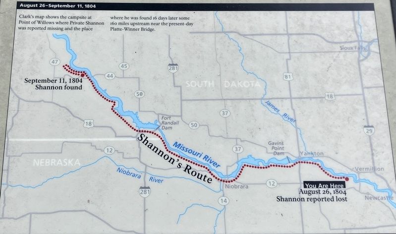
2. August 26-September 11, 1804
Clark's map shows the campsite at Point of Willows where Private Shannon was reported missing and the place where he was found 16 days later some 160 miles upstream near the present-day Platte-Winner Bridge.
Photographed by Barry Swackhamer, July 17, 2025
3. Shannon's Ominous Disappearance Marker
Credits. This page was last revised on November 6, 2026. It was originally submitted on November 6, 2026, by Barry Swackhamer of Brentwood, California. This page has been viewed 5 times since then. Photos: 1, 2, 3. submitted on November 6, 2026, by Barry Swackhamer of Brentwood, California.
