Wynot in Cedar County, Nebraska — The American Midwest (Upper Plains)
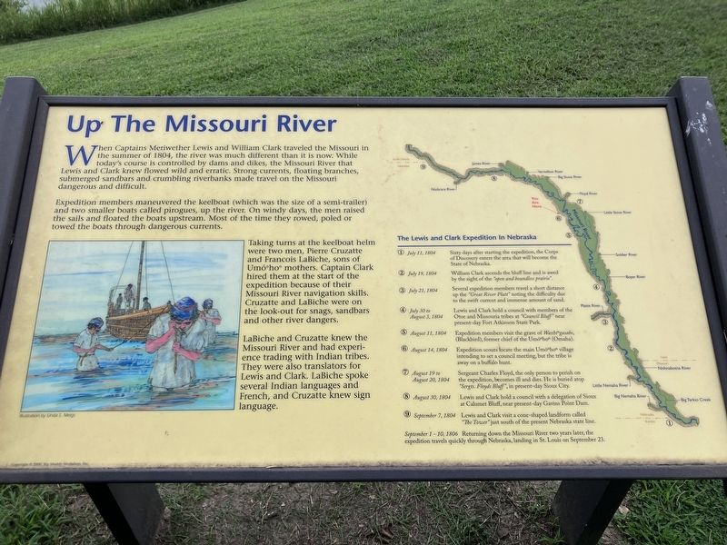
Up The Missouri River
Photographed by Barry Swackhamer, July 17, 2025
1. Up The Missouri River Marker
Expedition members maneuvered the keelboat (which was the size of a semi-trailer) and two smaller boats called pirogues, up the river. On windy days, the men raised the sails and floated the boats upstream. Most of the time they rowed, poled or towed the boats through dangerous currents.
Taking turns at the keelboat helm were two men, Pierre Cruzatte and Francois LeBiche, sons of Umó"ho" mothers. Captain Clark hired them at the start of the expedition because of their Missouri River navigation skills. Cruzatte and LaBiche were on the look-out for snags, sandbars and other river dangers.
LaBiche and Cruzatte knew the Missouri River and had experience trading with the Indian tribes. They were also translators for Lewis and
this page online
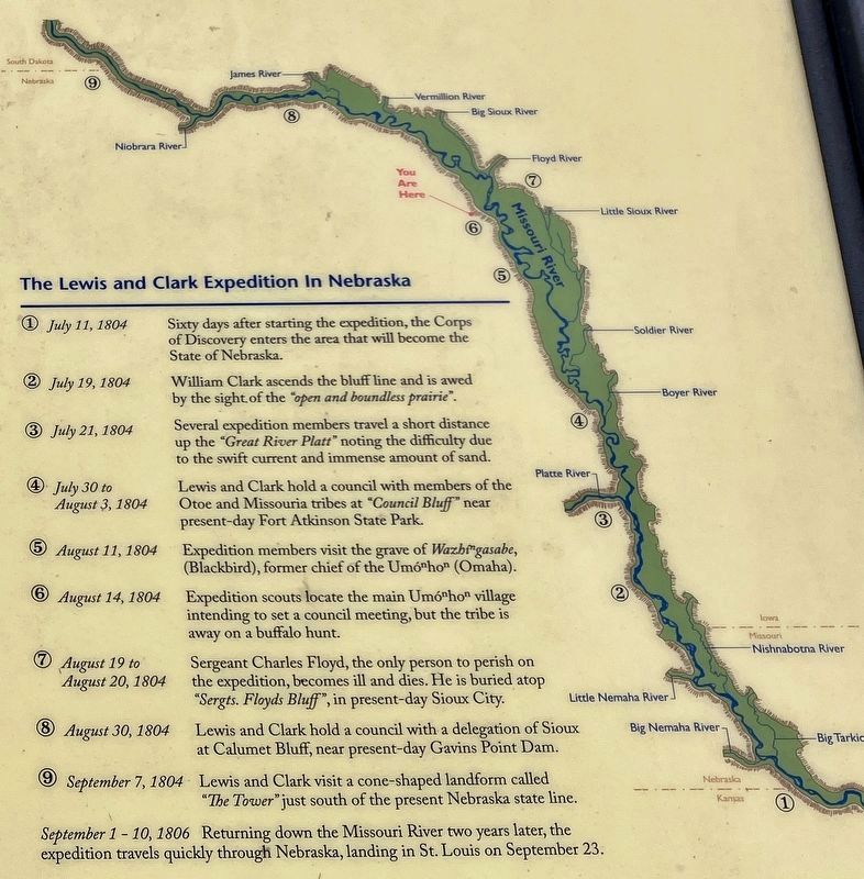
❶ July 11, 1804 Sixty days after starting the expedition, the Corps of Discovery entered the area that will become the State of Nebraska .
❷ July 18, 1804 William Clark ascends the bluffline and is awed by the sight of the "open and boundless prairie".
❸ July 21, 1804 Several expedition members travel a short distance up the "Great River Platt" noting the difficulty due to the swift current and immense amount of sand.
❹ July 30 to August 3, 1804 Lewis and Clark hold a council with members of the Otoe and Missouria tribes at "Council Bluff" near present-day Fort Atkinson State Park.
❺ August 11, 1804 Expedition members visit the grave of Wash"gaser, (Blackbird), former chief of the Umó"ho" (Omaha).
❻ August 14, 1804 Expedition scouts locate the main Umó"ho" village intending to set a council meeting. but the tribes is away on a buffalo hunt.
❼ August 19 to August 20, 1804 Sergeant Charles Floyd. the only person to perish
Photographed by Barry Swackhamer, July 17, 2025
2. Up The Missouri River Marker (detail)
Click on the image to enlarge it.
❽ August 30, 1804 Lewis and Clark hold a council with a delegation of Sioux at Calumet Bluff, near present-day Gavins Point Dam.
❾ September 7, 1804 Lewis and Clark visit a cone-shaped landform called The Tower" just south of the present Nebraska state line.
September 1-10, 1806 Returning down the Missouri River two years later, the expedition travels quickly through Nebraska, landing in St. Louis on September 23.
Topics. This historical marker is listed in these topic lists: Exploration • Waterways & Vessels.
Location. 42° 45.657′ N, 97° 4.918′ W. Marker is in Wynot, Nebraska, in Cedar County. It can be reached from Brooky Bottom Road near 572nd Avenue. The marker is located at Brooky Bottom River Access. Touch for map. Marker is at or near this postal address: 89245 Brooky Bottom Road, Wynot NE 68792, United States of America. Touch for directions.

Regionally, this marker is in Eastern Nebraska. It is also in the American Midwest, in the
Photographed by Barry Swackhamer, July 17, 2025
3. Up The Missouri River Marker
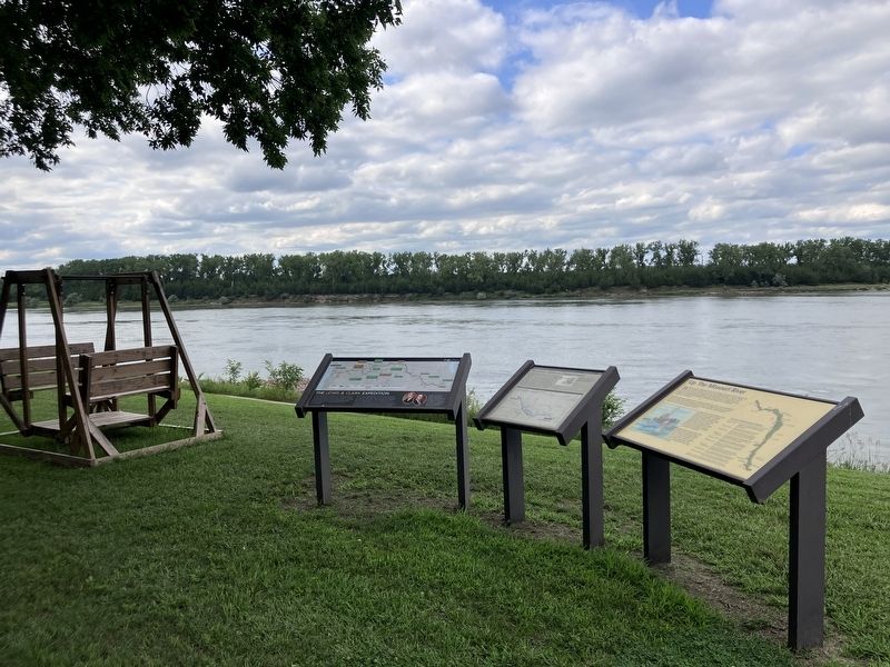
Other nearby markers. At least 8 other markers are within 6 miles of this marker, measured as the crow flies: The Lewis & Clark Expedition (here, next to this marker); Shannon's Ominous Disappearance (here, next to this marker); Goat Island (within shouting distance of this marker); Sculpting the Landscape (within shouting distance of this marker); This memorial is erected to the memory of the children of Pheobe, Ann and Henson Wiseman (approx. 0.8 miles away); Meckling & Lincoln (approx. 5.6 miles away in South Dakota); Meckling (approx. 5.7 miles away in South Dakota); Trinity Lutheran Church (approx. 5.8 miles away in South Dakota). Touch for a list and map of all markers in Wynot.
Credits. This page was last revised on November 6, 2026. It was originally submitted on November 6, 2026, by Barry Swackhamer of Brentwood, California. This page has been viewed 4 times since then. Photos: 1, 2, 3. submitted on November 6, 2026, by Barry Swackhamer of Brentwood, California.
