Castlefield in Manchester in Greater Manchester, England, United Kingdom — Northwestern Europe (the British Isles)
Campfield Markets & Fairs
⎯⎯⎯
Liverpool Road
Photographed by Ian Lefkowitz, September 14, 2026
1. Campfield Markets & Fairs side of marker
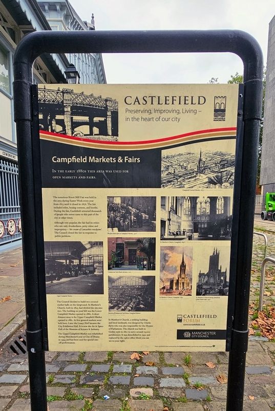
In the early 1880s this area was used for open markets and fairs.
The notorious Knott Mill Fair was held in the area during Easter Week every year from 1823 until it closed in 1876. The fair included rides, boxing contests, and booths. During the fair, Castlefield attracted thousands of people who never came to this part of the city at other times.
Although very popular, the fair had its critics who saw only drunkedness, petty crime and impropriety — ‘the cream of Lancashire rowdyism’. The Council closed the fair in response to public petitions.
The Council decided to build two covered market halls on the fairground. St Matthew’s Church, built in 1825, had divided the site into two. The building on your left was the Lower Campfield Market opened in 1880. A short distance away is the Upper Campfield Market opened in 1882. At first general markets were held here. Later the Lower Hall became the City Exhibition Hall. It is now the Air & Space Hall of the Museum of Science & Industry.
The Upper Campfield Market was refurbished during Manchester’s year as City of Drama in 1994 and has been used for special one-off performances.
St Matthew’s Church, a striking building and local landmark, was designed by Charles Barry who was also responsible for the Houses of Parliament. The church was built in Gothic style in 1822 to serve around 13,000 parishioners. It was demolished in 1952 and replaced by the 1960s office block you can see to your right.
(Captions)
Campfield Covered Market, 1877 © Manchester Local Studies
The first cheese fair at Campfield Market, 1926 © Manchester Local Studies
St Matthew’s Church, Campfield, 1898 © Manchester Local Studies
Upper Campfield Market © Manchester Local Studies
Commercial Sale Room entrance, 2011 © Countryscape
Interior of Commercial Sale Room, Campfield Market © Manchester Local Studies
St Matthew’s Church, Campfield, 1830 © Manchester Local Studies
St Matthew’s Church during demolition (from North side), 1952 © Manchester Local Studies
Liverpool Road
Across
this page online
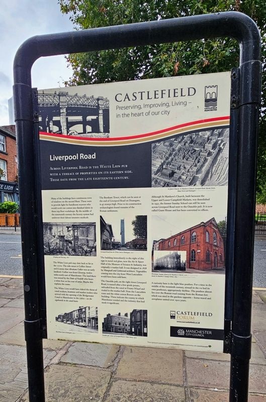
Many of the buildings have continuous rows of windows on the second floor. These were to provide light for handloom weavers who would work raw cotton into finished fabric in these top floor workshops. By the middle of the nineteenth century the factory system had undercut their labour intensive methods.
The White Lion pub may date back as far as the 1770s. The side street is Collier Street and it seems that Abraham Collier was an early landlord. Collier was from Glossop, twelve miles north east of Manchester. The land there was owned by the Duke of Norfolk who bears a white lion on his coat of arms. Maybe this explains the name.
The White Lion would have slaked the thirst of canal workers, boatmen and market traders who arrived with the opening of the Bridgewater Canal to Manchester in the 1760s — see the signboards in the canal basin.
The Beetham Tower, which can be seen at the end of Liverpool Road on Deansgate, is 47 storeys high. Prior to its construction archaeologists found remains of the Roman settlement.
The
Photographed by Ian Lefkowitz, September 14, 2026
2. Liverpool Road side of marker
The Oxnoble pub, on the right down Liverpool Road, is named after a low-grade potato, unloaded from the canal at Potato Wharf and traded in the market hall. Note the Lancashire roses and the white cotton flowers on the building. These indicate the county in which Manchester resided and the industry that had made it significant.
Although St Matthew’s Church, built between the Upper and Lower Campfield Markets, was demolished in 1952, the former Sunday School can still be seen across Liverpool Road next to the Oxnoble pub. It is now called Gunn House and has been converted to offices.
A curiosity here is the light blue postbox. For a time in the middle of the twentieth century, airmail in the UK had its own postboxes, appropriately skyblue. The postbox almost lies over the Roman road coming from the Roman fort which was sited in the gardens opposite — horse-travel and aeroplanes united over 1900 years.
(Captions)
St John’s Church, St Matthew’s Church, Liverpool Road, Byrom Street, Quay Street and Deansgate
Winding and Weaving, 1880
Liverpool Road from the White Lion to Deansgate, 2011
The former Sunday School of St Matthew’s Church, 2011
(inset) St Matthew’s Sunday School, 1890
The White Lion to Deansgate, 1975
Oxnoble pub, corner of Liverpool Road & Duke Street, 1975
Erected by Castlefield Forum.
Topics. This historical marker is listed in these topic lists: Industry & Commerce • Religion & Religious Structures • Roads & Vehicles. A significant historical year for this entry is 1823.
Location. 53° 28.577′ N, 2° 15.18′ W.
Photographed by Ian Lefkowitz, September 14, 2026
3. Campfield Markets & Fairs / Liverpool Road Marker
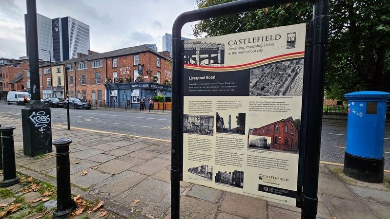
The signboard is located across the street from the White Lion pub, which is described in the text of the marker.

Regionally, this marker is in North West England. Globally, it is on the Atlantic Ocean, in the North Atlantic Region, in Europe, in Atlantic Europe, on one of the British Isles, in the Western World, and in the Anglosphere. Historically, it finds itself in what was once the Roman Empire.
Other nearby markers. At least 8 other markers are within walking distance of this marker: Roman Manchester / Welcome to Castlefield (within shouting distance of this marker); The North Gate / Roman Settlement in Manchester (about 90 meters away, measured in a direct line); Two Cylinder Crossley Engine (about 90 meters away); The Roman Fort (about 120 meters away); Western Wall & Roman Granary (about 150 meters away); John Owens (about 150 meters away); Castlefield (about 180 meters away); St. John’s Church Memorial
Photographed by Ian Lefkowitz, September 14, 2026
4. Campfield Markets & Fairs / Liverpool Road Marker
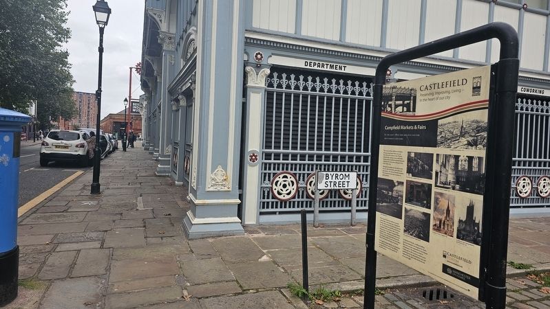
Looking west on Liverpool Road towards the Science & Industry Museum.
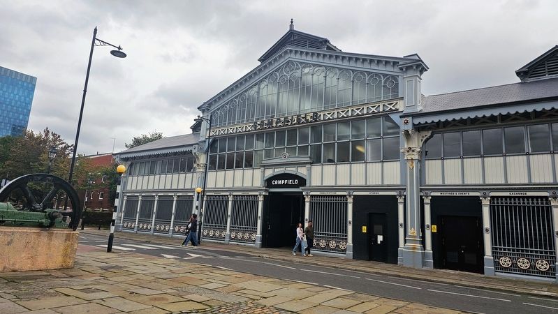
Photographed by Ian Lefkowitz, September 14, 2026
5. Campfield Market
The Campfield Market building is situated between the Science & Industry Museum and the signboard.
Credits. This page was last revised on November 10, 2026. It was originally submitted on November 6, 2026, by Ian Lefkowitz of New York, New York. This page has been viewed 5 times since then. Photos: 1, 2, 3, 4, 5. submitted on November 6, 2026, by Ian Lefkowitz of New York, New York. • Andrew Ruppenstein was the editor who published this page.
