Northampton in West Northamptonshire, England, United Kingdom — Northwestern Europe (the British Isles)
Archaeological Excavations
Photographed by Ray Gurganus, May 25, 2026
1. Archaeological Excavations Marker
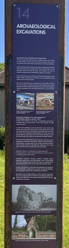
The grassy area behind the houses on Chalk Lane was excavated in the early 1960s to uncover the surviving north-eastern corner of the inner bailey of the castle. There were remains of two main buildings.
Against the bailey bank to the east were the royal apartments that had been destroyed by the recorded fire of 1318, and the remains of the decorated stonework from the doors and windows, as well as numerous fragments from stained-glass windows, were found.
In the north-eastern corner of the inner bailey, there had been a large kitchen range, containing several circular ovens, for baking bread and perhaps also for brewing drinks.
The area of Castle Park was excavated in the mid-1970s, and here there were remains of timber houses from the late Saxon town, which had been levelled to enable the building of the castle. These buildings had been protected by the overlying castle bank for several hundred years.
Excavation findings from redevelopment of Northampton Railway Station, 2013
Ahead of the rebuilding of the station, archaeologists were able to investigate the surviving
this page online
A small stone building lay in the south-western corner of the outer bailey, and a stone road surface led to a postern gate, which would have given direct access to the medieval west bridge. There were also late Saxon pits and ditches buried beneath the castle levels. The postern gate can now be seen in the 19th century boundary wall of the railway station site, where it was placed by the station builders.
One of the most significant discoveries during the excavations was the identification and study of the castle's medieval stone foundations. Archaeologists uncovered parts of the motte and bailey structure, which included sections of the defensive earthworks, and a large stone wall believed to have been part of the castle keep.
Definition: What is a 'castle keep'? A castle keep is the strongest part of a castle and used at the place of last resort if a castle were to be under attack.
Excavations uncovered numerous artifacts, including pottery fragments, animal bones, and metal objects, many of which dated back to the medieval period. These items help us to understand the daily life and activities that occurred at the castle during its prime.
Evidence was found of a shoe factory that operated on the castle site during World War I, including left over pieces of industrial buildings, tools, and debris relating to the manufacturing of footwear.
Excavations also revealed evidence of earlier railway construction layers and remaining sections of 19th century buildings together with medieval and World War I-era artifacts, demonstrating the long and varied history of the area.
(Marker Number 14.)
Topics. This historical marker is listed in these topic lists: Anthropology & Archaeology • Forts and Castles.
Location. 52° 14.249′ N, 0° 54.256′ W. Marker is in Northampton, England, in West Northamptonshire. It is on Western View. Touch for map. Marker is at or near this postal address: 2 Western View, Northampton, England NN1 1SN, United Kingdom. Touch for directions.

Regionally, it is on the Atlantic Ocean, in the North Atlantic Region, in Europe, in Atlantic Europe, on one of the British Isles, in the Western World, and in the Anglosphere. Historically, it finds itself in what was once the Roman Empire.
Other nearby markers. At least 8 other markers are within walking distance of this marker: Shoe Industry (here, next to this marker); The Great Fire of Northampton (here, next to this marker); The Fall of the Castle Walls (a few steps from this marker); Hazelrigg House and the Old Black Lion (a few steps from this marker); Stories from the Castle (a few steps from this marker); Royals and the Castle (within shouting distance of this marker); Thomas Becket (within shouting distance of this marker); Visitors to the Castle (within shouting distance of this marker). Touch for a list and map of all markers in Northampton.
Credits. This page was last revised on November 7, 2026. It was originally submitted on November 7, 2026, by Ray Gurganus of Washington, District of Columbia. This page has been viewed 4 times since then. Photo 1. submitted on November 7, 2026, by Ray Gurganus of Washington, District of Columbia. • Andrew Ruppenstein was the editor who published this page.
