Manchester in Greater Manchester, England, United Kingdom — Northwestern Europe (the British Isles)
'The Visible Boundary'
Photographed by Ian Lefkowitz, September 14, 2026
1. 'The Visible Boundary' Marker
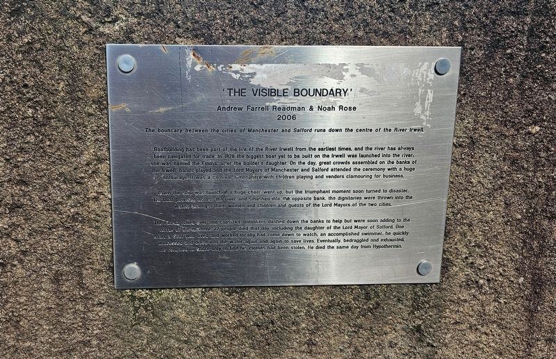
‘The Visible Boundary’
Andrew Farrell Readman & Noah Rose
2006
The boundary between the cities of Manchester and Salford runs down the centre of the River Irwell.
Boatbuilding has been part of the life of the River Irwell from the earliest times, and the river has always been navigated for trade. In 1828 the biggest boat yet to be built on the Irwell was launched into the river; she was named the Emma, after the builder’s daughter. On the day, great crowds assembled on the banks of the Irwell, bands played and the Lord Mayors of Manchester and Salford attended the ceremony with a huge entourage. It was a carnival atmosphere with children playing and vendors clamouring for business.
When the ship was launched a huge cheer went up, but the triumphant moment soon turned to disaster. The boat powered across the river and smashed into the opposite bank, the dignitaries were thrown into the water, amongst them women and children and guests of the Lord Mayors of the two cities.
The Emma rolled over and capsized. Onlookers dashed down the banks to help but were soon adding to the terror of the moment. 22 people died that day, including
this page online
Erected 2006.
Topics. This historical marker is listed in these topic lists: Disasters • Waterways & Vessels. A significant historical date for this entry is February 29, 1828.
Location. 53° 28.912′ N, 2° 15.176′ W. Marker is in Manchester, England, in Greater Manchester. It is on Bridge Street south of Browncross Street, on the left when traveling east. Touch for map. Marker is at or near this postal address: 2 Bridge Street, Manchester, England M3 2WJ, United Kingdom. Touch for directions.

Regionally, this marker is in North West England. Globally, it is on the Atlantic Ocean, in the North Atlantic Region, in Europe, in Atlantic Europe, on one of the British Isles, in the Western World, and in the Anglosphere. Historically, it finds itself in what was once the Roman Empire.
Photographed by Ian Lefkowitz, September 14, 2026
2. 'The Visible Boundary' Marker
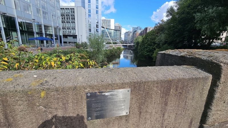
The plaque overlooks the River Irwell, which divides Salford and Manchester.
Other nearby markers. At least 8 other markers are within walking distance of this marker: Albert Bridge (a few steps from this marker); Hiroshima and Nagasaki Atomic Bombings Memorial (within shouting distance of this marker); First Provincial School of Anatomy (approx. 0.3 kilometers away); Richard Cobden / Owens College (approx. 0.4 kilometers away); Norman Evans (approx. 0.4 kilometers away); Sir Harry Secombe C.B.E. (approx. 0.4 kilometers away); Roy Castle OBE (approx. 0.4 kilometers away); Sir Edward Frankland PhD FRS / Sir Henry Enfield Roscoe BA PhD FRS (approx. 0.4 kilometers away). Touch for a list and map of all markers in Manchester.
Also see . . .
1. The Visible Boundary (Read the Plaque).
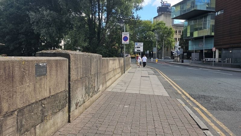
According to Noah Rose "In July 2006, after 5 years planning, the boundary between the neighbouring cities of Manchester and Salford was made visible with a 300m long pink dotted line, floating down the dead centre of the River Irwell. This temporary installation was conceived by Andy Farrell Readman and myself back in 2001. The installation turned out to be more temporary than we envisaged. On the day that the work was(Submitted on November 8, 2026, by Ian Lefkowitz of New York, New York.)to be launched - in front of an audience of visiting artists from Scotland - it turned out to have disappeared without a trace. The reason for its disappearance has not yet been satisfactorily explained. The pink polystyrene-and-steel floating boundary is missing, presumed on a round-the-world voyage. It may yet resurface in another location to divide or reunite two places which share some history"Photographed by Ian Lefkowitz, September 14, 20263. The Albert BridgeLooking towards Manchester and the People's History Museum.
2. Emma (1828 ship) (Wikipedia).
The Emma was a river flat launched on 29 February 1828 along the Mersey and Irwell Navigation, in Manchester. Built by the New Quay Company, it was one of the largest cargo vessels to be built alongside the Irwell. The vessel capsized shortly after its launch, causing the deaths of as many as 47 of its estimated 200 passengers.(Submitted on November 8, 2026, by Ian Lefkowitz of New York, New York.)
Credits. This page was last revised on November 9, 2026. It was originally submitted on November 8, 2026, by Ian Lefkowitz of New York, New York. This page has been viewed 6 times since then. Photos: 1, 2, 3. submitted on November 8, 2026, by Ian Lefkowitz of New York, New York. • Andrew Ruppenstein was the editor who published this page.
