Mitte in Hannover in Region Hannover, Lower Saxony, Germany — Central Europe
Der Neustädter Friedhof
Geschichte und bedeutende Grabmale
⎯⎯⎯
The Neustädter Cemetery
History and Significant Funerary Monuments
Photographed by James Hulse, October 9, 2026
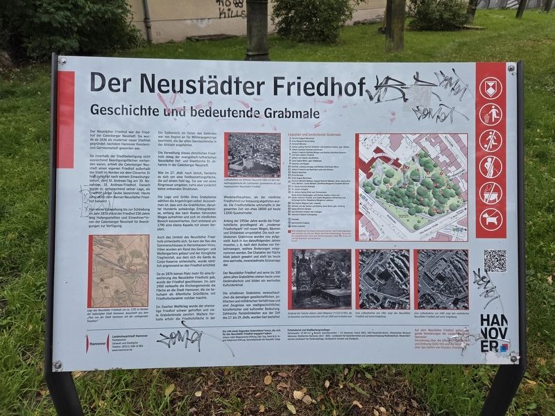
1. Der Neustädter Friedhof / The Neustädter Cemetery Marker

Da innerhalb der Stadtbefestigung nicht ausreichend Beerdigungsflächen vorhanden waren, erhielt die Calenberger Neustadt einen eigenen Friedhof außerhalb der Stadt im Norden vor dem Clevertor. Er hieß zunächst nach seinem Einweihungsdatum, dem St. Andreas-Tag am 30. November, St. Andreas-Friedhof. Danach wurde er, entsprechend seiner Lage, als Friedhof Lange Laube bezeichnet. Heute ist er unter dem Namen Neustädter Friedhof bekannt.
Von seiner Einweihung bis zur Schließung im Jahr 1876 stand der Friedhof 230 Jahre lang Hofangestellten und Einwohner*innen der Calenberger Neustadt für Beerdigungen zur Verfügung.
Ein Teilbereich im Osten des Geländes war von Beginn an für Militärangehörige bestimmt, die der alten Garnisonkirche in der Altstadt angehörten.
Die Verwaltung dieses christlichen Friedhofs oblag der evangelisch-lutherischen Neustädter Hof- und Stadtkirche St. Johannis in der Calenberger Neustadt.
Wie im 17. Jhdt. noch
this page online
Die Lage und Größe ihres Grabplatzes wählten die Angehörigen selbst. Anzunehmen ist, dass sich die Grabflächen, darunter Hunderte aufwändige Erbbegräbnisse, entlang des nach Norden führenden Weges aufreihten und sich im nördlichen Bereich konzentrierten. Dort entstand um 1790 eine kleine Kapelle mit einem Vorplatz.
Auch das Umfeld des Neustädter Friedhofs entwickelte sich. So kam der Bau des Sommerschlosses in Herrenhausen hinzu. Villen wurden am Rand des Georgen- und Welfengartens gebaut und der Königliche Tragierstall, aus dem sich die Garde du Corps-Kaserne entwickelte, wurde nördlich angrenzend an den Friedhof errichtet.
Da es 1876 keinen Platz mehr für eine Erweiterung des Neustädter Friedhofs gab, wurde der Friedhof geschlossen. Im Jahr 1900 verkaufte die Kirchengemeinde die Fläche an die Stadt Hannover, die sie behutsam als öffentliche Grünfläche mit Friedhofscharakter nutzbar machte.
Im Zweiten Weltkrieg wurde der ehemalige Friedhof schwer getroffen und viele
Photographed by James Hulse, October 9, 2026
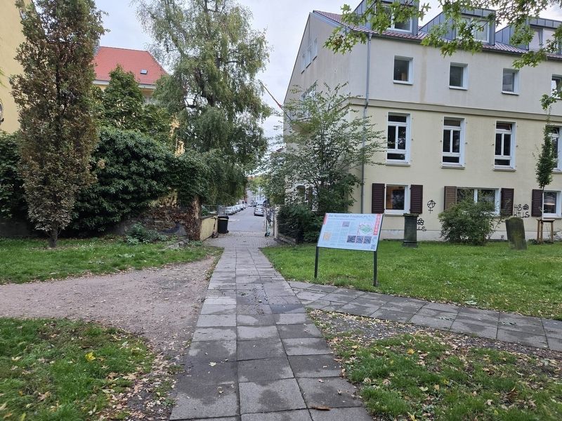
2. Der Neustädter Friedhof / The Neustädter Cemetery Marker
Anfang der 1950er Jahre wurde die Friedhofsfläche grundlegend als „moderner Friedhofspark“ mit neuen Wegen, Bäumen und Sitzbänken umgestaltet. Die noch verbliebenen Grabsteine wurden neu aufgestellt. Auch in den darauffolgenden Jahren mussten, z. B. nach dem Ausbau von Verkehrswegen, weitere Änderungen vorgenommen werden. Der Charakter der Fläche blieb jedoch gewahrt und stellt bis heute eine wertvolle, innenstadtnahe Grünanlage dar.
Der Neustädter Friedhof und seine bis 300 Jahre alten Grabstätten stehen heute unter Denkmalschutz und bilden ein wertvolles Kulturdenkmal.
Die erhaltenen Grabsteine veranschaulichen die damaligen gesellschaftlichen, politischen und militärischen Verhältnisse und sind Zeugnisse von stadtgeschichtlicher, künstlerischer und kultureller Bedeutung. Zahlreiche Persönlichkeiten aus der Zeit des 17. bis 19. Jhdts. wurden hier bestattet.
Lage des Neustädter Friedhofs um ca. 1725 im Norden der befestigten Stadt Hannover. Ausschnitt aus dem „Plan von der Stadt Hannover mit der umliegenden Situation“
Luftaufnahme von Wilhelm Hauschild 1956 mit dem Verwaltungsgebäude der Continental-Gummiwerke AG und angrenzendem Neustädter Friedhof
Grabmal der Familie Johann Jobst Wagener (*1712–†1785), die im barocken und klassizistischen Stil um 1900 noch erhalten war
Eine Luftaufnahme von 1961 zeigt den Neustädter Friedhof und seine Umgebung
Eine Luftaufnahme von 1980 zeigt den veränderten Neustädter Friedhof und seine Umgebung
The
Photographed by James Hulse, October 9, 2026
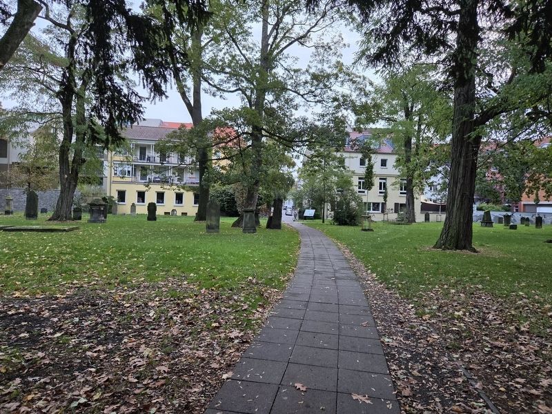
3. Der Neustädter Friedhof / The Neustädter Cemetery and Marker
Because there was insufficient burial space within the city fortifications, the Calenberger Neustadt received its own cemetery outside the city, north of the Clevertor. It was initially named St. Andreas Cemetery after its consecration date, St. Andrew’s Day on November 30. It was later called the Lange Laube Cemetery because of its location. Today, it is known as the Neustädter Cemetery.
From its consecration until its closure in 1876, the cemetery served court employees and residents of the Calenberger Neustadt as a burial place for 230 years.
From the beginning, an area in the eastern part of the grounds was designated for military personnel who belonged to the old garrison church in the Old Town.
The administration of this Christian cemetery was the responsibility of the Evangelical Lutheran Neustädter Court and City Church of St. Johannis in the Calenberger Neustadt.
As was still customary in the 17th century, it was a field burial ground located in an open field. It was enclosed by a surrounding wall but initially had no organized layout.
Families selected the location and size of their burial plots themselves. It is assumed that the burial plots, including hundreds of elaborate hereditary tombs, were arranged along the path leading north and concentrated in the northern section. A small chapel with a forecourt was built there around 1790.
The area surrounding the Neustädter Cemetery also developed. Herrenhausen’s summer palace was constructed, villas were built along the edges of the Georgengarten and Welfengarten, and the Royal Tragierstall, from which the Garde du Corps barracks developed, was erected immediately north of the cemetery.
Because there was no longer room to expand the Neustädter Cemetery in 1876, the cemetery was closed. In 1900, the parish sold the grounds to the City of Hanover, which carefully converted them into a public green space while retaining their cemetery character.
During the Second World War, the former cemetery was severely damaged and many funerary monuments were destroyed. The cemetery suffered further losses during reconstruction when its northern section was surrendered for development. Over time, the cemetery grounds decreased from approximately 18,000 square meters to the present 13,200 square meters.
At the beginning of the 1950s, the cemetery grounds were fundamentally redesigned as a “modern cemetery park” with new paths, trees and benches. The surviving gravestones were repositioned. Further changes were also necessary in subsequent years, including after the expansion of traffic routes. However, the character of the grounds was preserved, and the cemetery remains a valuable green space near the city center.
The Neustädter Cemetery and its burial sites, some as much as 300 years old, are now protected monuments and form a valuable cultural landmark.
The surviving gravestones illustrate the social, political and military conditions of the period and are significant records of the city’s history, art and culture. Numerous notable people from the 17th through the 19th centuries were buried here.
Location of the Neustädter Cemetery around 1725 north of the fortified city of Hanover. Detail from the “Plan of the City of Hanover with the Surrounding Area”
Aerial photograph by Wilhelm Hauschild from 1956 showing the administrative building of Continental-Gummiwerke AG and the adjacent Neustädter Cemetery
Tomb of the Johann Jobst Wagener family (*1712–†1785), which was still preserved in the Baroque and Neoclassical style around 1900
An aerial photograph from 1961 shows the Neustädter Cemetery and its surroundings
An aerial photograph from 1980 shows the altered Neustädter Cemetery and its surroundings
Erected 2021 by Landeshauptstadt Hannover, Fachbereich Umwelt und Stadtgrün.
Topics. This historical marker is listed in this topic list: Cemeteries & Burial Sites. A significant historical year for this entry is 1636.
Location. 52° 22.678′ N, 9° 43.581′ E. Marker is in Hannover, Niedersachsen (Lower Saxony), in Region Hannover. It is in Mitte. It is on Theodorstraße 0.1 kilometers west of Körnerstraße, on the left when traveling west. Touch for map. Marker is at or near this postal address: Theodorstraße 17, Hannover NI 30159, Germany. Touch for directions.

Regionally, it is in Europe, the European Union, Atlantic Europe, Central Europe, the Schengen Area, Western Europe, and the Western World. Historically, it finds itself in what was once the Holy Roman Empire and also the former West Germany.
Other nearby markers. At least 8 other markers are within walking distance of this marker: A different marker also named Der Neustädter Friedhof / The Neustädter Cemetery (within shouting distance of this marker); a different marker also named Der Neustädter Friedhof / The Neustädter Cemetery (about 120 meters away, measured in a direct line); Josef Berliner (about 180 meters away); Dr. Fritz Frensdorff (approx. 0.2 kilometers away); Brüggemannhof (approx. 0.3 kilometers away); Der Klagesmarkt (approx. 0.3 kilometers away); Der St. Nikolai-Friedhof / St. Nikolai Cemetery (approx. 0.3 kilometers away); Justus Bier (approx. 0.4 kilometers away). Touch for a list and map of all markers in Hannover.
More about this marker. This is one of three identical markers in the cemetery, each at a different entrance
Credits. This page was last revised on November 9, 2026. It was originally submitted on November 8, 2026, by James Hulse of Medina, Texas. This page has been viewed 7 times since then. Photos: 1, 2, 3. submitted on November 9, 2026, by James Hulse of Medina, Texas.
