Starkville in Oktibbeha County, Mississippi — The American South (East South Central)
Brush Arbor Cemetery
Historic Starkville
| — | Mississippi's College Town | — |
Photographed by Delaney Shaw, August 31, 2025
1. Brush Arbor Cemetery Marker
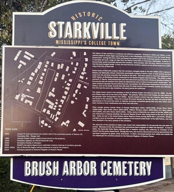
The history of this cemetery is scattered and difficult to pinpoint. During the 1830s and 1840s, a man named Joseph B. Earle began purchasing the land in both Mississippi and Alabama from the United States Government. During this time. Sore purchased the eastern half of the southwest quarter of section 36, in township 19 north, range ta east from the District Land Office in Columbus, Mississippi. A portion of his purchase would eventually become this cemetery, Unfortunately, after this time, there Is no record of how the land changed hands. In fact, the next time the cemetery appears on an official map is on a 1925 map of the City of Starkville.
Some locals of Starkville suspect that the cemetery changed hands in the state 1800s when a group of Baptist and Methodist African Americans purchased a parcel of land in order to hold worship services away from the all-white churches that existed at the time. Thie story seems to have first appeared in a 1937 History of Oktibbeha County conducted for the Worke Progress Administration. The author, a man named R. C. Morris, used manuscripts and interviews from local Starkville
this page online
The oldest known burial in the cemetery is that of Jimmie Cooper who died on June 21, 1882. He was only fifteen years old at the time of his death. His parents, Alford and Annie Cooper are also buried on the grounds, both having died in the 1020s. Immo Cooper's burial may not, however, have been the first burial in the cemetery. There are at least 33 known burials on the alto, but there are several other depressions in the trend that seem to indicate numerous unmarked graves that may have either never been marked or their headstones have been lost with time.
Other notable graves include those of George Washington Chifies (1840 1929), Grover Henry Zuber (2896-1948), Sam Smith (about 1834-1904), Willam Winstog (about
Photographed by Delaney Shaw, November 8, 2026
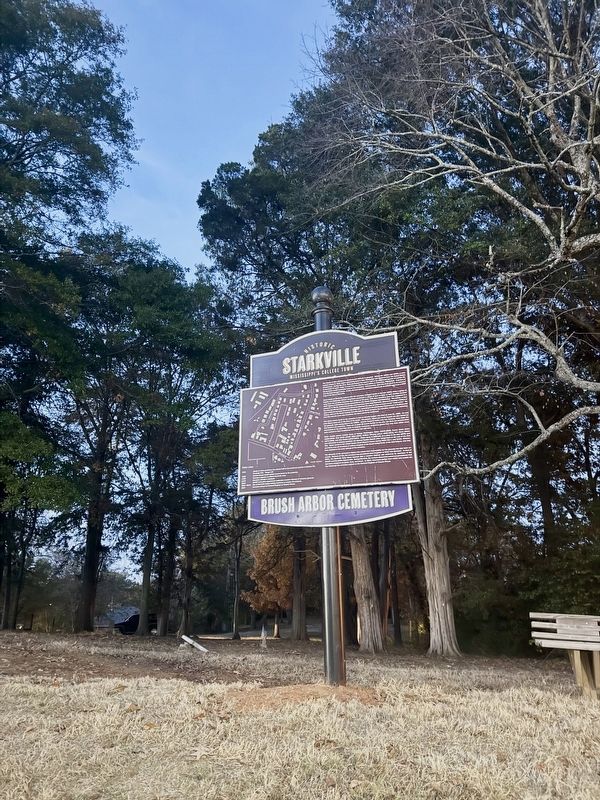
2. Brush Arbor Cemetery Marker
The obscurity of the cemetery's history has meant that responsibility for the grounds has also been un-certain. Because of this, the cemetery has sometimes been forgotten or fallen into disrepair. In June of 2004, the Starkville Daily News reported that a massive cleanup was underway by members of the NAACP and the police department. During this time, the workers discovered numerous gravestones that had been overgrown by grass, trees, and brush. In 2014, Interested parties from within and outside the city helped get the cemetery placed on the National Register of Historic Places.
Topics. This historical marker is listed in these topic lists: African Americans • Cemeteries & Burial Sites. A significant historical date for this entry is June 21, 1882.
Location. 33° 27.768′ N, 88° 48.334′ W. Marker is in Starkville, Mississippi, in Oktibbeha County. It is on University Drive west of North Nash Street, on the right when traveling west. Touch for map. Marker is at or near this postal address: 519 University Dr, Starkville MS 39759, United States of America. Touch for directions.

Regionally, this marker is in East Mississippi, in the Black Prairie, and in the Golden Triangle. It is also in the American South, specifically in the Deep South, and in the Black Belt. Globally, it is in North America, a Gulf of Mexico state, the Western Hemisphere, the Western World, and the Anglosphere. Historically, it finds itself in what was once the territory of the Mississippian Culture, one of the Confederate States of America, and the Antebellum South.
Other nearby markers. At least 8 other markers are within walking distance of this marker: Nash Street Historic District (about 400 feet away, measured in a direct line); Oktibbeha County Blues (approx. ¼ mile away); The Borden Milk Plant (approx. ¼ mile away); First Presbyterian Church (approx. 0.4 miles away); Needmore Community (approx. 0.4 miles away); Oktibbeha Gardens (approx. 0.4 miles away); Starkville (approx. half a mile away); Overstreet School District (approx. half a mile away). Touch for a list and map of all markers in Starkville.
Credits. This page was last revised on November 9, 2026. It was originally submitted on November 8, 2026, by Delaney Shaw of Seneca, South Carolina. This page has been viewed 9 times since then. Photos: 1, 2. submitted on November 8, 2026, by Delaney Shaw of Seneca, South Carolina. • Devry Becker Jones was the editor who published this page.
Editor’s want-list for this marker. A link to the National Register of Historic Places nomination form, citing the cemetery's historical significance. • Can you help?
