Near Richmond in Madison County, Kentucky — The American South (East South Central)
Manson's First Line
Photographed by Lee Hattabaugh, May 6, 2010
1. Manson's First Line Marker
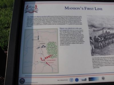
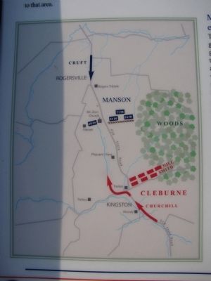
Manson was ordered not to risk a general engagement unless he was sure of success. This was sage advice since Manson's brigade was green. The 55th Indiana was the veteran of the group, having been mustered in June 16, just over two months earlier. the other three regiments
this page online
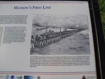
Civil War battles often played out in the manner prescribed by field manuals for maneuvering and fighting soldiers, such as Rifle and Light Infantry Tactics: For The Exercise And Maneuvers Of Troops When Acting As Light Infantry Or Riflemen, by Brevet Lieut. Col. W.J. Hardee, more commonly referred to as Hardee's Tactics. All of the officers who were trained at West Point were well versed in these rules, as were many of the amateurs who served in the militia. Soldiers generally arrived at a battlefield in a column, that is, a line of four men across. In order to fight the battle the man were then deployed in line of battle. Imagine a vertical line becoming horizontal, in a maneuver carried out in a rigidly prescribed way with thousands of men.
Erected by Civil War Discovery Trail.
Topics. This historical marker is listed in this topic list: War, US Civil. A significant historical month for this entry is June 1862.
Location. 37° 40.508′ N,
Photographed by Lee Hattabaugh, May 6, 2010
2. Wartime Illustration - Line of Battle

Regionally, this marker is in the American South, specifically in the Upper South, in Appalachia, and specifically in Southern Appalachia. Globally, it is in North America, the Western Hemisphere, the Western World, and the Anglosphere. Historically, it finds itself in what was once the territory of the Mississippian Culture and also the Antebellum South.
Other nearby markers. At least 8 other markers are within walking distance of this marker: The Confederates Crush The Union Left (here, next to this marker); Civil War Field Hospital (approx. 0.2 miles away); Mt. Zion Church - Field Hospital (approx. 0.2 miles away); Michigan Light Artillery Regiment / Batteries F and G (approx. 0.2 miles away); Union Artillery (approx. 0.2 miles
Photographed by Lee Hattabaugh, May 6, 2010
3. Manson's First Line Marker
Credits. This page was last revised on June 16, 2016. It was originally submitted on June 7, 2010, by Lee Hattabaugh of Capshaw, Alabama. This page has been viewed 974 times since then and 38 times this year. Photos: 1, 2, 3. submitted on June 7, 2010, by Lee Hattabaugh of Capshaw, Alabama. • Craig Swain was the editor who published this page.
Editor’s want-list for this marker. A wide shot of the marker and its surroundings. • Can you help?
