Hoveton in Norfolk, England, United Kingdom — Northwestern Europe (the British Isles)
Granary Staithe
Photographed by Ray Gurganus, April 23, 2026
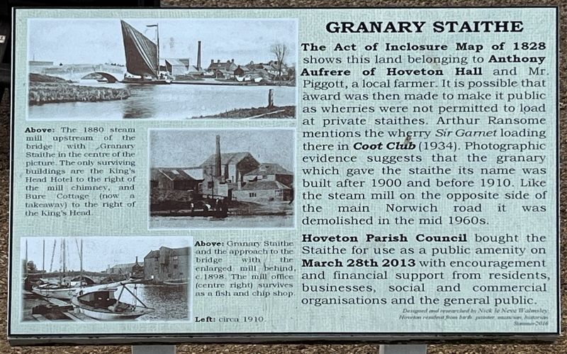
1. Granary Staithe Marker
Hoveton Parish Council bought the and the approach to the Staithe for use as a public amenity on March 28th 2013 with encouragement and financial support from residents, businesses, social and commercial organisations and the general public.
Captions
Above: The 1880 steam mill upstream of the bridge with Granary Staithe in the centre of the picture. The only surviving buildings are the King's Head Hotel to the right of the mill chimney, and Bure Cottage (now a takeaway) to the right of the King's Hend.
Above: Granary Staithe bridge with the enlarged mill behind, c. 1898. The
this page online
Topics. This historical marker is listed in this topic list: Waterways & Vessels. A significant historical year for this entry is 1828.
Location. 52° 42.706′ N, 1° 24.519′ E. Marker is in Hoveton, England, in Norfolk. It is on Norwich Road, on the left when traveling west. Touch for map. Marker is at or near this postal address: 11 Norwich Road, Hoveton, England NR12 8DA, United Kingdom. Touch for directions.

Regionally, this marker is in East Anglia. Globally, it is on the Atlantic Ocean, in the North Atlantic Region, in Europe, in Atlantic Europe, on one of the British Isles, in the Western World, and in the Anglosphere. Historically, it finds itself in what was once the Roman Empire.
Other nearby markers. At least 8 other markers are within 13 kilometers of this marker, measured as the crow flies: Pull's Ferry House (approx. 11.4 kilometers away); Pull's Ferry (approx. 11.4 kilometers away); Browne's Meadow (approx. 11.4 kilometers away); Elm Hill (approx. 11.6 kilometers away); Edith Cavell (approx. 11.6 kilometers away); Augustine Steward House (approx.
Photographed by Ray Gurganus, April 23, 2026
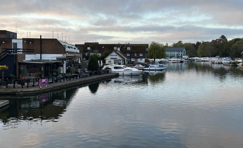
2. Hoveton Wharf
More about this marker. The marker is just a few steps south of the road and walkway, on a cantilevered support stand.
Credits. This page was last revised on November 10, 2026. It was originally submitted on November 10, 2026, by Ray Gurganus of Washington, District of Columbia. This page has been viewed 3 times since then. Photos: 1, 2. submitted on November 10, 2026, by Ray Gurganus of Washington, District of Columbia. • Andrew Ruppenstein was the editor who published this page.
