Golden Gate Canyon in Clear Creek County, Colorado — The American Mountains (Southwest)
Clear Creek Country
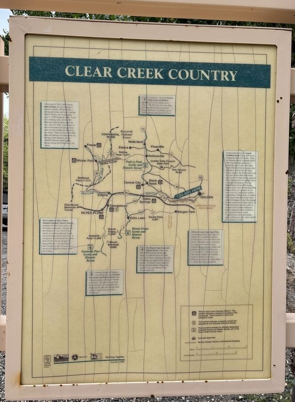
Photographed by Leslie Eudy, September 24, 2026
1. Clear Creek County Marker
To the south of Clear Creek Canyon, Idaho Springs, the site of George A. Jackson’s January 1859 gold strike, a thriving gold camp, and now a National Historic District, saw its population jump to 12,000 during the 1860s. It was also a smelting center and by 1903 thirty-one treatment plants dotted the area. After the 1870s, visitors came to soak in the mineral hot springs whose water was also bottled and sold across the country. Today, the Argo Gold Mill, Mine, and Museum, the Edgar Mine, the Heritage Center Museum, and the Underhill Museum interpret Idaho Springs mining and frontier history for visitors.
Established in 1918, the Peak to Peak Scenic and Historic Byway, is Colorado’s oldest scenic byway. The fifty-five-mile route offers matchless views of the Continental Divide and access to trailheads, ghost towns, and national parks and forests.
A major gold discovery in Central City/Black Hawk in May 1859 forever changed the future of Colorado. Today, this National Historic Landmark District offers visitors ample opportunity to explore the region’s past. The Gilpin County Historical Society
this page online
Jefferson County Open Space Park, encompassing Clear Creek along U.S. Highway 6, is a significant riparian ecosystem rich in Colorado history that attracts Coloradans eager to participate in its many recreational activities including hiking, climbing, rafting, gold panning, kayaking, sightseeing, and cave exploration. Jefferson
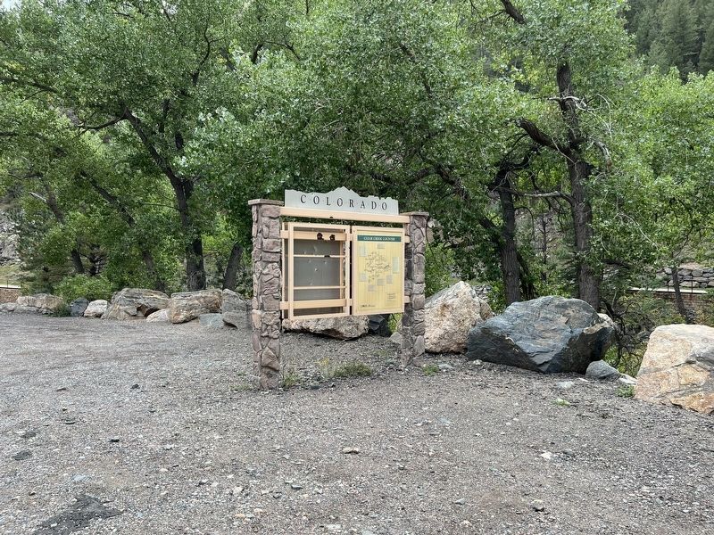
Photographed by Leslie Eudy, September 24, 2026
2. Clear Creek Country Marker Wide View
The Mount Evans Scenic and Historic Byway climbs more than 7,000 feet in just twenty-eight miles. At a peak elevation of 14,264 feet, visitors have a stunning view of the Front Range and might catch a glimpse of Colorado’s state animal – the Rocky Mountain Bighorn Sheep. (The summit is only open Memorial Day through Labor Day.)
Winding through old logging and mining areas, the Guanella Pass Scenic and Historic Byway takes travelers through a variety of Colorado ecosystems. The lower elevations are thick with spruce, fir, and aspen trees. Higher up, the road runs through broad meadows until it crests well above timberline.
The Georgetown-Silver Plume National Landmark Historic District, southwest of Clear Creek Canyon, has four major components – Georgetown, the Georgetown Loop, Silver Plume, and the surrounding landscape dotted with mine dumps and old structures. In Georgetown visit the Hamill House, the Hotel de Paris, and the Georgetown Energy Museum. Visit the Lebanch Mine Complex as part of a Loop tour, or stop by the George Rowe Museum in Silver Plume.
Topics. This historical marker is listed in these topic lists: Industry & Commerce • Parks & Recreational Areas • Settlements & Settlers.
Location. 39° 44.163′ N, 105° 22.747′ W. Marker is near Golden, Colorado, in Clear Creek County. It is in Golden Gate Canyon. It is on Clear Creek Canyon Road, on the left when traveling west. On U.S. Highway 6 between Black Hawk and Golden. A few miles south of where CO 119 branches off to Black Hawk. Touch for map. Marker is at or near this postal address: US-6, Golden CO, United States of America. Touch for directions.

Regionally, this marker is in the Colorado High Rockies and on the Continental Divide. It is also in the American Mountain West. Globally, it is in North America, the Rocky Mountains, the Western Hemisphere, the Western World, and the Anglosphere.
Other nearby markers. At least 8 other markers are within 8 miles of this marker, measured as the crow flies: Chinese in Colorado (here, next to this marker); Pay Dirt (here, next to this marker); Black Hawk History - Public School (approx. 7 miles away); Black Hawk History - Railroad Trestles (approx. 7.1 miles away); Windy Saddle Park / Connecting to the Past (approx. 7.1 miles away); Colorado Central Railroad (approx. 7.2 miles away); Black Hawk History - Fire Department (approx. 7.2 miles away); Black Hawk History - Transportation (approx. 7.3 miles away). Touch for a list and map of all markers in Golden.
Other markers no longer nearby. Recreation: Past to Present (was approx. 7.1 miles away but has been permanently removed); Water Carves Canyons (was approx. 7.1 miles away but has been permanently removed); Play in the Wind (was approx. 7.1 miles away but has been permanently removed).
Credits. This page was last revised on November 10, 2026. It was originally submitted on November 10, 2026, by Leslie Eudy of Golden, Colorado. This page has been viewed 3 times since then. Photos: 1, 2. submitted on November 10, 2026, by Leslie Eudy of Golden, Colorado. • Andrew Ruppenstein was the editor who published this page.
