Zanesville in Muskingum County, Ohio — The American Midwest (Great Lakes)
Putnam Presbyterian Church
Circa 1835
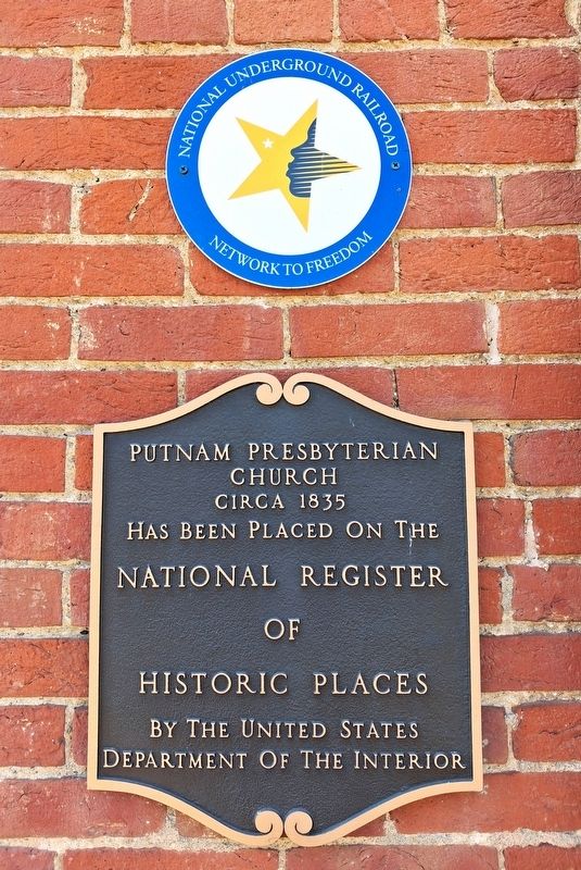
Photographed by William Fischer, Jr., November 10, 2026
1. Putnam Presbyterian Church Markers
has been placed on the
National Register
of
Historic Places
by the United States
Department of the Interior
National Underground
Network to Freedom
Topics and series. This historical marker is listed in these topic lists: Abolition & Underground RR • Religion & Religious Structures. In addition, it is included in the Network to Freedom series list. A significant historical year for this entry is 1835.
Location. 39° 55.887′ N, 82° 0.534′ W. Marker is in Zanesville, Ohio, in Muskingum County. It is at the intersection of Woodlawn Avenue and Jefferson Street, on the right when traveling south on Woodlawn Avenue. Touch for map. Marker is at or near this postal address: 467 Woodlawn Avenue, Zanesville OH 43701, United States of America. Touch for directions.

Regionally, this marker is in the American Midwest, in Appalachia, and specifically in Northern Appalachia. Globally, it is in North America, the Western Hemisphere, the Western World, and the Anglosphere. Historically, it finds itself in what was once the Haudenosaunee (Iroquois) Confederacy, the territory of the Mississippian Culture, and the Northwest Territory.
Other nearby markers. At least 8 other markers are within walking distance of this marker: 1865 (about 600 feet away, measured in a direct line); 1863 (about 600 feet away); 1861 (about 600 feet away); 1860 (about 600 feet away); 1859 (about 600 feet away); 1854 (about 600 feet away); 1852 (about 600 feet away); 1851 (about 600 feet away). Touch for a list and map of all markers in Zanesville.
Regarding Putnam Presbyterian Church. National Register Statement of Significance excerpt:
One of Ohio's oldest historic areas is Putnam, once a thriving city located south of the mouth of the Licking River in Muskingum County. Defined by natural boundaries on the north and east
this page online
principle landowners, Dr. Increase Mathews, General Rufus Putnam and Levi Whipple. Originally named Springfield, the town vied with Zanesville for selection as Ohio's capital in 1809-10 and lost. In 1814 its name was changed to Putnam, and in 1835 it was incorporated. Thirty-seven years later Putnam
was annexed to the city of Zanesville.
Springfield was one of the original settlements at the confluence of the Licking and Muskingum Rivers when John Mclntire established what was to become Zanesville. Zane's Trace was blazed by Colonel Ebenezer Zane in 1797, and the first settlers came that same year. Colonel Ebenezer Zane gave the
site of Zanesville to his son-in-law, John Mclntire, who worked arduously to promote the city. John Mclntire was outbid by Dr. Increase Mathews for the land across the river from Zanesville, and Springfield was formed. The deed to Springfield was held by Mathews, Putnam, and Whipple and was recorded on July 27, 1801. These three men attracted many New Englanders to settle in the area, and it was said
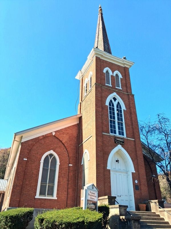
Photographed by William Fischer, Jr., November 10, 2026
2. Putnam Presbyterian Church and Markers
Also see . . .
1. Putnam Historic District National Register Nomination Form. (Submitted on November 10, 2026, by William Fischer, Jr. of Reynoldsburg, Ohio.)
2. National Underground Railroad Network to Freedom. (Submitted on November 10, 2026, by William Fischer, Jr. of Reynoldsburg, Ohio.)
Credits. This page was last revised on November 10, 2026. It was originally submitted on November 10, 2026, by William Fischer, Jr. of Reynoldsburg, Ohio. This page has been viewed 7 times since then. Photos: 1, 2. submitted on November 10, 2026, by William Fischer, Jr. of Reynoldsburg, Ohio.
