
Schuylerville in Saratoga County, New York — The American Northeast (Mid-Atlantic)
Lakes To Locks Passage
The Great Northeast Passage
| — | Champlain Canal Region | — |
Photographed by Steve Stoessel, November 7, 2026
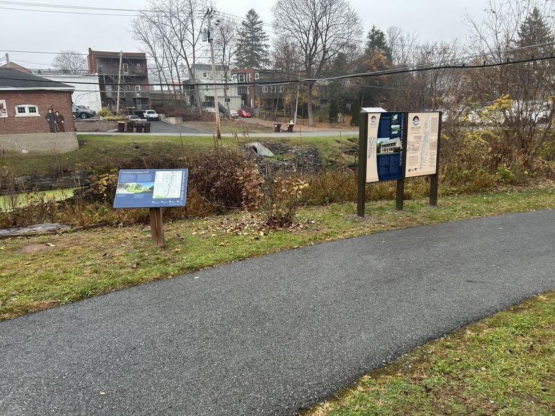
1. Lakes To Lock Passage Marker
( Left Panel:)
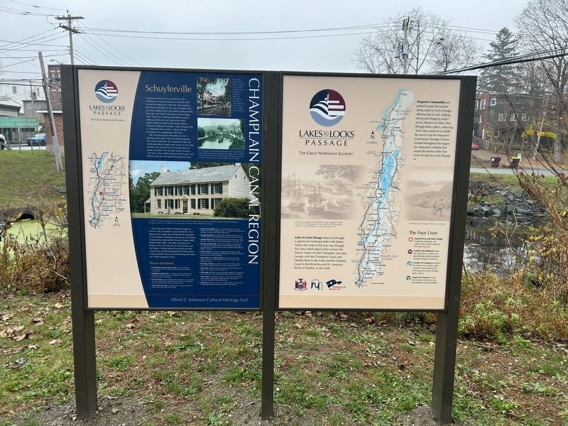
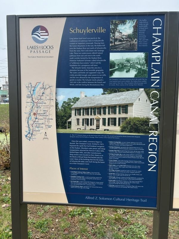
Schuylerville
Long before land travel was practical, the confluence of waterways here in Schuylerville created an important crossroads. Flowing from the Green Mountains in the east, the Batten Kill joins the Hudson River just north of Schuylerville. From the west, Fish Creek drains into Saratoga Lake. These two watercourses offered natural pathways from east and west to the north-south corridor formed by the Hudson River. Historian Nathaniel Sylvester called Schuylerville a "wilderness four-corners," which laid the foundation for a prosperous mill town.
The Schuyler family chose this area for a plantation because of the favorable geography. The waters and fertile soil supported crops, the creeks provided enough water power to run mills, and the river allowed for the transportation of goods to market. The Schuyler family played a vital role in the conflicts between the French and British, and later during the Revolutionary War.
Once the wars ended, commerce began to flourish. The Champlain Canal, finished in 1823, bypassed the rapids that had hindered navigation on the Hudson. Abundant water power
this page online
Places of Interest
• Canal Region Gateway Visitors Center, in Fort Hardy Park, is a destination for visitor information about the surrounding communities.
• Champlain Canalway Trail is a multi-use trail that connects the Schuyler House with Hudson Crossing Park and the Town of Greenwich via the Dix Bridge.
• Fort Hardy Park is where General John Burgoyne's troops stacked their arms following his surrender. It now serves as a recreational park with baseball fields and a community center.
• General Schuyler House, operated by the National Park Service, stands at the south edge of the Village.
• Hudson Crossing Park, on Lock 5 Island, offering access to the Hudson River and Champlain Canal, is a bi-county educational park with sites of historic and natural significance.
• Saratoga Monument, operated by
Photographed by Steve Stoessel, November 7, 2026
2. Lakes To Lock Passage Marker
• Saratoga Siege Trail, located along Fish Creek, tells the story of the American siege of British General John Burgoyne in October 1777.
• Saratoga Surrender Site, on the corner of Route 4 and Schuyler St., is where where British General John Burgoyne ceremonially surrendered his sword to American General Horatio Gates after the Battles of Saratoga.
• Victory Woods, a part of the Saratoga National Historical Park, marks the final encampment of the British Army under General John Burgoyne prior to their surrender.
• Stark's Knob, and the Knox Trail interpretive site a few miles north on US RT 4, offers a great view of the river from a rare geologic formation.
• The Village of Victory, located just south on NYS RT 32, retains much of the original architecture of the "company mill town."
• To the West, Saratoga Springs, known for its health, history and horses," lies 10 miles west on NYS RT 29.
• To the South, Stillwater is home to Saratoga Battlefield, considered by many historians as "the Turning Point" of the American Revolution.
•
Photographed by Steve Stoessel, November 7, 2026
3. Lakes To Lock Passage Marker
• To the East, Greenwich features a charming village with roots to the Underground Railroad and stunning 19th-century homes.
( Photo Captions, top to bottom: )
- The Hudson Valley Railway trolley ran right up the middle of Broad Street. It provided passenger service to surrounding towns from 1901 until 1928. Photo courtesy of the Saratoga Town Historian.
- The Champlain Canal linked Schuylerville to the world: The Erie Canal opened travel west to Buffalo. The Hudson River enabled travel south to New York. Lake Champlain offered passage north to Canada. Photo courtesy of the Saratoga Town Historian.
- The 1777 Schuyler House was the third manor built at this spot. The second was burned by British General John Burgoyne during his retreat from the Battles of Saratoga. Photo courtesy of the National Park Service.
Alfred Z. Solomon Cultural Heritage Trail
( Right Panel: )
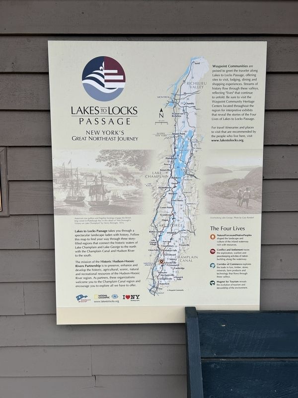
Lakes to Locks Passage takes you through a spectacular landscape laden with history. Follow
Photographed by Steve Stoessel, November 7, 2026
4. Lakes To Lock Passage Marker
Waypoint Communities are poised to greet the traveler along Lakes to Locks Passage, offering sites to visit, lodging, dining and shopping experiences. Streams of history flow through these valleys, reflecting "lives" that continue to unfold. Be sure to visit the Waypoint Community Heritage Centers located throughout the region for interpretive exhibits that reveal the stories of the Four Lives of Lakes to Locks Passage.
The Four Lives
· Natural Forces and Native Peoples shaped the landscape and culture of the inland waterway rich with resources. · Conflict and Settlement traces the exploration, warfare and peacekeeping activities of nation-building along the waterway. · Corridor of Commerce explores the trade in furs, timber, stone, minerals, farm products and technology that flows through these valleys. · Magnet for Tourism reveals the evolution of tourism
Photographed by Steve Stoessel, November 7, 2026
5. Lakes To Locks Passage Marker
( Illustration and Photo Captions:)
· American row galleys and flagship Saratoga engage the British brig Linnet in Plattsburgh Bay in this detail of "MacDonough's Victory on Lake Champlain" by Henry Reinagle, 1816.
· Overlooking Lake George. Photo by Gary Randorf.
Erected by State of New York, NY Scenic Byways, America's Byways.
Topics. This historical marker is listed in these topic lists: Settlements & Settlers • War, US Revolutionary • Waterways & Vessels. A significant historical month for this entry is October 1777.
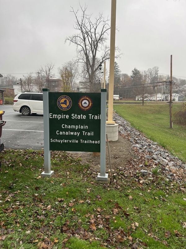
Location. 43° 5.994′ N, 73° 34.796′ W. Marker is in Schuylerville, New York, in Saratoga County. It is on Empire State Trail north of Ferry Street (New York State Route 29), on the right when traveling south. Marker is at the Schuylerville trailhead. Touch for map. Marker is at or near this postal address: 28 Ferry St, Schuylerville NY 12871, United States of America. Touch for directions.

Regionally, this marker is in Upstate New York, in the Capital District, and in the Albany Metropolitan Area. It is also in the American Northeast and in the Mid-Atlantic. Globally, it is in North America, the Great North Woods, the Western Hemisphere, the Western World, and the Anglosphere. Historically, it finds itself in what was once New Netherland and also one of the original Thirteen Colonies.
Other nearby markers. At least 8 other markers are within walking distance of this marker: Champlain Canal Region (here, next to this marker); a different marker also named Lakes To Locks Passage (a few steps from this marker); Henry Knox And The Noble Train Of Artillery (a few steps from this marker); First Bridge (a few steps from this marker); General Lafayette (a few steps from this marker); The Empire State Trail (within shouting distance of this marker); Near This Spot (within shouting distance of this marker); a different marker also named Lakes To Locks Passage (within shouting distance of this marker). Touch for a list and map of all markers in Schuylerville.
Credits. This page was last revised on November 12, 2026. It was originally submitted on November 11, 2026, by Steve Stoessel of Niskayuna, New York. This page has been viewed 7 times since then. Photos: 1, 2, 3, 4. submitted on November 11, 2026, by Steve Stoessel of Niskayuna, New York. 5. submitted on November 12, 2026, by Steve Stoessel of Niskayuna, New York.
