
King's Lynn in Norfolk, England, United Kingdom — Northwestern Europe (the British Isles)
St John's Walk
| — | The Walks | — |
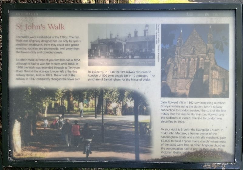
Photographed by Ray Gurganus, April 29, 2026
1. St John's Walk Marker
St John's Walk in front of you was laid out in 1851, although it had to wait for its trees until 1868. In 1906 the Walk was extended through to Tennyson Road. Behind the vicarage to your left is the fine railway station, built in 1871. The arrival of the railway in 1847 completely changed the town and its economy. In 1848 the first railway excursion to London of 500 Lynn people left in 17 carriages. The purchase of Sandringham for the Prince of Wales (later Edward VII) in 1862 saw increasing numbers of royal visitors using the station. Lynn's railway connection to London survived the cuts of the late 1960s, but the lines to Hunstanton, Norwich and the Midlands all closed. The line to London was electrified in 1993.
To your right is St John the Evangelist Church. In 1843 John Motteux, a former owner of the Sandringham Estate and a rich silk merchant, gave £2,000 to build a 'poor
this page online
Erected by Borough Council of King's Lynn & West Norfolk.
Topics. This historical marker is listed in these topic lists: Parks & Recreational Areas • Railroads & Streetcars • Religion & Religious Structures.
Location. 52° 45.21′ N, 0° 24.194′ E. Marker is in King's Lynn, England, in Norfolk. It can be reached from Blackfriars Road, on the right when traveling south. Touch for map. Marker is at or near this postal address: 12 Blackfriars Road, King's Lynn, England PE30 1NN, United Kingdom. Touch for directions.

Regionally, this marker is in East Anglia. Globally, it is on the Atlantic Ocean, in the North Atlantic Region, in Europe, in Atlantic Europe, on one of the British Isles, in the Western World, and in the Anglosphere. Historically, it finds itself in what was once the Roman Empire and also the Hanseatic League.
Other nearby markers. At least 8 other markers are within walking distance of this marker: St James' Park (about 150 meters away, measured in a direct line); Red Mount Chapel (about 210 meters away); a different marker also named St James' Park (approx. 0.3 kilometers away); St James' Chapel (approx. 0.3 kilometers away); Exploring Greyfriars Tower (approx. 0.3 kilometers away); Tower Gardens (approx. 0.4 kilometers away); Greyfriars Tower (approx. 0.4 kilometers away); Greyfriars, King's Lynn (approx. 0.4 kilometers away). Touch for a list and map of all markers in King's Lynn.
Credits. This page was last revised on November 13, 2026. It was originally submitted on November 12, 2026, by Ray Gurganus of Washington, District of Columbia. This page has been viewed 6 times since then. Photo 1. submitted on November 12, 2026, by Ray Gurganus of Washington, District of Columbia. • Andrew Ruppenstein was the editor who published this page.
Editor’s want-list for this marker. photo of the marker within its surroundings • Can you help?
