
King's Lynn in Norfolk, England, United Kingdom — Northwestern Europe (the British Isles)
St James' Park
| — | The Walks | — |
Photographed by Ray Gurganus, April 29, 2026
1. St James' Park Marker
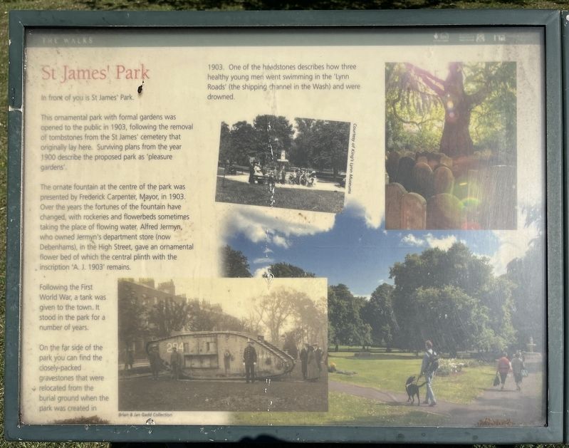
This ornamental park with formal gardens was opened to the public in 1903, following the removal of tombstones from the St James' cemetery that originally lay here. Surviving plans from the year 1900 describe the proposed park as 'pleasure gardens'.
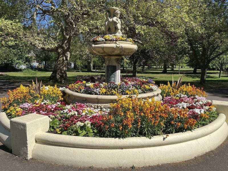
The ornate fountain at the centre of the park was presented by Frederick Carpenter, Mayor, in 1903. Over the years the fortunes of the fountain have changed, with rockeries and flowerbeds sometimes taking the place of flowing water. Alfred Jermyn, who owned Jermyn's department store (now Debenhams), in the High Street, gave an ornamental flower bed of which the central plinth with the inscription 'A. J. 1903' remains.
Following the First World War, a tank was given to the town. It stood in the park for a number of years.
On the far side of the park you can find the closely-packed gravestones that were relocated from the burial ground when the park was created in 1903. One of the headstones describes how three healthy young men went swimming in the "Lynn Roads' (the shipping channel in the Wash) and were drowned.
Erected by Borough
this page online
Topics. This historical marker is listed in this topic list: Parks & Recreational Areas. A significant historical year for this entry is 1903.
Location. 52° 45.181′ N, 0° 24.064′ E. Marker is in King's Lynn, England, in Norfolk. It is at the intersection of Saint James' Road and Blackfriars Road, on the right when traveling north on Saint James' Road. Touch for map. Marker is in this post office area: King's Lynn, England PE30 1NN, United Kingdom. Touch for directions.

Regionally, this marker is in East Anglia. Globally, it is on the Atlantic Ocean, in the North Atlantic Region, in Europe, in Atlantic Europe, on one of the British Isles, in the Western World, and in the Anglosphere. Historically, it finds itself in what was once the Roman Empire and also the Hanseatic League.
Other nearby markers. At least 8 other markers are within walking distance of this marker: A different marker also named St James' Park (about 150 meters away, measured in a direct line); St John's Walk (about 150 meters away); St James' Chapel (about 180 meters away); Exploring Greyfriars Tower (about 210
Photographed by Ray Gurganus, April 29, 2026
2. St James' Park Fountain
Credits. This page was last revised on November 14, 2026. It was originally submitted on November 12, 2026, by Ray Gurganus of Washington, District of Columbia. This page has been viewed 7 times since then. Photos: 1, 2. submitted on November 12, 2026, by Ray Gurganus of Washington, District of Columbia. • Andrew Ruppenstein was the editor who published this page.
