
King's Lynn in Norfolk, England, United Kingdom — Northwestern Europe (the British Isles)
King's Lynn Greyfriars 1538
Photographed by Ray Gurganus, April 29, 2026
1. King's Lynn Greyfriars 1538 Marker
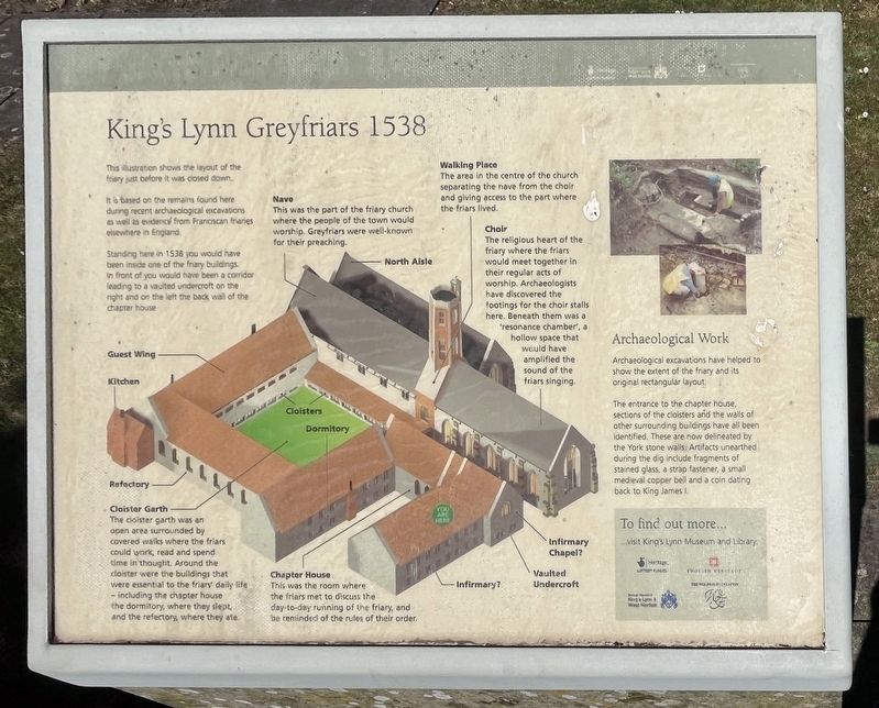
It is based on the remains found here during recent archaeological excavations as well as evidence from Franciscan friaries elsewhere in England.
Standing here in 1538 you would have been inside one of the friary buildings in front of you would have been a corridor leading to a vaulted undercroft on the night and on the left the back wall of the chapter house.
Illustration Captions
Cloister Garth
The cloister garth was an open area surrounded by covered walks where the friars could work, read and spend time in thought. Around the cloister were the buildings that were essential to the friars daily life - including the chapter house the dormitory, where they slept, and the refectory, where they ate.
Nave
This was the part of the friary church where the people of the town would worship. Greyfriars were well-known for their preaching.
Chapter House
This was the room where the friars met to discuss the day-to-day running of the friary, and be reminded of the rules of their order.
Walking Place
The area in the centre of the
this page online
Choir
The religious heart of the friary where the friars would meet together in their regular acts of worship. Archaeologists have discovered the footings for the choir stalls here. Beneath them was a resonance chamber, a hollow space that would have amplified the sound of the friars singing.
Archaeological Work
Archaeological excavations have helped to show the extent of the friary and its original rectangular layout.
The entrance to the chapter house, sections of the cloisters and the walls of other surrounding buildings have all been identified. These are now delineated by the York stone walls. Artifacts unearthed during the dig include fragments of stained glass, a strap fastener, a small medieval copper bell and a coin dating back to King James I.
Erected by Borough Council of King's Lynn & West Norfolk.
Topics. This historical marker is listed in these topic lists: Anthropology & Archaeology • Religion & Religious Structures. A significant historical year for this entry is 1538.
Location. 52° 45.072′ N, 0° 23.956′ E.
Photographed by Ray Gurganus, April 29, 2026
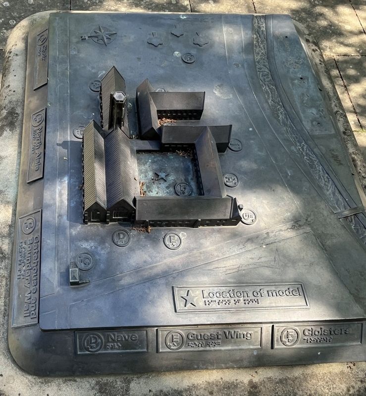
2. Model of King's Lynn Greyfriars

Regionally, this marker is in East Anglia. Globally, it is on the Atlantic Ocean, in the North Atlantic Region, in Europe, in Atlantic Europe, on one of the British Isles, in the Western World, and in the Anglosphere. Historically, it finds itself in what was once the Roman Empire and also the Hanseatic League.
Other nearby markers. At least 8 other markers are within walking distance of this marker: Greyfriars Tower (within shouting distance of this marker); Tower Gardens (within shouting distance of this marker); Greyfriars, King's Lynn (within shouting distance of this marker); Exploring Greyfriars Tower (within shouting distance of this marker); St James' Chapel (about 90 meters away, measured in a direct line); St James' Park (about 90 meters away); All Saints Church (about 150 meters away); Ladybridge (about 180 meters away). Touch for a list and map of all markers in King's Lynn.
Credits. This page was last revised on November 12, 2026. It was originally submitted on November 12, 2026, by Ray Gurganus of Washington, District of Columbia. This page has been viewed 5 times since then. Photos: 1, 2. submitted on November 12, 2026, by Ray Gurganus of Washington, District of Columbia. • Andrew Ruppenstein was the editor who published this page.
