Junior College Neighborhood Association in Santa Rosa in Sonoma County, California — The American West (Pacific Coastal)
Santa Rosa 1906 Earthquake Monument
| — | Santa Rosa Rural Cemetery | — |
Photographed by Andrew Ruppenstein, November 11, 2026
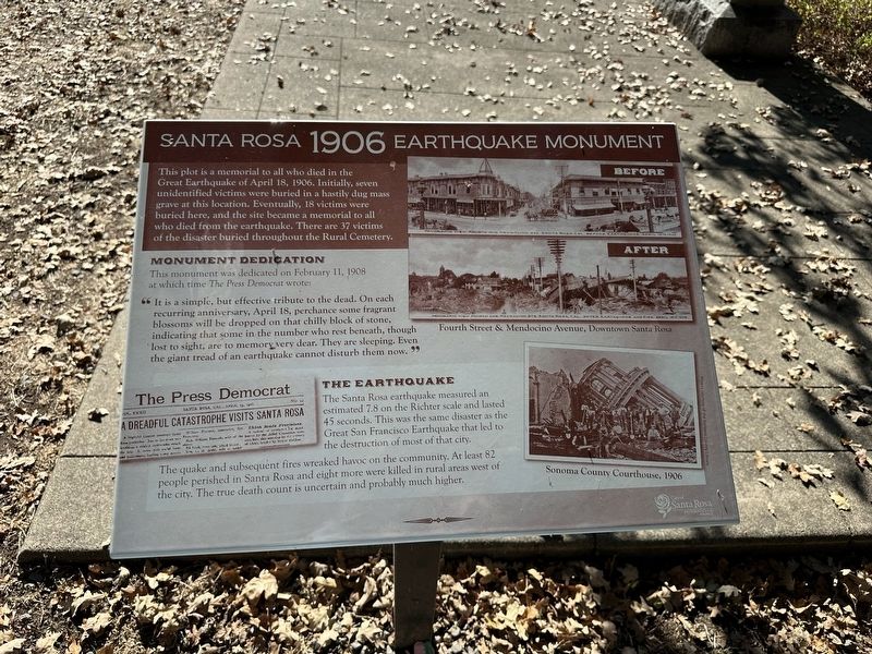
1. Santa Rosa 1906 Earthquake Monument Marker
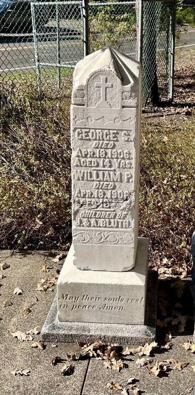
This plot is a memorial to all who died in the Great Earthquake of April 18, 1906. Initially, seven unidentified victims were buried in a hastily dug mass grave at this location. Eventually, 18 victims were buried here, and the site became a memorial to all who died from the earthquake. There are 37 victims of the disaster buried throughout the Rural Cemetery.
Monument Dedication
This monument was dedicated on February 11, 1908 at which time The Press Democrat wrote:
” It is a simple, but effective tribute to the dead. On each recurring anniversary, April 18, perchance some fragrant blossoms will be dropped on that chilly block of stone, indicating that some in the number who rest beneath, though lost to sight, are to memory very dear. They are sleeping. Even the giant tread of an earthquake cannot disturb them now.“The Earthquake
The Santa Rosa earthquake measured an estimated 7.8 on the Richter scale and lasted 45 seconds. This was the same disaster as the Great San Francisco Earthquake that led to the destruction of most of that city. The quake and subsequent fires wreaked havoc on the community.
this page online
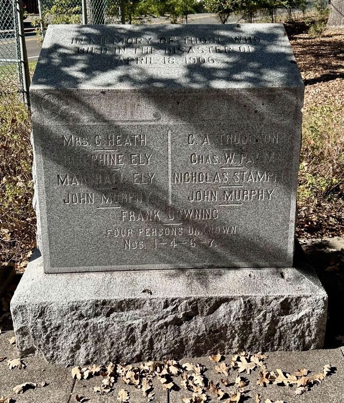
(Monument text:)
In memory of those who in the disaster of April 18, 1906
Mrs. C. Heath · Josephine Ely · C. A. Trudgeon · Chas. W Palm · Marshall Ely · Nicholas Stampf · John Murphy · John Murphy · Frank Downing
Four persons unknown
Nos. 1-4-6-7
Topics. This historical marker and monument is listed in these topic lists: Cemeteries & Burial Sites • Disasters. A significant historical date for this entry is April 18, 1906.
Location. 38° 27.339′ N, 122° 42.333′ W. Marker is in Santa Rosa, California, in Sonoma County. It is in the Junior College Neighborhood Association. It is on Franklin Avenue, on the right when traveling north. This is stop No. 1 on the Santa Rosa Rural Cemetery self-guided tour and is easily seen as one enters the cemetery through the Franklin Avenue gate. (Note, however, that parking is more easily available by the McDonald Avenue gate, which also has the self-guided tour brochures available). Touch for map. Marker is at or near this postal address:
Photographed by Andrew Ruppenstein, November 11, 2026
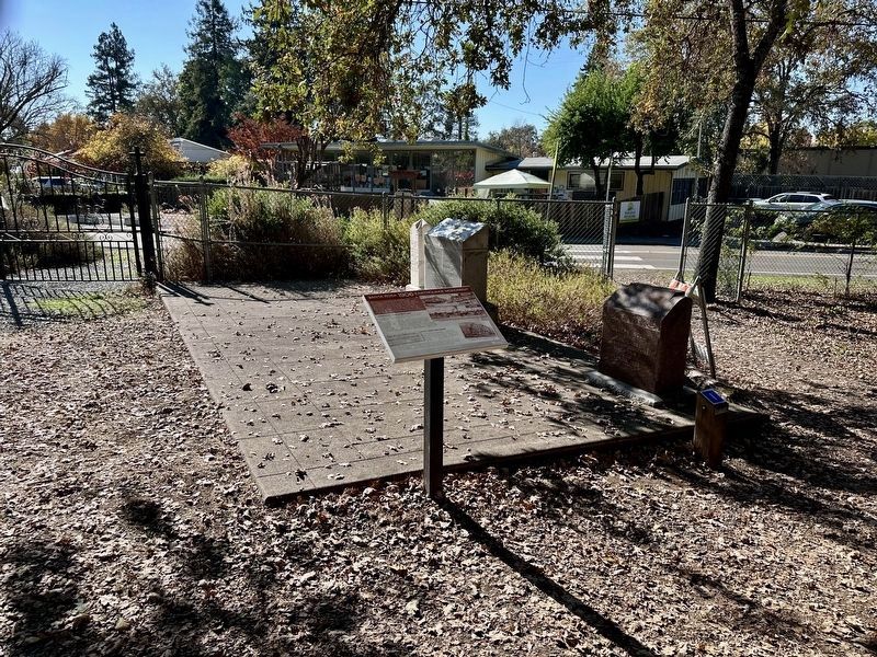
2. Santa Rosa 1906 Earthquake Monument Marker and memorial burial plot

Regionally, this marker and monument is in Wine Country, in the San Francisco Bay Area, in the North Coast, and on the Coast Ranges. It is also on the American Pacific Coast. Globally, it is in North America, on the Ring of Fire, on the Pacific Rim, in the Western Hemisphere, in the Western World, and in the Anglosphere. Historically, it finds itself in what was once New Spain and also Mexico’s Alta California.
Other nearby markers. At least 8 other markers are within 2 miles of this marker, measured as the crow flies: Santa Rosa Rural Cemetery Lost Veterans Memorial (a few steps from this marker); Santa Rosa Rural Cemetery (a few steps from this marker); From Slave to Rights Activist (about 300 feet away, measured in a direct line); A Legacy of Redwoods (about 500 feet away); Mableton (approx. 0.4 miles away); Fremont Park (approx. 0.9 miles away); Rosenberg’s Department Store (approx. one mile away); Santa Rosa Post Office and Federal Building (approx. 1.2 miles away). Touch for a list and map of all markers in Santa Rosa.
Another
Photographed by Andrew Ruppenstein, November 11, 2026
3. Santa Rosa 1906 Earthquake Monument
Also see . . .
1. Santa Rosa: The 1906 earthquake almost lost to history (KTVU, April 20, 2026). Article plus video (3:27) (Submitted on November 12, 2026.)
2. 1906 San Francisco Earthquake (Wikipedia). Excerpt:
A magnitude 7.9 earthquake struck the coast of Northern California at 05:12 am Pacific Standard Time on Wednesday, April 18, 1906. With a maximum Mercalli intensity of XI (Extreme), it created high-intensity shaking from Eureka on the North Coast to the Salinas Valley, an agricultural region to the south of the San Francisco Bay Area.(Submitted on November 13, 2026.)
Photographed by Andrew Ruppenstein, November 11, 2026
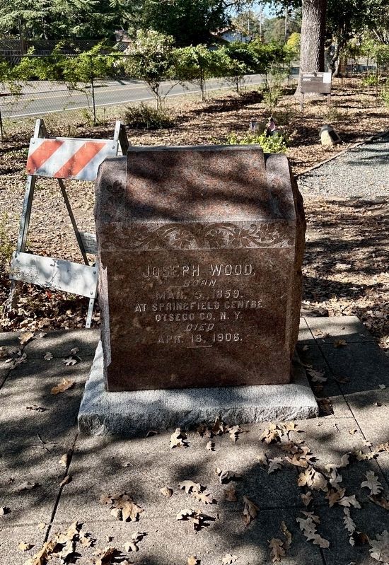
4. Headstone of earthquake victim Joseph Wood (located at the memorial plot)
Photographed by Andrew Ruppenstein, November 11, 2026
5. Headstone of earthquake victims George S. and William P. Bluth (located at the memorial plot)
Credits. This page was last revised on November 13, 2026. It was originally submitted on November 12, 2026, by Andrew Ruppenstein of Lamorinda, California. This page has been viewed 2 times since then. Photos: 1, 2, 3, 4. submitted on November 12, 2026, by Andrew Ruppenstein of Lamorinda, California. 5. submitted on November 13, 2026, by Andrew Ruppenstein of Lamorinda, California.
