
Rutherfordton in Polk County, North Carolina — The American South (South Atlantic)
Alexander's Ford
A Turning Point
| — | Overmountain Victory National Historic Trail | — |
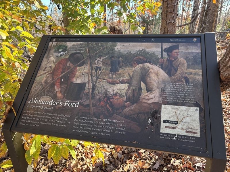
Photographed by Benjamin Rubin, November 15, 2026
1. Alexander's Ford Marker
They camped at the ford that night. During their stay they learned that the British force led by Major Patrick Ferguson was nearby. The next morning they changed course. The militia's best-equipped men led the way to catch and destroy Ferguson and his men.
Visit the ford—it is an easy, 1.5 mile walk down the trail. This fragile site can be viewed from the trail-marked fence.
Today Alexander's Ford at the Bradiey Nature Preserve is open for the public to retrace the patriot route down to the Green River Ford. The trail follows the old roadway for most of the way. The trail and the ford are part of the Overmountain Victory National Historic Trail (nps.govlovvi) and are owned and managed by Polk County, North Carolina.
The patriot militirode 60 miles from here to the Battie of Kings Mountain.
Erected by National Park Service, U.S. Department of the Interior.
this page online
Topics. This historical marker is listed in these topic lists: Colonial Era • Settlements & Settlers • War, US Revolutionary. A significant historical date for this entry is October 5, 1780.
Location. 35° 18.728′ N, 82° 2.471′ W. Marker is in Rutherfordton, North Carolina, in Polk County. It can be reached from Grays Chapel Church Road 0.2 miles south of Gray's Road, on the right when traveling south. Touch for map. Marker is at or near this postal address: 394 Grays Chapel Church Rd, Rutherfordton NC 28139, United States of America. Touch for directions.

Regionally, this marker is in the Mountains. It is also in the American South, specifically in the Upper South, in Appalachia, and specifically in Southern Appalachia. Globally, it is in North America, the Western Hemisphere, the Western World, and the Anglosphere. Historically, it finds itself in what was once the original Cherokee Nation, the territory of the Mississippian Culture, one of the original Thirteen Colonies, one of the Confederate States of America, and the Antebellum South.
Other nearby markers. At least 8 other markers are within 7 miles of this marker, measured as the crow flies: Overmountain Men (approx. 1.4 miles away); Green River Plantation (approx. 2.2 miles away); Rutherfordton (approx. 6 miles away); Stoneman's Raid (approx. 6.1 miles away); Rutherford County (approx. 6.2 miles away); Rutherfordton Confederate Monument (approx. 6.2 miles away); The Charters of Freedom (approx. 6.2 miles away); Carrier-Ward House (approx. 6.2 miles away). Touch for a list and map of all markers in Rutherfordton.
Another marker is no longer nearby. Green River Plantation (was approx. 2.2 miles away but has been confirmed missing).
Also see . . . Overmountain Victory National Historic Trail. National Park Service (Submitted on November 17, 2026.)
Credits. This page was last revised on November 17, 2026. It was originally submitted on November 15, 2026, by Benjamin Rubin of Columbia, South Carolina. This page has been viewed 7 times since then. Photo 1. submitted on November 15, 2026, by Benjamin Rubin of Columbia, South Carolina. • Bernard Fisher was the editor who published this page.
Editor’s want-list for this marker. Wide shot of marker and its surroundings. Photos of the ford. • Can you help?
