
Southwark in Greater London, England, United Kingdom — Northwestern Europe (the British Isles)
St Mary's Churchyard
Photographed by Ray Gurganus, April 8, 2026
1. St Mary's Churchyard Marker
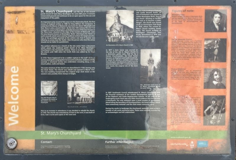
An important early record of this area is in the Domesday Book, the first census of England written in 1086 for King William the Conqueror. It noted that the Manor of Walworth was home for about 100 people and that 'there is also a church there'. By the late 13th century the area had changed its name to Newington, probably because of the new houses or the 'New town' situated on the edge of the hamlet of Walworth. Later the area became known as Newington 'Butts' referring to the 'Butts' or earth mounds which were used by medieval archers for target practice. One of the privileges granted to the archers was that if anyone was killed by an arrow near the 'butts', then the person who shot the arrow should not be liable for punishment.
The earliest reference to a church at the site comes from a document which places the medieval parish church at St. Mary Newington Churchyard in the fourteenth century. There is
this page online
In 1714 "there happened to be a sudden rupture in the wall" during a service causing the congregation to run out in confusion. Understandably worried, a structural survey was undertaken revealing decay in the church pillars, walls and beams.
The main structure of the church was demolished in 1720, leaving only the Clock Tower. The Church was rebuilt and opened in March 1721. The new building incorporated the original large clock tower at the western end, possibly three storeys in height.
Due to an increase in attendance it was decided to rebuild the church in 1793. The church was extended by 25 feet to the west, it was built of brick, had a turret and cupola at the west end.
As the roads leading to Elephant and Castle became busier, an Act of Parliament was passed to widen Newington Butts. Due to the church 'abutting so far into the road as to become a public danger', the church was moved south to Kennington Park Road in 1876, where the current St. Mary's Church building stands today. The church building at Newington Churchyard
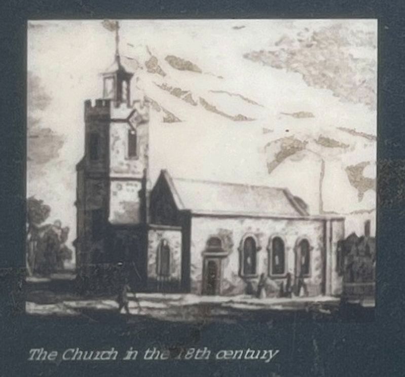
Illustration from the marker
2. The Church in the 18th Century
In 1877 a clock tower was erected on the site of the old St. Mary's Church in a distinctive gothic style. Paid for by a former Churchwarden, the Clock Tower became an Elephant and Castle landmark. It stood for almost a century until it fell into disrepair, was deemed a safety hazard and demolished in 1971. A memorial stone now marks the original site of the clock tower.
In 2007 Southwark Council relandscaped St. Mary's Churchyard with the financial assistance of the London Development Agency as part of the Elephant and Castle Regeneration Scheme. At the time of the landscaping works there was very little visual evidence that the site was a churchyard. The only remnants were a small number of gravestones placed along the boundary of Churchyard Row, the listed railings- which were extensively restored- and the clock tower memorial stone.
During the works to landscape the churchyard, workmen came across a number of old vaults and burial plots. These were carefully recorded by an archaeologist and left undisturbed.
Figures of note:
Michael Faraday
Michael Faraday
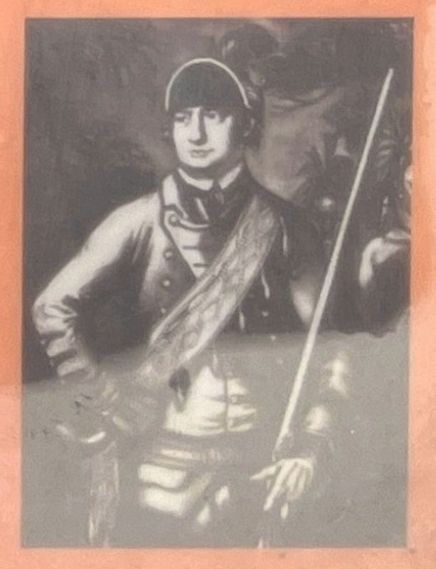
Illustration from the marker
3. Major Robert Rogers
George Alexander Gratton
George Alexander Gratton was a Caribbean boy brought to England from the island of St. Vincent in 1810 and was baptised at St. Mary's during the same year. Known as 'The Spotted Negro Boy', he was afflicted with a skin disorder known as piebaldism - a loss of pigmentation in the skin causing permanent white marks. George was shown about London and the provinces as something of a curiosity. Sadly he died when only five years old, in February 1813. He was buried at Great Marlow, where there is a monument to his memory.
Thomas Middleton
was an Thomas Middleton Elizabethean plaint and poet who collaborated with Shakespeare on scenes from Macbeth and author of such works as Mask of Cupid; A Mad World, my Masters; and the Spanish Gipsy. He died in 1627 and was buried in St. Mary's Churchyard.
Major Robert Rogers
Major Robert Rogers was a colonial farmer recruited from New Hampshire, America, in 1755 by the British for service in the Seven Years' War (1754-63). He created a unit called Rogers' Rangers in 1756 (the first Rangers), and by 1758 the British placed him in charge of all colonial Ranger companies. The Rangers wore distinctive green outfits and developed tactics called "Rogers' Ranging Rules. These tactics are still in use by Rangers today, including the Green Berets. After several successful expeditions Robert Rogers travelled to London in 1778. He became disillusioned with life outside of the military and died in 1795 a debtor in the Kings Bench Prison, near the present Borough Road. He is buried at St. Mary's in an unmarked pauper's grave.
Erected by Southwark Council.
Topics. This historical marker is listed in these topic lists: Cemeteries & Burial Sites • Religion & Religious Structures.
Location. 51° 29.56′ N, 0° 6.093′ W. Marker is in Southwark, England, in Greater London. It can be reached from Newington Butts, on the left when traveling north. The marker is located within St Mary’s Churchyard. Touch for map. Marker is at or near this postal address: 105 Newington Butts, Southwark, England SE17 3DH, United Kingdom. Touch for directions.

Regionally, this marker is in London and in the Greater South East. Globally, it is on the Atlantic Ocean, in the North Atlantic Region, in Europe, in Atlantic Europe, on one of the British Isles, in the Western World, and in the Anglosphere. Historically, it finds itself in what was once the Roman Empire.
Other nearby markers. At least 8 other markers are within walking distance of this marker: Welcome to St Mary's Churchyard (within shouting distance of this marker); The Faraday Memorial (approx. 0.3 kilometers away); Craigie Aitchison (approx. half a kilometer away); The Ice Age Tree Trail (approx. 0.6 kilometers away); Section of the Berlin Wall (approx. 0.6 kilometers away); British 15-inch naval guns (approx. 0.6 kilometers away); St George's Fields (approx. 0.7 kilometers away); Soviet World War II Memorial (approx. 0.7 kilometers away). Touch for a list and map of all markers in Southwark.
Credits. This page was last revised on November 18, 2026. It was originally submitted on November 16, 2026, by Ray Gurganus of Washington, District of Columbia. This page has been viewed 4 times since then. Photos: 1, 2, 3. submitted on November 16, 2026, by Ray Gurganus of Washington, District of Columbia. • Andrew Ruppenstein was the editor who published this page.
Editor’s want-list for this marker. photo of the marker within its surroundings • Can you help?
