
Upper Ferntree Gully in Knox, Victoria, Australia — Oceania
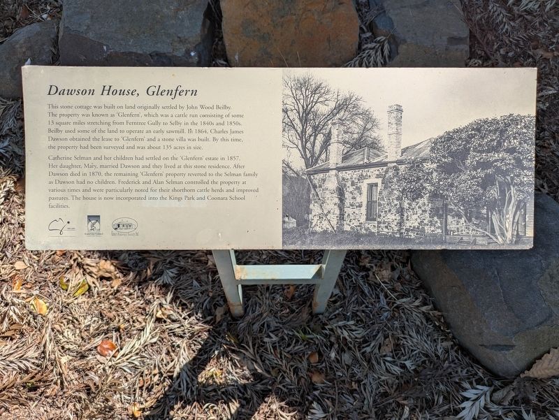
Dawson House, Glenfern
Photographed by Dean Barton-Ancliffe, October 8, 2026
1. Dawson House, Glenfern Marker
The property was known as 'Glenfern', which was a cattle run consisting of some 13 square miles stretching from Ferntree Gully to Selby in the 1840s and 1850s.
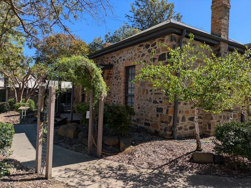
Beilby used some of the land to operate an early sawmill. In 1864, Charles James Dawson obtained the lease to 'Glenfern' and a stone villa was built. By this time, the property had been surveyed and was about 135 acres in size.
Catherine Selman and her children had settled on the 'Glenfern' estate in 1857.
Her daughter, Mary, married Dawson and they lived at this stone residence. After Dawson died in 1870, the remaining 'Glenfern' property reverted to the Selman family as Dawson had no children. Frederick and Alan Selman controlled the property at various times and were particularly noted for their shorthorn cattle herds and improved pastures. The house is now incorporated into the Kings Park and Coonara School facilities.
Erected by Knox City Council and Knox Historical Society.
Topics. This historical marker is listed in these topic lists: Colonial Era • Settlements & Settlers. A significant historical year for this entry is 1964.
Location. 37° 53.731′ S,
this page online

Regionally, it is in Oceania, in Australasia, in the Pacific Ocean, in South Pacific, on the Pacific Rim, in the Western World, and in the Anglosphere. Historically, it finds itself in what was once a British colony.
Other nearby markers. At least 8 other markers are within 6 kilometers of this marker, measured as the crow flies: City of Knox History (approx. 1.6 kilometers away); Ferntree Gully Cemetery (approx. 1.6 kilometers away); The Anzac Avenue of Honour Memorial (approx. 4.2 kilometers away); The Anzac Avenue of Honour, Ferny Creek (approx. 4.2 kilometers away); ANZAC World War I Memorial (approx. 4.2 kilometers away); Historic Avenue of Honour - City of Knox (approx. 4.2 kilometers away); Ramon Cowling Bushland Reserve (approx. 5 kilometers away); Alfred Nicholas Gardens (approx. 5.2 kilometers
Photographed by Dean Barton-Ancliffe, October 8, 2026
2. Dawson House, Glenfern
Credits. This page was last revised on November 18, 2026. It was originally submitted on November 16, 2026, by Dean Barton-Ancliffe of Rowville, Victoria. This page has been viewed 3 times since then. Photos: 1, 2. submitted on November 16, 2026, by Dean Barton-Ancliffe of Rowville, Victoria. • Andrew Ruppenstein was the editor who published this page.
