
Aylesbury in Buckinghamshire, England, United Kingdom — Northwestern Europe (the British Isles)
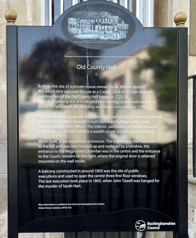
Old County Hall
Photographed by Ray Gurganus, May 23, 2026
1. Old County Hall Marker
 Built on the site of a private house owned by Mr William Benson (for which rent was paid for use as a County Gaol of £20 per annum), construction of the Old County Hall began in 1722-23. After first running out of funds and then having raised more by way of an act of Parliament, the building was finally completed in 1740.
The building was originally intended to be part of a new County Gaol and included two rather splendid Court rooms and a Magistrates court together with Clerks' offices. The interior, particularly of Court One and the former Crush Hall, exhibits a wealth of oak panelling and carvings.
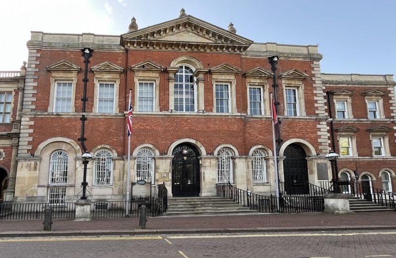
When built, there were three entrances. The entrance to the Gaol was to the left and was later bricked up and replaced by a window, the entrance to the Magistrates Chamber was in the centre and the entrance to the Courts remains on the right, where the original door is retained mounted on the wall inside.
A balcony constructed in around 1805 was the site of public executions and used to span the centre three first floor windows. The last execution took place in 1845, when John Tawell was hanged for the murder
this page online
Erected by Buckinghamshire Council.
Topics. This historical marker is listed in this topic list: Law Enforcement. A significant historical year for this entry is 1722.
Location. 51° 48.948′ N, 0° 48.721′ W. Marker is in Aylesbury, England, in Buckinghamshire. It is on Market Square, on the right when traveling north. Touch for map. Marker is at or near this postal address: 38 Market Square, Aylesbury, England HP20 1TW, United Kingdom. Touch for directions.

Regionally, this marker is in the Greater South East. Globally, it is on the Atlantic Ocean, in the North Atlantic Region, in Europe, in Atlantic Europe, on one of the British Isles, in the Western World, and in the Anglosphere. Historically, it finds itself in what was once the Roman Empire.
Other nearby markers. At least 8 other markers are within walking distance of this marker: The Clock Tower (within shouting distance of this marker); Old County Hall and Courthouse (within shouting distance of this marker); Judges Lodgings (within shouting distance of this marker); Site of Aylesbury Gaol 1740-1849 (within shouting distance of this marker);
Photographed by Ray Gurganus, May 23, 2026
2. Old County Hall and Marker
Credits. This page was last revised on November 21, 2026. It was originally submitted on November 20, 2026, by Ray Gurganus of Washington, District of Columbia. This page has been viewed 6 times since then. Photos: 1, 2. submitted on November 20, 2026, by Ray Gurganus of Washington, District of Columbia. • Andrew Ruppenstein was the editor who published this page.
