Oxford in Talbot County, Maryland — The American Northeast (Mid-Atlantic)
Oxford
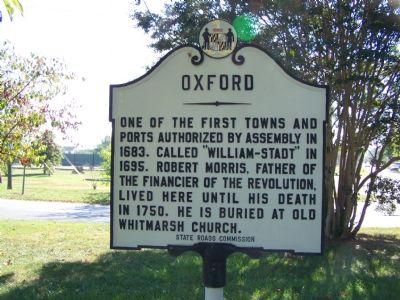
One of the first towns and ports authorized by Assembly in 1683. Called “William-Stade” in 1695. Robert Morris, father of the financier of the Revolution lived here until his death in 1750. He is buried at Old Whitmarsh Church.
Erected by State Roads Commission.
Topics. This historical marker is listed in these topic lists: Colonial Era • Settlements & Settlers • War, US Revolutionary. A significant historical year for this entry is 1683.
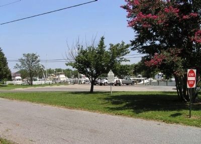
Location. 38° 41.085′ N, 76° 10.244′ W. Marker is in Oxford, Maryland, in Talbot County. Marker is at the intersection of Maryland Route 333 and S. Morris Street, on the left when traveling west on State Route 333. Marker is in the triangular median. Touch for map. Marker is in this post office area: Oxford MD 21654, United States of America. Touch for directions.
Other nearby markers. At least 8 other markers are within walking distance of this marker. Miniature Skipjack, Yankee Pedler (approx. 0.2 miles away); 1812-1865: Rebuilding (approx. 0.3 miles away); 1738-1793: Boom and Bust (approx. 0.3 miles away); Before There Was an Oxford (approx. 0.3 miles away); 1668-1710: Oxford's Beginnings (approx. 0.3 miles away); 1952-Present: Oxford Rises Again (approx. 0.3 miles away); 1870-1900: Oxford Booms Again (approx. 0.3 miles away); 1900-1950: Holding On (approx. 0.3 miles away). Touch for a list and map of all markers in Oxford.
Also see . . . Town Of Oxford - Maryland : A brief history. Town website entry:
"Oxford is one of the oldest towns in Maryland." (Submitted on August 9, 2010, by PaulwC3 of Northern, Virginia.)
Credits. This page was last revised on March 4, 2022. It was originally submitted on October 26, 2007, by Bill Pfingsten of Bel Air, Maryland. This page has been viewed 1,159 times since then and 29 times this year. Photos: 1. submitted on October 26, 2007, by Bill Pfingsten of Bel Air, Maryland. 2. submitted on August 9, 2010, by PaulwC3 of Northern, Virginia. 3. submitted on October 26, 2007, by Bill Pfingsten of Bel Air, Maryland. 4. submitted on August 9, 2010, by PaulwC3 of Northern, Virginia. • J. J. Prats was the editor who published this page.


