Ehrenberg in La Paz County, Arizona — The American Mountains (Southwest)
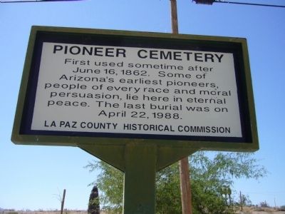
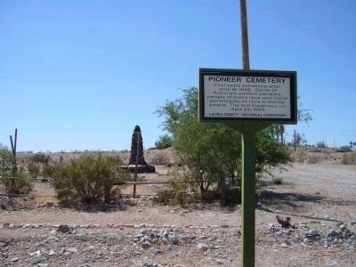
Pioneer Cemetery
Erected by La Paz County Historical Commission.
Topics. This historical marker is listed in these topic lists: Cemeteries & Burial Sites • Notable Places. A significant historical month for this entry is April 1898.
Location. 33° 36.344′ N, 114° 31.425′ W. Marker is in Ehrenberg, Arizona, in La Paz County. Marker is on Ehrenberg Poston Highway, on the right when traveling north. Marker is on Ehrenberg Poston Highway north of Interstate 10. Touch for map. Marker is in this post office area: Ehrenberg AZ 85334, United States of America. Touch for directions.
Other nearby markers. At least 7 other markers are within 14 miles of this marker, measured as the crow flies. Ehrenberg Cemetery (within shouting distance of this marker); In Memory of Hualapai Ancestors (approx. 5˝ miles away); Blythe Intake (approx. 8.7 miles away in California); Palo Verde Irrigation District Diversion Dam (approx. 8.7 miles away in California); 390th Bomb Group (H) (approx. 10.9 miles away in California); Desert Strike (approx. 11.7 miles away in California); Giant Desert Figures (approx. 13.4 miles away in California).
Credits. This page was last revised on June 16, 2016. It was originally submitted on June 13, 2010, by Bill Kirchner of Tucson, Arizona. This page has been viewed 1,460 times since then and 44 times this year. Photos: 1, 2, 3. submitted on June 13, 2010, by Bill Kirchner of Tucson, Arizona. • Syd Whittle was the editor who published this page.


