Corpus Christi in Nueces County, Texas — The American South (West South Central)
Alonzo Álvarez de Pineda
Inscription.
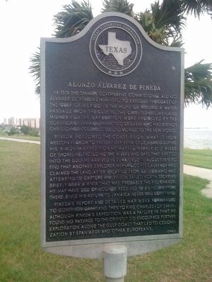
In 1519 the Spanish government commissioned Alonzo Álvarez de Pineda (1494-1519) to explore the coast of the Gulf of Mexico in the hope of finding a water passage from the Gulf to the Orient. Ships, men, and money for the expedition were provided by the Governor of Jamaica, Francisco de Garay, who had been on Christopher Columbus' second voyage to the new world.
Pineda followed the coast from what is now Western Florida to present day Vera Cruz, Mexico. During his 9-month expedition, he mapped nearly 800 miles of shoreline, including the rivers and bays that emptied into the Gulf. He arrived in Vera Cruz in August 1519 to find another explorer, Hernán Cortés, already had claimed the land. After escaping from Cortés, who had attempted to capture him, Pineda sailed north, stopping briefly near a river that was probably the Rio Grande. He may have died of wounds received in an Indian fight there, since his return to Jamaica never was confirmed.
Pineda's report and detailed map were forwarded to Governor Garay and then to King Charles I of Spain. Although Pineda's expedition was a failure in that he found no passage to the Orient, it did encourage further exploration along the Gulf Coast that led to colonization by Spaniards and other Europeans.
Erected 1983 by Texas Historical Commission . (Marker Number 14425.)
Topics. This historical marker is listed in these topic lists: Colonial Era • Exploration. A significant historical year for this entry is 1519.
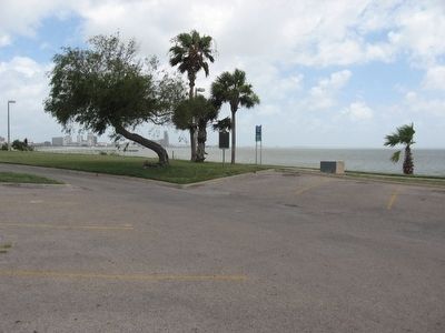
Location. 27° 46.083′ N, 97° 23.14′ W. Marker is in Corpus Christi, Texas, in Nueces County. Marker is on Ocean Drive, on the left when traveling north. Located in Oleander Point at Cole Park across from Oleander Avenue. The marker is beside the parking lot. Touch for map. Marker is in this post office area: Corpus Christi TX 78401, United States of America. Touch for directions.
Other nearby markers. At least 8 other markers are within 2 miles of this marker, measured as the crow flies. First Baptist Church of Corpus Christi (approx. 0.3 miles away); Camp Scurry (approx. 0.4 miles away); Sisters of the Incarnate Word (approx. 0.6 miles away); Site of Alta Vista Hotel (approx. 0.7 miles away); Moses Menger Elementary School (approx. 0.7 miles away); Arthur Edward Spohn, M.D. and Spohn Hospital (approx. 0.9 miles away); Elihu Harrison Ropes (approx. 1.1 miles away); Wynn Seale Junior High School (approx. 1.1 miles away). Touch for a list and map of all markers in Corpus Christi.
Also see . . . Alonzo Álvarez de Pineda - Wikipedia. (Submitted on June 26, 2010, by Bill Pfingsten of Bel Air, Maryland.)
Credits. This page was last revised on June 16, 2016. It was originally submitted on June 17, 2010, by Steve Gustafson of Lufkin, Texas. This page has been viewed 2,687 times since then and 97 times this year. Photos: 1, 2. submitted on June 17, 2010, by Steve Gustafson of Lufkin, Texas. • Bill Pfingsten was the editor who published this page.

