Mission Dolores in San Francisco City and County, California — The American West (Pacific Coastal)
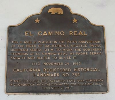
El Camino Real
the birth of California’s apostle,
Padre Junípero Serra, O.F.M. to mark the northern terminus of El Camino Real as Padre Serra
knew it and helped to blaze it.
1713 - November 24 - 1963
Landmark No. 784.
Erected 1963 by The California State Park Commissionn and the Committee for El Camino Real. (Marker Number 784.)
Topics and series. This historical marker is listed in these topic lists: Churches & Religion • Hispanic Americans • Roads & Vehicles • Settlements & Settlers. In addition, it is included in the California Historical Landmarks, and the El Camino Real, “The King's Highway” (California) series lists. A significant historical year for this entry is 1713.
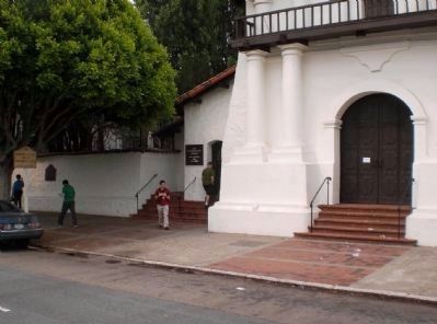
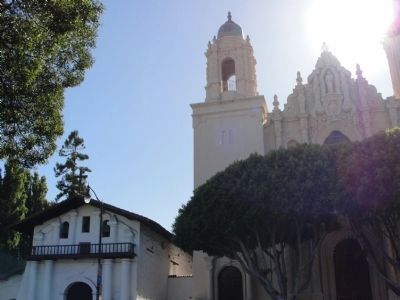
Location. 37° 45.847′ N, 122° 25.592′ W. Marker is in San Francisco, California, in San Francisco City and County. It is in Mission Dolores. Marker is on Dolores Street north of Chula Lane, on the right when traveling south. The marker is on the wall of the Mission Dolores Cemetery off of Dolores Street, midway between 16th Street and Chula Lane, just south of the "Old Mission Dolores" and the Mission Dolores Basilica. Touch for map. Marker is at or near this postal address: 3321 16th Street, San Francisco CA 94114, United States of America. Touch for directions.
Other nearby markers. At least 8 other markers are within walking distance of this marker. Misión San Francisco de Asís (a few steps from this marker); The Frank J. Portman Memorial Diorama (a few steps from this marker); Fray Francisco Palou, O.F.M. (a few steps from this marker); La Misión San Francisco de Asís (within shouting distance of this marker); Guillermo Granizo (within shouting distance of this marker); Elixir (about 700 feet away, measured in a direct line); Site of Original Mission Dolores Chapel and Dolores Lagoon / Rammaytush (approx. 0.2 miles away); The Coast Miwok (approx. 0.2 miles away). Touch for a list and map of all markers in San Francisco.
Also see . . . California Missions Trail. San Francisco de Asis - Mission Dolores - 6th mission. On a site selected by Juan Bautista de Anza, the first mission church was a 50-foot long log and mud structure that was eventually moved to higher ground, adjacent to Lake Dolores which gives it its second name, "Mission Dolores". Dedicated to Saint Francis by Father Serra in 1776, today the mission sits in the heart of San Francisco and is the oldest building in the city. Much of the original church interior is intact and the guilded
reredos and colorful wall paintings are good examples of early California art. (Submitted on June 22, 2010, by Richard E. Miller of Oxon Hill, Maryland.)

4. El Camino Real - San Diego Marker
This marker, located approximately 530 miles south, marks the starting point of the El Camino Real.
Click for more information.
Click for more information.
Credits. This page was last revised on February 7, 2023. It was originally submitted on June 22, 2010, by Richard E. Miller of Oxon Hill, Maryland. This page has been viewed 1,112 times since then and 21 times this year. Photos: 1. submitted on June 22, 2010, by Richard E. Miller of Oxon Hill, Maryland. 2. submitted on June 24, 2010. 3. submitted on June 22, 2010, by Richard E. Miller of Oxon Hill, Maryland. 4. submitted on October 1, 2008, by Syd Whittle of Mesa, Arizona. • Syd Whittle was the editor who published this page.


