Newtown in Bucks County, Pennsylvania — The American Northeast (Mid-Atlantic)
Newtown - County Seat
Newtown Heritage Walk No. 32
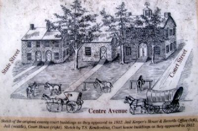
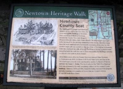
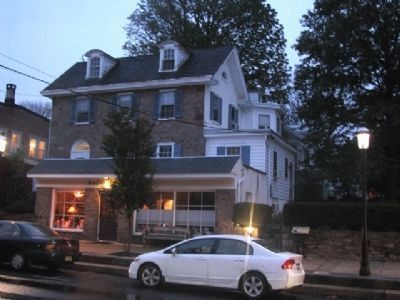
The buildings at 35 South State Street are situated on the tract of land on which the three main public buildings in Newtown were erected in 1726 when Newtown became the County Seat (Jail Keeper's House & Records Office, Jail, Court House). The original jail was found to be too small for the growing criminality of the county, naturally arising from the wild conditions of a backwoods community of the time. In 1745, another larger jail was erected on this site. Some of the original brownstone walls that enclosed the cells of the jail (building at far left in sketch) were reused to build the wall that can be seen surrounding the buildings currently on this site (see wall in photo below).
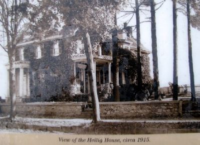
About thirty years after the County Seat was removed from Newtown to Doylestown in 1813, the home at 35 South State Street and part of the old courthouse property were purchased at auction by Maurice P. Linton and later by Daniel C. Heilig. This land included the "Old Office Building" that was presumably the only remaining evidence of the original County buildings. Between 1873 and 1884, Daniel B. Heilig renovated this property and also constructed a number of stores that are located between 27 and 33 South State Street.
Erected 2007 by Newtown Business & Professional Association and Newtown Heritage Association.
Topics. This historical marker is listed in these topic lists: Colonial Era • Government & Politics • Industry & Commerce • Political Subdivisions • Settlements & Settlers. A significant historical year for this entry is 1726.
Location. 40° 13.687′ N, 74° 56.206′ W. Marker is in Newtown, Pennsylvania, in Bucks County. Marker is on State Street, on the left when traveling south. Marker is about 75 feet north of Centre Avenue. Touch for map. Marker is at or near this postal address: 35 S State Street, Newtown PA 18940, United States of America. Touch for directions.
Other nearby markers. At least 8 other markers are within walking distance of this marker. The First National Bank (within shouting distance of this marker); Justices House (within shouting distance of this marker); Half-Moon Inn (within shouting distance of this marker); Loyalist Raid of 1778 (within shouting distance of this marker); February 9, 1778 (within shouting distance of this marker); Bird in Hand (about 300 feet away, measured in a direct line); Temperance House (about 300 feet away); Paxson-Croasdale Building & Trolley (about 400 feet away). Touch for a list and map of all markers in Newtown.
Also see . . .
1. History of Newtown Borough. (Submitted on June 29, 2010, by William Fischer, Jr. of Scranton, Pennsylvania.)
2. Newtown Historic Walk. (Submitted on June 29, 2010, by William Fischer, Jr. of Scranton, Pennsylvania.)

Photographed By William Fischer, Jr., October 15, 2009
3. Sketch on Newtown - County Seat Marker
[Caption reads] Sketch of the original county court buildings as they appeared in 1812. Jail Keeper's & Records Office (left), Jail (middle), Court House (right). Sketch by T.S. Kenderline. Court house buildings as they appeared in 1812.
Credits. This page was last revised on July 14, 2021. It was originally submitted on June 29, 2010, by William Fischer, Jr. of Scranton, Pennsylvania. This page has been viewed 704 times since then and 13 times this year. Photos: 1, 2, 3, 4. submitted on June 29, 2010, by William Fischer, Jr. of Scranton, Pennsylvania.


