Near Dodgeville in Iowa County, Wisconsin — The American Midwest (Great Lakes)
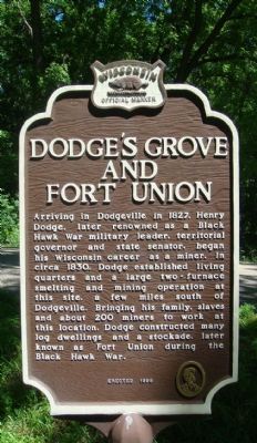
Dodge's Grove and Fort Union
Erected 1998 by Wisconsin Historical Society. (Marker Number 403.)
Topics and series. This historical marker is listed in these topic lists: African Americans • Forts and Castles • Industry & Commerce • Settlements & Settlers • Wars, US Indian. In addition, it is included in the Black Hawk War, and the Wisconsin Historical Society series lists. A significant historical year for this entry is 1827.
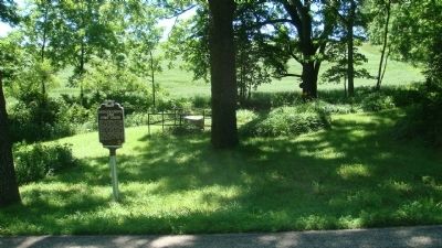
Location. 42° 54.978′ N, 90° 7.084′ W. Marker is near Dodgeville, Wisconsin, in Iowa County. Marker is on County Road Y, 0.1 miles east of Governor Dodge Road, on the right when traveling east. The marker is between the places where Gov. Dodge Rd. intersects County Y from the south and from the north. There is no parking at the marker site or room to park at the side of the road there. Touch for map. Marker is in this post office area: Mineral Point WI 53565, United States of America. Touch for directions.
Other nearby markers. At least 8 other markers are within 6 miles of this marker, measured as the crow flies. Dodge Mining Camp Cabin (approx. 3 miles away); Iowa County Courthouse (approx. 3.2 miles away); Veterans Memorial (approx. 3.2 miles away); Shake Rag (approx. 4.8 miles away); Wisconsin Territory (approx. 5 miles away); Site of Fort Jackson (approx. 5 miles away); Historic Mineral Point (approx. 5.1 miles away); Old Military Road (approx. 5.3 miles away). Touch for a list and map of all markers in Dodgeville.
Credits. This page was last revised on December 30, 2019. It was originally submitted on June 19, 2010, by William J. Toman of Green Lake, Wisconsin. This page has been viewed 1,796 times since then and 83 times this year. Last updated on June 30, 2010, by William J. Toman of Green Lake, Wisconsin. Photos: 1, 2, 3. submitted on June 19, 2010, by William J. Toman of Green Lake, Wisconsin. • Kevin W. was the editor who published this page.


