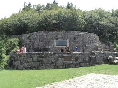
Near Newfound Gap in Sevier County, Tennessee — The American South (East South Central)
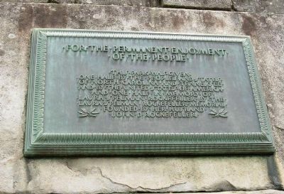
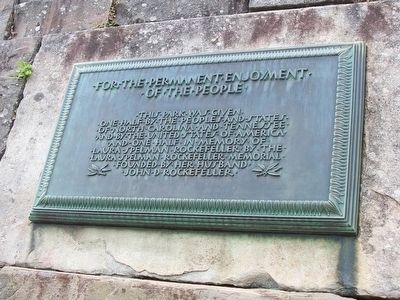
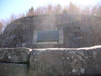
Rockefeller Memorial
Erected 1940.
Topics. This historical marker and memorial is listed in these topic lists: Charity & Public Work • Parks & Recreational Areas.
Location. 35° 36.669′ N, 83° 25.48′ W. Marker is near Newfound Gap, Tennessee, in Sevier County. Marker is on Newfound Gap Road (U.S. 441) near Clingman's Dome Road, on the left when traveling south. Touch for map. Marker is in this post office area: Gatlinburg TN 37738, United States of America. Touch for directions.
Other nearby markers. At least 8 other markers are within walking distance of this marker. The Great Smokies (within shouting distance of this marker in North Carolina); The Appalachian Trail (within shouting distance of this marker in North Carolina); Hands That Built (within shouting distance of this marker in North Carolina); Land of Diversity (within shouting distance of this marker); People of the Mountains (within shouting distance of this marker in North Carolina); “To the free people of America” (within shouting distance of this marker in North Carolina); A Mountain Sanctuary (about 400 feet away, measured in a direct line in North Carolina); Great Smoky Mountains National Park (about 400 feet away in North Carolina).
Also see . . . How the Great Smokies became a National Park. A National Park Service Website. (Submitted on November 6, 2007, by Kevin W. of Stafford, Virginia.)
Additional commentary.
1. Newfound Gap & Clingmans Dome: Great Smoky Mountains National Park
A 24-mile paved road that climbs from the base of the Great Smoky Mountains, near the Rockefeller Memorial, to the highest peak. When combined, the Newfound Gap and Clingmans Dome roads may well be the most popular scenic drive in North Carolina and Tennessee. The Appalachian Trail also traverses the gap, as do a small number of other hiking trails. With beautiful scenery and numerous historic sites, the area's popularity is well deserved. Most people tour this area drive at some point during their visit to Great Smoky Mountains National Park, the most-visited national park in the country.
— Submitted November 6, 2007, by Kevin W. of Stafford, Virginia.
Additional keywords. Great Smoky Mountains, Newfound Gap, Appalachian Trail, Franklin D. Roosevelt
Photographed By Stanley and Terrie Howard, March 4, 2009
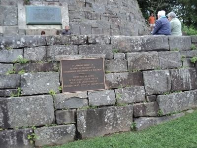
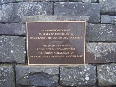
5. Rockefeller Memorial Golden Anniversary plaque
In commemoration of 50 years of excellence in conservation restoration and enjoyment.
Presented June 15, 1984 by the Citizens Committee for the Golden Anniversary the Great Smoky Mountain National Park
Presented June 15, 1984 by the Citizens Committee for the Golden Anniversary the Great Smoky Mountain National Park
Credits. This page was last revised on December 17, 2019. It was originally submitted on November 2, 2007, by Julie Szabo of Oldsmar, Florida. This page has been viewed 2,945 times since then and 34 times this year. Photos: 1. submitted on November 2, 2007, by Julie Szabo of Oldsmar, Florida. 2. submitted on February 2, 2015, by Randall York of Mansfield, Ohio. 3. submitted on November 2, 2007, by Julie Szabo of Oldsmar, Florida. 4. submitted on August 29, 2012, by Bill Coughlin of Woodland Park, New Jersey. 5. submitted on June 15, 2009, by Stanley and Terrie Howard of Greer, South Carolina. 6. submitted on August 29, 2012, by Bill Coughlin of Woodland Park, New Jersey. • J. J. Prats was the editor who published this page.
