Near Mechanicsville in Hanover County, Virginia — The American South (Mid-Atlantic)
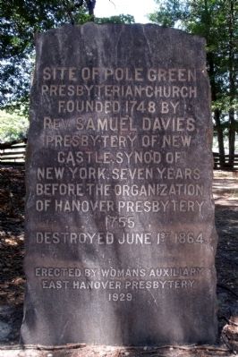
Site of Polegreen
Presbyterian Church
Rev. Samuel Davies
Presbytery of New
Castle synod of
New York. Seven years
before the organization
of Hanover Presbytery
1755
Destroyed June 1st 1864.
Erected by Woman's Auxillary
East Hanover Presbytery
1929.
Erected 1929 by Woman's Auxillary East Hanover Presbytery.
Topics. This historical marker is listed in these topic lists: Churches & Religion • Colonial Era • Landmarks • Notable Places. A significant historical date for this entry is June 1, 1778.
Location. 37° 38.706′ N, 77° 19.838′ W. Marker is near Mechanicsville, Virginia, in Hanover County. Marker can be reached from the intersection of Rural Point Road (County Route 643) and Heatherwood Drive (Virginia Route 1750). Touch for map. Marker is at or near this postal address: 6411 Heatherwood Drive, Mechanicsville VA 23116, United States of America. Touch for directions.
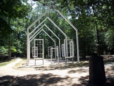
Other nearby markers. At least 8 other markers are within walking distance of this marker. Polegreen Church (a few steps from this marker); a different marker also named Polegreen Church (a few steps from this marker); The Reading Room (within shouting distance of this marker); Welcome to Historic Polegreen Church (within shouting distance of this marker); The Polegreen Story (within shouting distance of this marker); a different marker also named Polegreen Church (within shouting distance of this marker); Historic Polegreen Church (about 300 feet away, measured in a direct line); Battle of Totopotomoy Creek (about 500 feet away). Touch for a list and map of all markers in Mechanicsville.
Also see . . . Historic Polegreen Church Foundation. (Submitted on July 5, 2010, by Bernard Fisher of Richmond, Virginia.)
Credits. This page was last revised on June 16, 2016. It was originally submitted on July 5, 2010, by Bernard Fisher of Richmond, Virginia. This page has been viewed 788 times since then and 9 times this year. Photos: 1, 2, 3. submitted on July 5, 2010, by Bernard Fisher of Richmond, Virginia.


