Cumberland Township near Round Top in Adams County, Pennsylvania — The American Northeast (Mid-Atlantic)
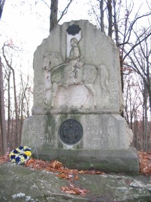
5th New York Cavalry
1st Brigade, 3rd Division
— Cavalry Corps —
1st Brig.
3rd Div.
Cavalry Corps
(Back):
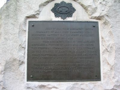
July 3rd 1863 this regiment under command of Maj. John Hammond here supported Battery E, 4th U.S. Horse Artillery, Lieut. S.S. Elder losing 6 men.
This regiment, June 30th 1863 met, and repulsed a portion of Lee's cavalry, under the personal command of Gen. J.E.B. Stewart in the streets of Hanover, in a hand to hand fight, capturing Lieut. Col. Paine and 75 men, with a loss of 26 men killed and wounded.
July 2nd 1863 this regiment attacked Gen. Stewart's cavalry at Hunterstown and afterwards made a flank movement to this position.
Erected 1888 by State of New York.
Topics. This memorial is listed in this topic list: War, US Civil. A significant historical date for this entry is July 3, 1863.
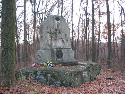
Location. 39° 46.993′ N, 77° 14.777′ W. Marker is near Round Top, Pennsylvania, in Adams County. It is in Cumberland Township. Memorial can be reached from South Confederate Avenue, on the right when traveling east. Located on Bushman Hill, in the south section of Gettysburg National Battlefield Park. Located along a walking trail around Bushman Hill. Touch for map. Marker is in this post office area: Gettysburg PA 17325, United States of America. Touch for directions.
Other nearby markers. At least 8 other markers are within walking distance of this marker. Battery E, Fourth U.S. Artillery (within shouting distance of this marker); William Wells (about 600 feet away, measured in a direct line); A Ride to Death (approx. 0.2 miles away); Farm Field to Battlefield (approx. 0.2 miles away); First Brigade (approx. 0.2 miles away); 18th Pennsylvania Cavalry (approx. 0.2 miles away); Third Division (approx. ¼ mile away); First Regiment Vermont Cavalry (approx. 0.3 miles away). Touch for a list and map of all markers in Round Top.
Also see . . . 5th New York Cavalry. Service record of the regiment. The 5th was also known as the Ira Harris Cavalry and the De Forrest Cavalry. (Submitted on January 21, 2009, by Craig Swain of Leesburg, Virginia.)
Photographed By Craig Swain, November 11, 2008
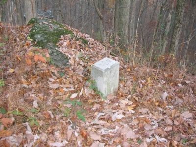
4. Right Flank Marker Stone
The 5th New York Cavalry's right flank marker stone stands a few dozen yards west of the monument. Like many flank markers, one should consider the indicated position not as an absolute reference point, but a general guide to the unit location. Looking around the stone, one gets an appreciation for the rugged terrain in this sector of the battlefield.
Photographed By Craig Swain, November 11, 2008
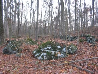
5. Rough Ground on Bushman Hill
Another view of the rough ground around Bushman Hill. This looks at a section of the east side of the hill, along the trail to the monument. At the time of the battle, the hilltop itself was thinly wooded. However the low ground on all sides of the hill was part of a wood lot. A portion of the 5th New York was posted to this side of the hill during the day, fending off skirmishers from the 1st Texas.
Credits. This page was last revised on February 7, 2023. It was originally submitted on January 21, 2009, by Craig Swain of Leesburg, Virginia. This page has been viewed 1,331 times since then and 13 times this year. Last updated on July 6, 2010, by Lee McGinnis of Sykesville, Maryland. Photos: 1, 2, 3, 4, 5. submitted on January 21, 2009, by Craig Swain of Leesburg, Virginia.
