Near Blue Grass in Highland County, Virginia — The American South (Mid-Atlantic)
Camp Allegheny
Confederate Outpost
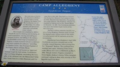
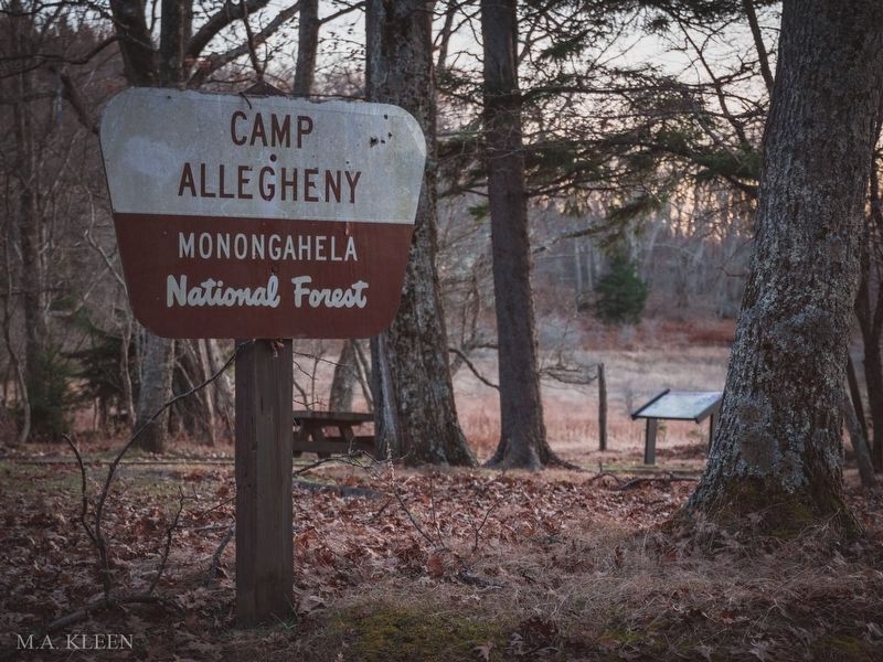
Two miles west on the former Staunton-to-Parkersburg Turnpike is Camp Allegheny, the highest Civil War fortification east of the Mississippi. Its rolling meadows and spectacular views belie a punishing winter climate.
The turnpike was completed in 1839 to "benefit the state by retaining and increasing its western population, clearing and settling an extensive territory, and adding to the revenue...the formidable central range of mountains of Virginia, a county at present almost a wilderness and where comforts are unknown," according to Claudius Crozet, then Principal Engineer of the Virginia Board of Public Works.
In 1861, the road became an important strategic target for both armies. Confederates dug in at Camp Allegheny, overlooking the turnpike, to bar advances into the Shenandoah Valley after Union victories at Rich Mountain and Corricks Ford in July 1861. They held this vital position during Gen. Robert E. Lee's attack on nearby Cheat Mountain that September. The garrison here under Edward "Old Allegheny" Johnson was attacked by Federals led by Gen. Robert Milroy on December 13, 1861. The Confederate defenders won one of the hardest fought battles of the war's first year.
Southern soldiers endured a horrible winter at Camp Allegheny. Diseases swept through the exposed camp, killing scores of men whose unmarked graves still lie scattered across the mountaintop.
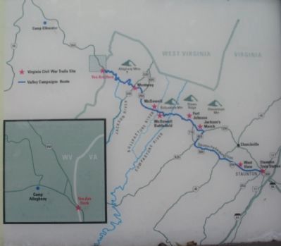
Abandoning Camp Allegheny in April 1862, Confederate survivors retreated east on the turnpike, toward Staunton, before joining Gen. T.J. "Stonewall" Jackson. The combined force marched west again, defeating Union forces under Milroy once more at McDowell on May 8, 1862. Though western Virginia remained in Union hands, Jackson's famous Valley campaign continued, ending in June with victories at Port Republic and Cross Keys.
"I want this fight whipped out here before winter [or] it will be so cold that we cannot stand it."
- Sheperd Green Pryor, 12th Georgia Infantry C.S.A., in a letter home from Camp Allegheny 1861.
Erected by Virginia Civil War Trails.
Topics and series. This historical marker is listed in these topic lists: Forts and Castles • War, US Civil. In addition, it is included in the Virginia Civil War Trails series list. A significant historical month for this entry is April 1862.
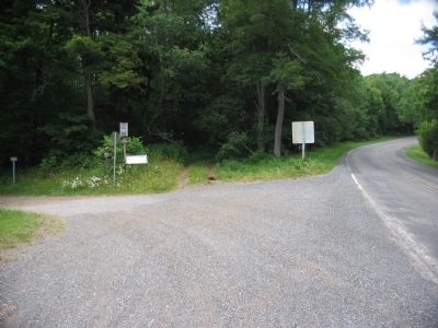
Location. 38° 27.97′ N, 79° 41.623′ W. Marker is near Blue Grass, Virginia, in Highland County. Marker is on Elleber Sods Road (U.S. 250), on the right when traveling south. Touch for map. Marker is in this post office area: Monterey VA 24465, United States of America. Touch for directions.
Other nearby markers. At least 8 other markers are within 2 miles of this marker, measured as the crow flies. Highland County / West Virginia (approx. 0.7 miles away); The First Campaign (approx. 0.7 miles away in West Virginia); War In West Virginia (approx. 0.7 miles away in West Virginia); The Great Raid (approx. 0.7 miles away in West Virginia); a different marker also named Camp Allegheny (approx. 0.7 miles away in West Virginia); West Virginia / Virginia (approx. 0.7 miles away in West Virginia); Camp Allegheny 1861-1862 (approx. 1.6 miles away in West Virginia); a different marker also named Camp Allegheny (approx. 1.6 miles away in West Virginia).
Also see . . . The Staunton-Parkersburg Turnpike Alliance. Website homepage:
The alliance website offers details of the historic turnpike. (Submitted on July 11, 2010, by Craig Swain of Leesburg, Virginia.)
via Historic America, unknown
4. Camp Allegheny Battlefield in Pocahontas County, West Virginia
Historic America website entry
Click for more information.
Click for more information.
Credits. This page was last revised on March 30, 2022. It was originally submitted on July 11, 2010, by Craig Swain of Leesburg, Virginia. This page has been viewed 1,650 times since then and 40 times this year. Photos: 1, 2, 3. submitted on July 11, 2010, by Craig Swain of Leesburg, Virginia. 4. submitted on March 30, 2022, by Larry Gertner of New York, New York. 5. submitted on July 11, 2010, by Craig Swain of Leesburg, Virginia.
