Henrico in Henrico County, Virginia — The American South (Mid-Atlantic)
Fort Brady Trail
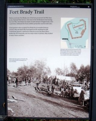
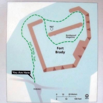
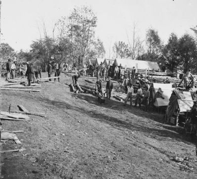
Union gunners who occupied Fort Brady for six months between October 1864 and April 1865 found garrison life anything but dull. Confederate gunners, stationed in batteries across the James River, shelled the fort frequently, and one major attack in January 1865 resulted in many Union casualties.
Erected 2010 by Richmond National Battlefield Park.
Topics. This historical marker is listed in these topic lists: Forts and Castles • War, US Civil. A significant historical month for this entry is January 1865.
Location. 37° 23.53′ N, 77° 21.645′ W. Marker is in Henrico, Virginia, in Henrico County. Marker can be reached from Hoke Brady Road, 0.9 miles south of Kingsland Road. Touch for map. Marker is in this post office area: Henrico VA 23231, United States of America. Touch for directions.
Other nearby markers. At least 8 other markers are within one mile of this marker, measured as the crow flies. Union Defensive Lines (a few steps from this marker); Fort Brady (a few steps from this marker); Battle of Trent's Reach (about 300 feet away, measured in a direct line); Powder Magazine (about 400 feet away); a different marker also named Powder Magazine (about 400 feet away); Guns of Fort Brady (about 400 feet away); Guarding the James (about 400 feet away); The Tides (approx. 1.1 miles away). Touch for a list and map of all markers in Henrico.
More about this marker. The backdrop photo carries the caption, "Soldiers built winter quarters in November 1864 on the windswept bluff overlooking the river, next to Fort Brady."
Also see . . .
1. Richmond National Battlefield Park. (Submitted on July 11, 2010, by Bernard Fisher of Richmond, Virginia.)
2. Old Marker at this Location. This marker replaced an older one at this location titled "Union Defensive Lines" (Submitted on July 12, 2010, by Bernard Fisher of Richmond, Virginia.)
Credits. This page was last revised on June 16, 2016. It was originally submitted on July 11, 2010, by Bernard Fisher of Richmond, Virginia. This page has been viewed 1,615 times since then and 40 times this year. Photos: 1, 2, 3, 4, 5, 6. submitted on July 11, 2010, by Bernard Fisher of Richmond, Virginia.
