Henrico in Henrico County, Virginia — The American South (Mid-Atlantic)
Fort Harrison Trail
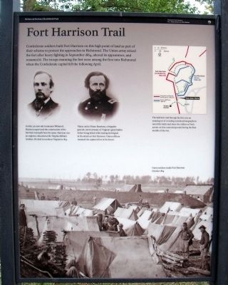
In 1862, 30-year-old Lieutenant William E. Harrison supervised the construction of the fort that eventually bore his name. Harrison was an engineer, educated at the Virginia Military Institute. He died in northern Virginia in 1873.
Maine native Hiram Burnham, a brigadier general, survived many of Virginia's great battles before being killed while leading his brigade in the attack on Fort Harrison. Union officers renamed the captured fort in his honor.
Erected 2010 by Richmond National Battlefield Park.
Topics. This historical marker is listed in these topic lists: Forts and Castles • War, US Civil. A significant historical month for this entry is September 1864.
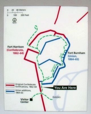
Location. 37° 25.666′ N, 77° 22.361′ W. Marker is in Henrico, Virginia, in Henrico County. Marker can be reached from Battlefield Park Road, 0.2 miles south of Picnic Road. Touch for map. Marker is in this post office area: Henrico VA 23231, United States of America. Touch for directions.
Other nearby markers. At least 8 other markers are within walking distance of this marker. First Park Headquarters (a few steps from this marker); a different marker also named First Park Headquarters (a few steps from this marker); Freedom Fighters (a few steps from this marker); Confederate Counterattack (within shouting distance of this marker); A Unique Photograph (about 300 feet away, measured in a direct line); Fort Harrison (about 300 feet away); Counterattack (about 300 feet away); Surprise Attack (about 400 feet away). Touch for a list and map of all markers in Henrico.
More about this marker. On the upper left are portraits of Confederate Lieutenant William E. Harrison and Union Brigadier General Hiram Burnham.
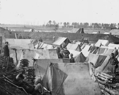
On the bottom is a photo of "Union soldiers inside Fort Harrison October 1864"
Related marker. Click here for another marker that is related to this marker. Old Marker At This Location also titled "Fort Harrison Trail".
Also see . . . Richmond National Battlefield Park. (Submitted on July 11, 2010.)
Credits. This page was last revised on November 5, 2021. It was originally submitted on July 11, 2010, by Bernard Fisher of Richmond, Virginia. This page has been viewed 1,088 times since then and 87 times this year. Photos: 1, 2, 3, 4. submitted on July 11, 2010, by Bernard Fisher of Richmond, Virginia.


