Georgetown in Northwest Washington in Washington, District of Columbia — The American Northeast (Mid-Atlantic)
Mount Zion United Methodist Church and Heritage Center, and the Female Union Band Cemetery
1334 29th Street, NW
— African American Heritage Trail, Washington DC —
Inscription.
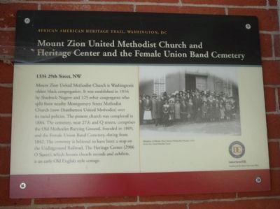
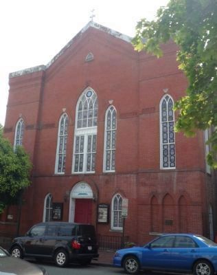
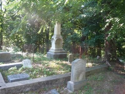
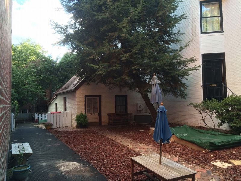
Mount Zion United Methodist Church is Washington’s oldest Black congregation. It was established in 1816 by Shadrack Nugent and 125 other congregants who split from nearby Montgomery Street Methodist Church (now Dumbarton United Methodist) over its racial policies. The present church was completed in 1884. The cemetery, near 27th and Q streets, comprises the Old Methodist Burying Ground, founded in 1809, and the Female Union Band Cemetery, dating from 1842. The cemetery is believed to have been a stop on the Underground Railroad. The Heritage Center (2906 O Street), which houses church records and exhibits, is an early Old English style cottage.
Erected by Cultural Tourism DC.
Topics and series. This historical marker is listed in these topic lists: African Americans • Cemeteries & Burial Sites • Churches & Religion. In addition, it is included in the African American Heritage Trail series list. A significant historical year for this entry is 1816.
Location. 38° 54.478′ N, 77° 3.495′ W. Marker is in Northwest Washington in Washington, District of Columbia. It is in Georgetown. Marker is on 29th Street Northwest north of Dumbarton Avenue Northwest, on the right when traveling south. Touch for map. Marker is at or near this postal address: 1334 29th Street Northwest, Washington DC 20007, United States of America. Touch for directions.
Other nearby markers. At least 8 other markers are within walking distance of this marker. Mt. Zion United Methodist Church (a few steps from this marker); Mt. Zion United Methodist Church Parsonage (within shouting distance of this marker); Alfred and Hannah Pope (within shouting distance of this marker); The Colonial (about 400 feet away, measured in a direct line); Early African American Georgetown (about 400 feet away); Hughes House (about 400 feet away); Stately Houses and Gardens (about 500 feet away); Poplar Street (about 500 feet away). Touch for a list and map of all markers in Northwest Washington.
More about this marker.
[Photo caption:]
Members of Mount Zion Union United Methodist Church, 1912
Mount Zion Union United Methodist Church
Also see . . . Mount Zion Cemetery (Washington, D.C.). Wikipedia entry (Submitted on March 15, 2021, by Larry Gertner of New York, New York.)
Additional keywords. Georgetown National Historic District; Mount Zion Cemetery.
Credits. This page was last revised on January 30, 2023. It was originally submitted on July 4, 2010, by Richard E. Miller of Oxon Hill, Maryland. This page has been viewed 1,409 times since then and 20 times this year. Last updated on July 11, 2010, by Richard E. Miller of Oxon Hill, Maryland. Photos: 1, 2. submitted on July 4, 2010, by Richard E. Miller of Oxon Hill, Maryland. 3. submitted on July 11, 2010, by Richard E. Miller of Oxon Hill, Maryland. 4. submitted on September 12, 2016, by J. Makali Bruton of Accra, Ghana. • Kevin W. was the editor who published this page.


