Royal Oak in Oakland County, Michigan — The American Midwest (Great Lakes)
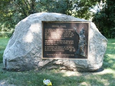
Indian Trail
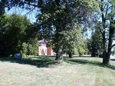
The children of the American Revolution planted the pin oak tree nearby in 1939 to mark the trail.
To perpetuate the memory of the natives of our land, this monument is set for the Michigan Sesquicentennial
Erected 1987 by Friends of the Almon Starr Historic House.
Topics. This historical marker is listed in these topic lists: Native Americans • Roads & Vehicles. A significant historical year for this entry is 1939.
Location. 42° 30.997′ N, 83° 9.906′ W. Marker is in Royal Oak, Michigan, in Oakland County. Marker can be reached from Crooks Road, 1.1 miles east of Woodward Avenue (Michigan Highway 1). Touch for map. Marker is at or near this postal address: 3123 Crooks Road, Royal Oak MI 48073, United States of America. Touch for directions.
Other nearby markers. At least 8 other markers are within 2 miles of this marker, measured as the crow flies. Saginaw Trail / John Almon Starr House (within shouting distance of this marker); Hedge's Wigwam (approx. 0.4 miles away); Union School Bell (approx. 0.4 miles away); Dr. Firman W. Clawson Homestead Site (approx. half a mile away); Orson Starr Home (approx. one mile away); Roseland Park Mausoleum (approx. one mile away); American Legion Post 374 Veterans Memorial (approx. 1.1 miles away); Berkley Veterans Memorial (approx. 1.3 miles away). Touch for a list and map of all markers in Royal Oak.
Credits. This page was last revised on June 16, 2016. It was originally submitted on July 13, 2010, by Joel Seewald of Madison Heights, Michigan. This page has been viewed 1,806 times since then and 71 times this year. Photos: 1, 2. submitted on July 13, 2010, by Joel Seewald of Madison Heights, Michigan. • Bill Pfingsten was the editor who published this page.

