Farmington in Hartford County, Connecticut — The American Northeast (New England)
The Farmington Canal
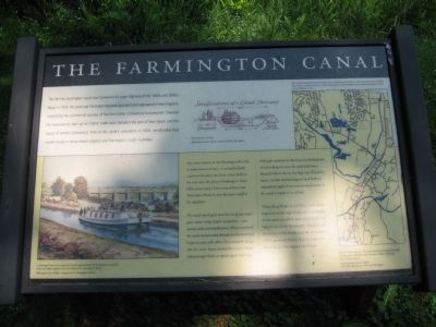
The Farmington Canal
The 56-mile Farmington Canal was Connecticut's super-highway of the 1830s and 1840s. Begun in 1825, the canal was the largest engineering project ever attempted in New England. Inspired by the commercial success of the Erie Canal, Connecticut businessmen financed the waterway to open up an interior trade route between the port of New Haven and the towns of central Connecticut. Prior to the canal's completion in 1829, merchandise had moved slowly in horse-drawn wagons over the region's rough roadways.
The canal relied on the Farmington River for its main source of water. A navigable feeder canal carried water east from a dam built on the river near the present Farmington Town Hall, across today's Devonwood Drive and Town Farm Road, to join the main canal at the aqueduct.
The canal was dug by hand by local and immigrant labor, using simple equipment – axes, shovels, picks and wheelbarrows. When completed, the canal's 36-foot width allowed two flat-bottomed barges to pass each other. On a towpath alongside the canal, horses hauled the 75-foot freight and passenger boats at speeds up to four mph.
Although important to the economic development of towns along its route, the canal itself was a financial failure due to the high cost of maintenance. In 1848, the Farmington Canal Railroad acquired the right-of-way and converted much of the canal's towpath to its rail bed.
Today, along Route 10 and Town Farm Road, fragments of the high berms and deep ditches of the canal can still be seen. Fortunately, this historic site of the Farmington Aqueduct and the section of the feeder canal in Devonwood will be preserved forever, thanks to generous donors to the Farmington Land Trust.
Erected by the Farmington Land Trust.
Topics. This historical marker is listed in this topic list: Waterways & Vessels. A significant historical year for this entry is 1825.
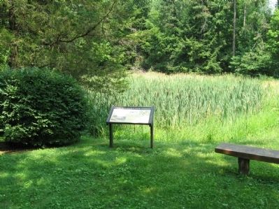
Location. 41° 45.267′ N, 72° 49.12′ W. Marker is in Farmington, Connecticut, in Hartford County. Marker is at the intersection of Waterville Road and Aqueduct Lane, on the right when traveling south on Waterville Road. Touch for map. Marker is in this post office area: Farmington CT 06032, United States of America. Touch for directions.
Other nearby markers. At least 8 other markers are within 3 miles of this marker, measured as the crow flies. Canal Aqueduct (here, next to this marker); The Farmington Aqueduct (about 700 feet away, measured in a direct line); Canal Junction (approx. ¼ mile away); Birthplace of Wilford Woodruff (approx. 1.3 miles away); Farmington (approx. 1.7 miles away); Lest We Forget (approx. 2 miles away); Farmington and the Freedom Trail (approx. 2.4 miles away); a different marker also named Farmington (approx. 2½ miles away). Touch for a list and map of all markers in Farmington.
Also see . . . The Farmington Canal on Wikipedia. (Submitted on July 13, 2010, by Michael Herrick of Southbury, Connecticut.)

Photographed By Michael Herrick, July 7, 2010
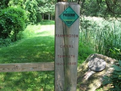
4. Marker Near the Gatepost
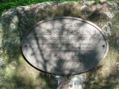
James McA. Thomson, II
Architect, Antiquarian, Concerned Citizen
His foresight and generosity made possible
the acquisition and preservation of this
historic place by the Farmington Land Trust.
This plaque placed by
his family and friends
1995
Credits. This page was last revised on June 16, 2016. It was originally submitted on July 13, 2010, by Michael Herrick of Southbury, Connecticut. This page has been viewed 1,970 times since then and 28 times this year. Photos: 1, 2, 3, 4. submitted on July 13, 2010, by Michael Herrick of Southbury, Connecticut.


