Corryton in Knox County, Tennessee — The American South (East South Central)
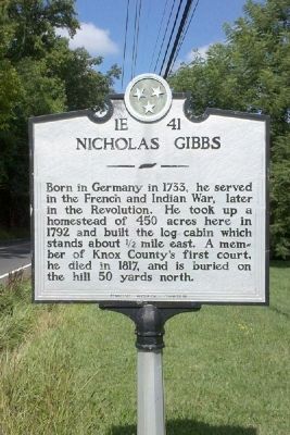
Nicholas Gibbs
Erected by Tennessee Historical Commission. (Marker Number 1E 41.)
Topics and series. This historical marker is listed in these topic lists: Settlements & Settlers • War, French and Indian • War, US Revolutionary. In addition, it is included in the Tennessee Historical Commission series list. A significant historical year for this entry is 1733.
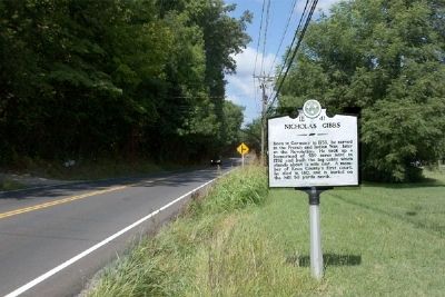
Location. 36° 7.241′ N, 83° 51.448′ W. Marker is in Corryton, Tennessee, in Knox County. Marker is on Emory Road (Tennessee Route 331) ¼ mile west of Tazewell Pike (Tennessee Route 131), on the right when traveling west. Touch for map. Marker is at or near this postal address: 7412 Emory Road, Corryton TN 37721, United States of America. Touch for directions.
Other nearby markers. At least 8 other markers are within 7 miles of this marker, measured as the crow flies. Nicholas Gibbs Homestead (approx. 0.8 miles away); George Mann (approx. 2.1 miles away); Mr. Anderson's Log College (approx. 4½ miles away); Norris Freeway (approx. 5 miles away); Mt. Fuji (approx. 5.6 miles away); Sawyer's Fort (approx. 6.2 miles away); Alfred Buffat Homeplace (approx. 6½ miles away); Savage Garden (approx. 6.7 miles away). Touch for a list and map of all markers in Corryton.
Credits. This page was last revised on June 16, 2016. It was originally submitted on July 15, 2010, by Donald Raby of Knoxville, Tennessee. This page has been viewed 1,500 times since then and 58 times this year. Photos: 1, 2. submitted on July 15, 2010, by Donald Raby of Knoxville, Tennessee. • Craig Swain was the editor who published this page.

