Near Woodford in Spotsylvania County, Virginia — The American South (Mid-Atlantic)
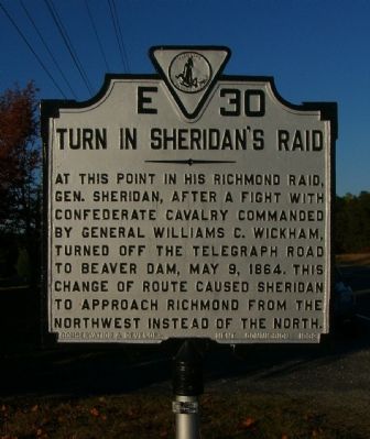
Turn in Sheridan’s Raid
Erected 1932 by Conservation and Development Commission. (Marker Number E-30.)
Topics and series. This historical marker is listed in these topic lists: Roads & Vehicles • War, US Civil. In addition, it is included in the Virginia Department of Historic Resources (DHR) series list. A significant historical month for this entry is May 1852.
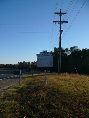
Location. 38° 6.443′ N, 77° 31.782′ W. Marker is near Woodford, Virginia, in Spotsylvania County. Marker is at the intersection of Jefferson Davis Hwy (U.S. 1) and Dew Lane, on the right when traveling south on Jefferson Davis Hwy. Touch for map. Marker is at or near this postal address: 5730 Jefferson Davis Hwy, Woodford VA 22580, United States of America. Touch for directions.
Other nearby markers. At least 8 other markers are within 5 miles of this marker, measured as the crow flies. Jerrell’s Mill (approx. 0.7 miles away); Spotsylvania County / Caroline County (approx. 0.7 miles away); Nancy Wright’s (approx. 1.2 miles away); Mud Tavern (approx. 1.7 miles away); Stanard’s Mill (approx. 3 miles away); John J. Wright Parksite (approx. 5 miles away); Spotsylvania Sunday School Union Parksite (approx. 5 miles away); Secondary Education for African American Children (approx. 5 miles away). Touch for a list and map of all markers in Woodford.
Credits. This page was last revised on July 9, 2021. It was originally submitted on November 5, 2007, by Kevin W. of Stafford, Virginia. This page has been viewed 1,355 times since then and 34 times this year. Photos: 1, 2. submitted on November 5, 2007, by Kevin W. of Stafford, Virginia.

